Astoria Topo Map Oregon
To zoom in, hover over the map of Astoria
USGS Topo Map 46123a1 - 1:100,000 scale
| Topo Map Name: | Astoria |
| USGS Topo Quad ID: | 46123a1 |
| Print Size: | ca. 39" wide x 24" high |
| Southeast Coordinates: | 46° N latitude / 123° W longitude |
| Map Center Coordinates: | 46.25° N latitude / 123.5° W longitude |
| U.S. States: | OR, WA |
| Filename: | 46123a1.jpg |
| Download Map JPG Image: | Astoria topo map 1:100,000 scale |
| Map Type: | Topographic |
| Topo Series: | 30´x60´ |
| Map Scale: | 1:100,000 |
| Source of Map Images: | United States Geological Survey (USGS) |
| Alternate Map Versions: |
Astoria OR 1981, updated 1982 Download PDF Buy paper map Astoria OR 1981, updated 1989 Download PDF Buy paper map Astoria OR 1981, updated 1989 Download PDF Buy paper map |
1:100,000 Topos surrounding Astoria
Westport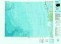 |
Chehalis River |
Centralia |
Ilwaco |
Astoria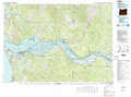 |
Mount Saint Helens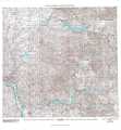 |
Nehalem River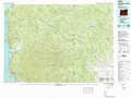 |
Vancouver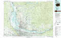 |
> Back to 46122a1 at 1:250,000 scale
> Back to U.S. Topo Maps home
1:24,000 Topo Quads covered by the spatial extent of this 100k map (Astoria)
|
Long Island 
|
Oman Ranch 
|
Upper Naselle River 
|
Sweigiler Creek 
|
Blaney Creek 
|
Elochoman Pass 
|
Boistfort Peak 
|
Wildwood 
|
|
Chinook 
|
Knappton 
|
Rosburg 
|
Grays River 
|
Skamokawa 
|
Skamokawa Pass 
|
Elochoman Lake 
|
Abernathy Mountain 
|
|
Warrenton 
|
Astoria 
|
Cathlamet Bay 
|
Knappa 
|
Cathlamet 
|
Nassa Point 
|
Oak Point 
|
Coal Creek 
|
|
Gearhart 
|
Olney 
|
Green Mountain 
|
Wickiup Mountain 
|
Nicolai Mountain 
|
Marshland 
|
Clatskanie 
|
Delena 
|
