Drake Topo Map North Dakota
To zoom in, hover over the map of Drake
USGS Topo Map 47100e1 - 1:100,000 scale
| Topo Map Name: | Drake |
| USGS Topo Quad ID: | 47100e1 |
| Print Size: | ca. 39" wide x 24" high |
| Southeast Coordinates: | 47.5° N latitude / 100° W longitude |
| Map Center Coordinates: | 47.75° N latitude / 100.5° W longitude |
| U.S. State: | ND |
| Filename: | 47100e1.jpg |
| Download Map JPG Image: | Drake topo map 1:100,000 scale |
| Map Type: | Topographic |
| Topo Series: | 30´x60´ |
| Map Scale: | 1:100,000 |
| Source of Map Images: | United States Geological Survey (USGS) |
| Alternate Map Versions: |
Drake ND 1979, updated 1980 Download PDF Buy paper map |
1:100,000 Topos surrounding Drake
Minot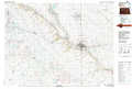 |
Velva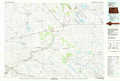 |
Leeds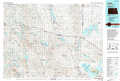 |
Garrison |
Drake |
New Rockford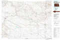 |
Hazen |
Mc Clusky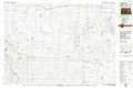 |
Carrington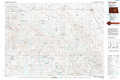 |
> Back to 47100a1 at 1:250,000 scale
> Back to U.S. Topo Maps home
1:24,000 Topo Quads covered by the spatial extent of this 100k map (Drake)
|
Blacktail Coulee 
|
Kongsberg Ne 
|
Balfour Nw 
|
Balfour 
|
Drake Nw 
|
Drake 
|
Anamoose 
|
Clifton 
|
|
Ruso 
|
Kongsberg 
|
Butte 
|
Kief 
|
Drake Sw 
|
Drake Se 
|
Anamoose Sw 
|
Martin 
|
|
Horseshoe Valley 
|
Long Lake 
|
Alkali Lake 
|
Siebold Lake 
|
Lincoln Valley Nw 
|
Lincoln Valley 
|
Sheyenne Lake 
|
Sheyenne Lake Ne 
|
|
Turtle Lake 
|
Peterson Lake 
|
Pelican Lake 
|
Pelican Lake Se 
|
Lincoln Valley Sw 
|
Lincoln Valley Se 
|
Mertz Slough 
|
Pony Gulch 
|
