Kenmare Topo Map North Dakota
To zoom in, hover over the map of Kenmare
USGS Topo Map 48102e1 - 1:100,000 scale
| Topo Map Name: | Kenmare |
| USGS Topo Quad ID: | 48102e1 |
| Print Size: | ca. 39" wide x 24" high |
| Southeast Coordinates: | 48.5° N latitude / 102° W longitude |
| Map Center Coordinates: | 48.75° N latitude / 102.5° W longitude |
| U.S. State: | ND |
| Filename: | 48102e1.jpg |
| Download Map JPG Image: | Kenmare topo map 1:100,000 scale |
| Map Type: | Topographic |
| Topo Series: | 30´x60´ |
| Map Scale: | 1:100,000 |
| Source of Map Images: | United States Geological Survey (USGS) |
| Alternate Map Versions: |
Kenmare ND 1982, updated 1982 Download PDF Buy paper map |
1:100,000 Topos surrounding Kenmare
Crosby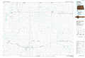 |
Kenmare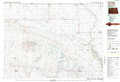 |
Mohall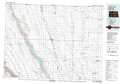 |
Williston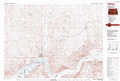 |
Stanley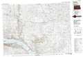 |
Minot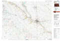 |
> Back to 48102a1 at 1:250,000 scale
> Back to U.S. Topo Maps home
1:24,000 Topo Quads covered by the spatial extent of this 100k map (Kenmare)
|
Atacol 
|
Columbus 
|
Stampede 
|
Portal 
|
Flaxton 
|
Northgate 
|
Bowbells Nw 
|
Bowbells Ne 
|
|
Columbus Sw 
|
Columbus Se 
|
Beaver Lake 
|
Rennie Lake 
|
Woburn 
|
Coteau 
|
Bowbells 
|
Bowbells Se 
|
|
Bush Lake 
|
Grand View 
|
Grubb Lake 
|
Helde Lake 
|
Thompson Lake 
|
Vanville Ne 
|
Niobe 
|
Kenmare 
|
|
Mcgregor 
|
Battleview 
|
Powers Lake 
|
Lunds Valley 
|
Lostwood Lakes 
|
Westby Lake 
|
Mosquito Butte 
|
Coulee 
|
