Texarkana Topo Map Texas
To zoom in, hover over the map of Texarkana
USGS Topo Map 33094a1 - 1:250,000 scale
| Topo Map Name: | Texarkana |
| USGS Topo Quad ID: | 33094a1 |
| Print Size: | ca. 32" wide x 22 1/2" high |
| Southeast Coordinates: | 33° N latitude / 94° W longitude |
| Map Center Coordinates: | 33.5° N latitude / 95° W longitude |
| U.S. States: | TX, OK, AR, LA |
| Filename: | 33094a1.jpg |
| Download Map JPG Image: | Texarkana topo map 1:250,000 scale |
| Map Type: | Topographic |
| Topo Series: | 1°x2° |
| Map Scale: | 1:250,000 |
| Source of Map Images: | United States Geological Survey (USGS) |
| Alternate Map Versions: |
Texarkana TX 1953, updated 1964 Download PDF Buy paper map Texarkana TX 1953, updated 1966 Download PDF Buy paper map Texarkana TX 1953, updated 1974 Download PDF Buy paper map Texarkana TX 1953, updated 1974 Download PDF Buy paper map Texarkana TX 1956 Download PDF Buy paper map |
1:250,000 Topos surrounding Texarkana
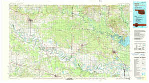
Ardmore OK |
Mc Alester OK, AR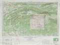 |
Little Rock AR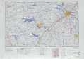 |
Sherman TX, OK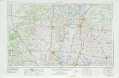 |
Texarkana TX, OK, AR, LA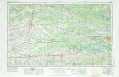 |
El Dorado AR, LA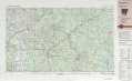 |
Dallas TX |
Tyler TX, LA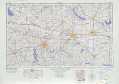 |
Shreveport LA |
> Back to U.S. Topo Maps home
1:100,000 Topo Maps covered by the spatial extent of this 250k map (Texarkana)
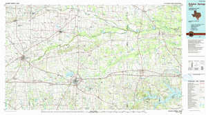
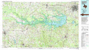
Paris TX, OK |
Idabel OK, AR, TX |
Sulphur Springs TX |
Texarkana TX, AR |