Hoquiam Topo Map Washington
To zoom in, hover over the map of Hoquiam
USGS Topo Map 46122a1 - 1:250,000 scale
| Topo Map Name: | Hoquiam |
| USGS Topo Quad ID: | 46122a1 |
| Print Size: | ca. 32" wide x 22 1/2" high |
| Southeast Coordinates: | 46° N latitude / 122° W longitude |
| Map Center Coordinates: | 46.5° N latitude / 123° W longitude |
| U.S. States: | WA, OR |
| Filename: | 46122a1.jpg |
| Download Map JPG Image: | Hoquiam topo map 1:250,000 scale |
| Map Type: | Topographic |
| Topo Series: | 1°x2° |
| Map Scale: | 1:250,000 |
| Source of Map Images: | United States Geological Survey (USGS) |
| Alternate Map Versions: |
Hoquiam WA 1953 Download PDF Buy paper map Hoquiam WA 1953, updated 1953 Download PDF Buy paper map Hoquiam WA 1957, updated 1957 Download PDF Buy paper map Hoquiam WA 1958, updated 1969 Download PDF Buy paper map Hoquiam WA 1958, updated 1975 Download PDF Buy paper map Hoquiam WA 1962, updated 1962 Download PDF Buy paper map |
1:250,000 Topos surrounding Hoquiam
Copalis Beach WA, OR |
Seattle WA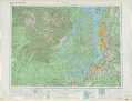 |
Wenatchee WA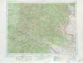 |
Cape Disappointment WA |
Hoquiam WA, OR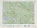 |
Yakima WA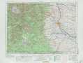 |
Vancouver OR, WA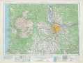 |
The Dalles OR, WA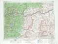 |
> Back to U.S. Topo Maps home
1:100,000 Topo Maps covered by the spatial extent of this 250k map (Hoquiam)
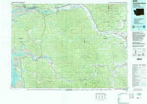
Chehalis River WA |
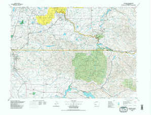
Centralia WA |
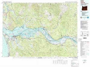
Astoria OR, WA |
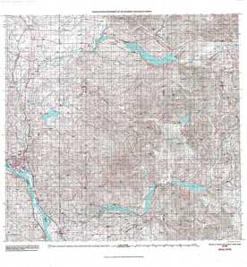
Mount Saint Helens WA, OR |