Map Center of Concord topo map
Interactive topo map of Map Center of Concord, MA
| Place Name: | Map Center of Concord |
| Feature Class: | Topo Map |
| Country: | United States |
| Latitude: | 42.4375 |
| Longitude: | -71.375 |
| USGS Quad: | Concord topo map |
| 7.5´ topo: | 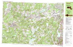 |
| State topo index: | MA topo index |
| Alternate map versions: | MA topographic maps Editions by year, direct download as GeoPDF. |
| 30´ x 60´ topo: | 1:100,000 scale map |
| 1° x 2° topo: | 1:250,000 scale map |
- Strawberry Hill
- Cat Rock Park
- Pierce Park
- Sherman Bridge
- Minute Man National Historical Park
- Minute Man Monument
- Great Meadows National Wildlife Refuge
- Interchange Forty Seven
- Interchange Forty Eight
- Interchange Forty Six
- Interchange Forty Five
- Assabet River Reservoir
- Ben Smith Dam
- Sandy Pond Dam
- Millpond Dam
- Millpond
- Assabet River at High Street Dam
- Assabet River Reservoir
- Musquetaquid Pond Dam
- Musquetaquid Pond
- Haywards Pond Dam
- Haywards Pond
- Warners Pond Dam
- Erikson Dam
- Fort Pond Brook Reservoir
- Barretts Mill Road Dam
- Allen Dam
- Batemans Pond Dam
- Mount Tabor
- Batemans Pond Swamp
- Sudbury River Swamp
- Concord River Swamp
- South Acton Swamp
- Cold Brook Meadow
- Gulf Meadows
- Mill Pond
- Plain
- Iron Ore Bog
- Flagstaff Hill
- Conant Hill
- Damons Mills Westvale
- Silver Hill
- South Bridge
- Springs Brook Park
- Bloody Bluff
- Bound Rock
- Flagg Hill
- Nagog Brook
- Acton
- Angiers Pond
- Annursnac Hill
- Baldwin Pond
- Barkers Pond
- Bridge Brook
- Bridge Brook Swamp
- Bottomless Pond
- Cold Brook
- East Acton
- Elizabeth Brook
- Faulkner Hill
- Fort Pond Brook
- Goodman Hill
- Great Hill
- Guggins Brook
- Kennedys Pond
- Inch Brook
- Kelly Corner
- Lower Village
- Maynard
- Ministers Pond
- Nashoba Brook
- North Sudbury
- Nine Acre Corner
- Pendleton Hill
- Pine Lake
- Pine Rest
- Puffer Pond
- Round Hill
- Run Brook
- Second Division Brook
- Sedge Meadows
- South Acton
- Stearns Millpond
- Sudbury
- Summer Hill
- Taylor Brook
- Tuttle Hill
- Vose Hill
- Vose Pond
- Warners Pond
- West Acton
- West Concord
- White Pond
- White Pond
- Willis Hill
- Willis Pond
- Wright Hill
- Heath Hen Meadow Brook
- Authors Ridge
- Baker Bridge
- Balls Hill
- Batemans Pond
- Bear Hill
- Beaver Pond
- Bedford
- Bedford Levels
- Buttricks Hill
- Cambridge Reservoir
- Cat Rock Hill
- Cherry Brook
- Concord
- Concord Reservoir
- Corly Pate Hill
- Cranberry Hill
- Dakins Brook
- Davis Hill
- Dugan Brook
- Elm Brook
- Fairhaven Bay
- Fairhaven Hill
- Fairyland Pond
- Farmers Cliff
- Farrar Pond
- Fiske Hill
- Fullers Hill
- Goose Pond
- Great Meadows
- Hartwells Hill
- Hastings
- Hathaway Hill
- Hazel Brook
- Hobbs Brook
- Hubbard Hill
- Hutchins Pond
- Jupiter Ridge
- Katahdin Hill
- Kendal Green
- Kiln Brook
- Lincoln
- Lincoln Reservoir
- Little Goose Pond
- McCusker Pond
- Meriams Corner
- Mill Brook
- Mount Misery
- Nashawtuc Hill
- Old North Bridge
- Pantry Brook
- Pine Hill
- Pine Hill
- Poplar Hill
- Prospect Hill
- Punkatasset Hill
- Revolutionary Ridge
- Flints Pond
- Sawmill Brook
- Sherman Bridge
- Silver Hill
- Smiths Hill
- South Lincoln
- Spencer Brook
- Spring Brook
- Tophet Swamp
- Walden Pond
- West Bedford
- Yellow Birch Swamp
- Crosby Pond
- Egg Rock
- Folly Pond
- Folsom Pond
- Iron Mine Brook
- Todd Pond
- Valley Pond
- Reservoir Hill
- Warner Pond
- Prospectville
- Halfmoon Meadow Brook
- Thoreaus Bog
- Old North Bridge
- Hardys Hill
- John Buttrick House Post Office (historical)
- Westvale Post Office (historical)
- Warnerville Post Office (historical)
- Lawrence G Hanscom Field
- Millipore Heliport
- Digital Heliport - Boxboro
- Raytheon Heliport
- Horizon Hill Heliport
- Sids Airport
- Digital - Powdermill Heliport
- Digital Heliport
- Prospect Hill Heliport
- Assabet River
- Sudbury River
- Acton Arboretum
- Acton Post Office
- Bedford Center Historic District
- Bedford Post Office
- Community Gardens
- Concord Battleground
- Concord Monument Square-Lexington Road Historic District
- Concord Playground
- Concord Post Office
- Drumlin Farm Bird Sanctuary
- Elm Brook Conservation Area
- Elm Street Playground
- Farrington Memorial
- Gardner Field
- Goward Field
- Great Hill Recreation Area
- Hartwell Town Forest
- Ice House Pond
- Idylwide
- Jones Field
- Katahdin Woods
- Lincoln Center Historic District
- Lincoln Center Post Office
- Lincoln Post Office
- Little Meadow Conservation Area
- Lost Pond
- Marvin Street Play Area
- Maynard Post Office
- Musketamquid Village
- Pratts Brook Conservation Area
- Stonymeade Conservation Land
- Walden Pond State Reservation
- West Acton Post Office
- White Cedar Swamp Conservation Area
- Willard Common
- Acton Centre Historic District
- Sudbury Center Historic District
- Assabet River National Wildlife Refuge