Southeast coordinates of Lowell topo map
Interactive topo map of Southeast coordinates of Lowell, MA
| Place Name: | Southeast coordinates of Lowell |
| Feature Class: | Topo Map |
| Country: | United States |
| Latitude: | 42.625 |
| Longitude: | -71.25 |
| USGS Quad: | Lowell topo map |
| 7.5´ topo: | 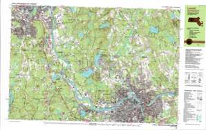 |
| State topo index: | MA topo index |
| Alternate map versions: | MA topographic maps Editions by year, direct download as GeoPDF. |
| 30´ x 60´ topo: | 1:100,000 scale map |
| 1° x 2° topo: | 1:250,000 scale map |
- Christian Hill
- Collinsville
- Flaggy Meadows Playground
- Kittredge Park
- Central Bridge
- Hunts Falls Bridge
- Ouelette Bridge
- Gage Park
- McPherson Playground
- Alumni Field
- Shedd Park
- Lowell-Dracut State Forest
- Highland Playground
- Washington Park
- South Common Park
- Fort Hill Park
- Merrimack Wasteway
- Lawrence Wasteway
- Hamilton Canal
- Massachusetts Wasteway
- Eastern Canal
- Guard Locks
- Tyler Park
- Interchange Thirty Eight
- Tyngsboro Bridge
- Interchange Thirty-six
- Interchange Thirty-five
- Interchange Thirty-four
- Interchange Thirty-three
- Concord River Reservoir
- Wamesit Power Company Dam
- Newfield Pond Dam
- Fletchers Pond
- Fletchers Pond Dam
- Cow Pond Brook Dam
- Cow Pond Brook Reservoir
- Middlesex Dam
- Concord River Reservoir
- Lower Pawtucket Canal Dam
- Lower Pawtucket Canal Reservoir
- Upper Pawtucket Canal Reservoir
- Upper Pawtucket Canal Dam
- Old Guard Locks Dam
- Pawtucket Canal Reservoir
- Swains Pond Dam
- Northern Canal Head Gates Dam
- Merrimack River Reservoir
- Merrimack River Reservoir
- Collinsville Dam
- Beaver Brook Reservoir
- Lowell Reservoir
- Lowell Reservoir Dam
- Massapoag Pond Dam
- Pleasant Street Dam
- Beaver Brook Reservoir
- Upper Flint Pond Dam
- Upper Flint Pond
- Mascuppic Lake Dam
- Locust Pond Dam
- Peters Pond Dam
- Richardsons Brook Swamp
- Western Canal
- Middlesex Canal
- Tyngs Swamp
- Potash Brook
- Nutting Hill
- Merrimack Canal
- Western Canal
- Lower Locks
- Hovey Square
- Lowell-Dracut State Forest
- Boston and Lowell Railroad Memorial
- Abrams Hill
- Althea Lake
- Bear Hill
- Black Brook
- Bridge Meadow Brook
- Chaney Hill
- Cold Springs Brook
- Curtis Hill
- Deep Brook
- Dunstable
- Flatrock Hill
- Flint Pond
- Flints Corner
- Flushing Hill
- Forest Hill
- Fox Ledge
- Frederick Corner
- Hauk Brook
- Hayward Corner
- Camp Immaculate Heart
- Joint Grass Brook
- Kendall Hill
- Camp Kiwanis
- Lawrence Brook
- Locust Hill
- Locust Pond
- Lower Massapoag Pond
- Mascuppic Lake
- Camp Massapoag
- Massapoag Pond
- Massapoag Ponds
- Newfield Pond
- Norris Corner
- North Chelmsford
- Oak Hill
- Pine Hill
- Potash Hill
- Roby Hill
- Mount Royal
- Salmon Brook
- Scarlet Brook
- Scotty Hollow
- Scribner Hill
- Spectacle Hill
- Stony Brook
- Swains Pond
- Swan Corner
- Tyngs Island
- Tyngsboro
- Upper Massapoag Pond
- Uptons Pond
- Whidden Corner
- Ayres City
- Belvidere
- Black Brook
- Bleachery
- Bump Hill
- Burns Hill
- Cedar Pond
- Centralville
- Claypit Brook
- Double Brook
- Dracut
- Duck Islands
- Fort Hill
- Highlands
- Kenwood
- Ledge Hill
- Long Pond
- Long Pond Park
- Loon Hill
- Lowell
- Marsh Hill
- Middlesex Village
- Nickel Mine Brook
- Oaklands
- Pawtucket Falls
- Pawtucketville
- Peppermint Brook
- Peters Pond
- River Meadow Brook
- Spruce Swamp
- Trout Brook
- Tull Brook
- Varnumtown
- Wamesit
- Whortleberry Hill
- Winter Hill
- Chandler Hill
- Marbles Brook
- Pawtucket Canal
- Pawtucket Dam
- Willowdale
- East Groton
- Poplar Hill
- Potash Brook
- Western Canal
- Wicassic Falls
- Merrimac Mills Post Office (historical)
- Larsons Seaplane Base
- Beaver Brook
- Concord River
- Northern Canal
- Francis Gate
- Ayers Pond
- Beaver Brook
- Cambridge Hill
- Cold Brook
- Gage Hill
- Gilboa Hill
- Golden Brook
- Gumpas Hill
- Gumpas Pond
- Gumpas Pond Brook
- Hale Brook
- Harris Brook
- Harris Pond
- Hassells Brook
- Island Pond Brook
- Jeremy Hill
- Limit Brook
- Little Island Pond
- Long Hill
- Long Pond
- Merrill Hill
- Musquash Brook
- Old Maids Brook
- Pelham
- Poplar Hill
- Pulpit Rock
- Sagamore Park
- Salmon Brook
- Sandy Pond
- Seavey Hill
- Spit Brook
- Tonys Brook
- Interchange 3
- Interchange 4
- Interchange 5
- C S S Heliport
- Steck Farm Airport
- Digital Heliport
- Ayers Pond Dam
- Gumpas Pond Dam
- Lowell National Historical Park
- Fields Grove
- Fun World
- Interchange 1
- Interchange 2
- Jeremy Hill Forest
- Labine Park
- Pelham Post Office
- Proctor Park
- Roby Park
- Boarding House Park
- City Hall Historic District
- Dunstable Post Office
- Eastern Canal Park
- Kerouac Commemorative
- Lowell Locks
- Lowell Post Office (historical)
- Lucy Larcom Park
- Memorial Stadium
- North Chelmsford Post Office
- Princeton Village
- Town Common
- Tyngsboro Post Office
- Wash Park
- Washington Square Historic District
- City Hall Historic District
- Merrimack-Middle Street Historic District
- South Common Historic District
- Tyler Park Historic District