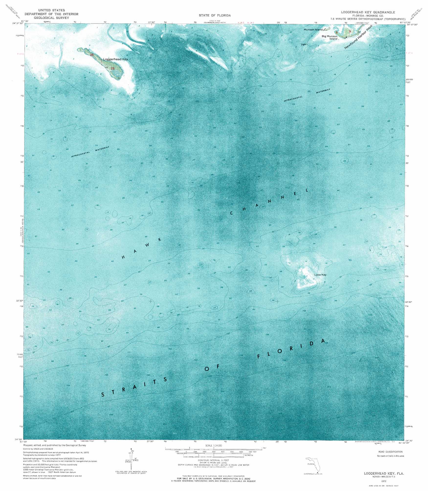
Key Lois Topo Map Florida
To zoom in, hover over the map of Key Lois
USGS Topo Quad 24081e4 - 1:24,000 scale
| Topo Map Name: | Key Lois |
| USGS Topo Quad ID: | 24081e4 |
| Print Size: | ca. 21 1/4" wide x 27" high |
| Southeast Coordinates: | 24.5° N latitude / 81.375° W longitude |
| Map Center Coordinates: | 24.5625° N latitude / 81.4375° W longitude |
| U.S. State: | FL |
| Filename: | P24081E4.jpg |
| Download Map JPG Image: | Key Lois topo map 1:24,000 scale |
| Map Type: | Orthophoto |
| Topo Series: | 7.5´ |
| Map Scale: | 1:24,000 |
| Source of Map Images: | United States Geological Survey (USGS) |
| Alternate Map Versions: |
Loggerhead Key FL 1972, updated 1973 Download PDF Buy paper map Loggerhead Key FL 1972, updated 1973 Download PDF Buy paper map Key Lois FL 2012 Download PDF Buy paper map Key Lois FL 2015 Download PDF Buy paper map |
1:24,000 Topo Quads surrounding Key Lois
Sawyer Key |
Content Keys |
Horseshoe Keys |
East Bahia Honda Key |
|
Snipe Keys |
Sugarloaf Key |
Summerland Key |
Big Pine Key |
Sevenmile Bridge |
Boca Chica Key |
Saddlebunch Keys |
Key Lois |
> Back to 24081e1 at 1:100,000 scale
> Back to 24080a1 at 1:250,000 scale
> Back to U.S. Topo Maps home
Key Lois topo map: Gazetteer
Key Lois: Islands
Big Munson Island elevation 1m 3′Key Lois elevation 0m 0′
Looe Key elevation 0m 0′
Munson Island elevation 0m 0′
Key Lois: Parks
Looe Key National Marine Sanctuary elevation 0m 0′Key Lois digital topo map on disk
Buy this Key Lois topo map showing relief, roads, GPS coordinates and other geographical features, as a high-resolution digital map file on DVD: