Taylor Slough Topo Map Florida
To zoom in, hover over the map of Taylor Slough
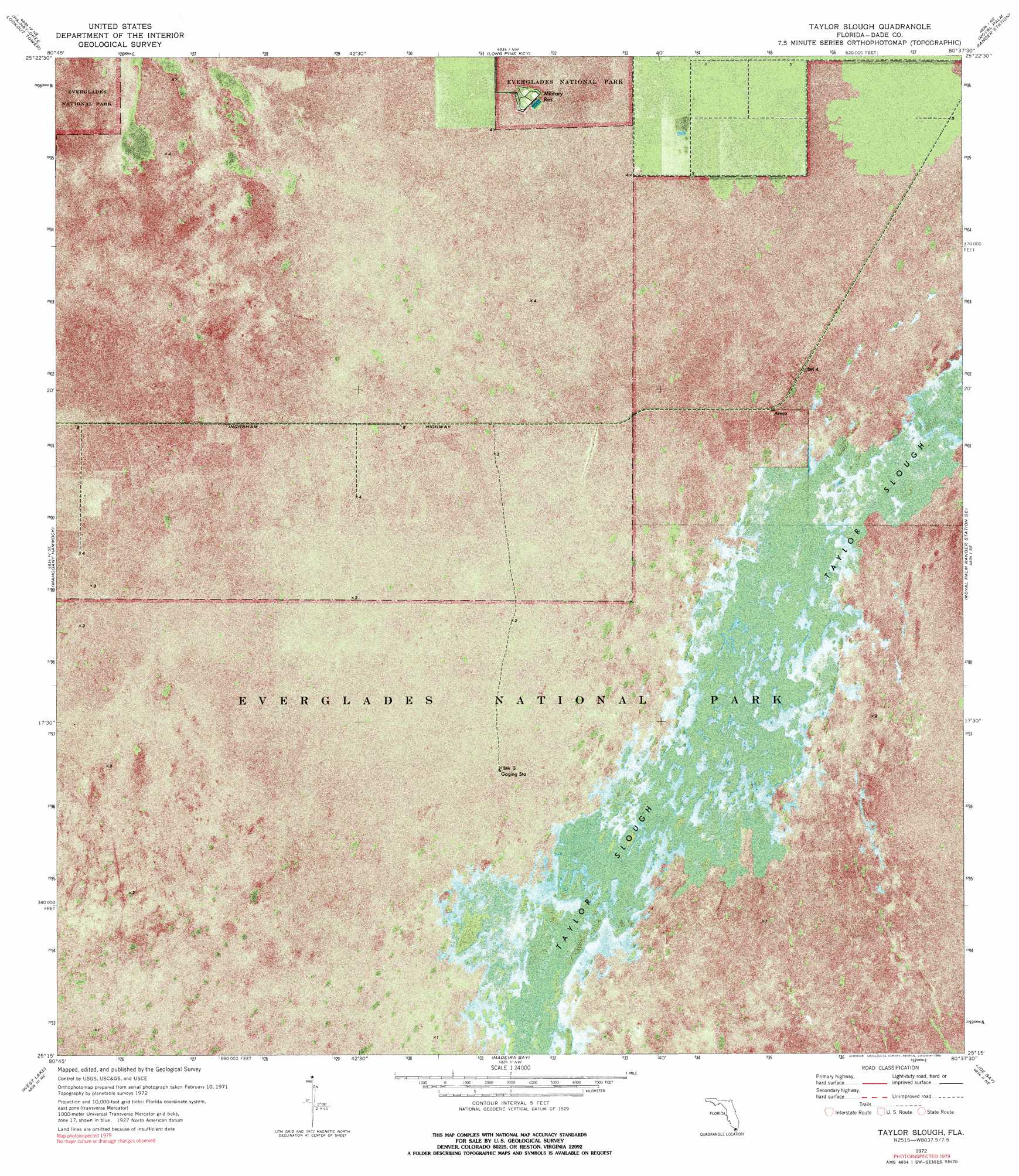
USGS Topo Quad 25080c6 - 1:24,000 scale
| Topo Map Name: | Taylor Slough |
| USGS Topo Quad ID: | 25080c6 |
| Print Size: | ca. 21 1/4" wide x 27" high |
| Southeast Coordinates: | 25.25° N latitude / 80.625° W longitude |
| Map Center Coordinates: | 25.3125° N latitude / 80.6875° W longitude |
| U.S. State: | FL |
| Filename: | P25080C6.jpg |
| Download Map JPG Image: | Taylor Slough topo map 1:24,000 scale |
| Map Type: | Orthophoto |
| Topo Series: | 7.5´ |
| Map Scale: | 1:24,000 |
| Source of Map Images: | United States Geological Survey (USGS) |
| Alternate Map Versions: |
Taylor Slough FL 1972, updated 1975 Download PDF Buy paper map Taylor Slough FL 1972, updated 1990 Download PDF Buy paper map Taylor Slough FL 2012 Download PDF Buy paper map Taylor Slough FL 2015 Download PDF Buy paper map |
1:24,000 Topo Quads surrounding Taylor Slough
Indian Camp Creek |
Panther Mound |
Black Hammock |
Grossman Hammock |
Goulds |
Tarpon Bay |
Pa-Hay-Okee Lookout Tower |
Long Pine Key |
Royal Palm Ranger Station |
Homestead |
Whitewater Bay East |
Mahogany Hammock |
Taylor Slough |
Royal Palm Ranger Station Se |
Glades |
Flamingo |
West Lake |
Madeira Bay |
Joe Bay |
Blackwater Sound |
Clive Key |
Pelican Keys |
Calusa Keys |
Tavernier |
Rock Harbor |
> Back to 25080a1 at 1:100,000 scale
> Back to 25080a1 at 1:250,000 scale
> Back to U.S. Topo Maps home
Taylor Slough digital topo map on disk
Buy this Taylor Slough topo map showing relief, roads, GPS coordinates and other geographical features, as a high-resolution digital map file on DVD: