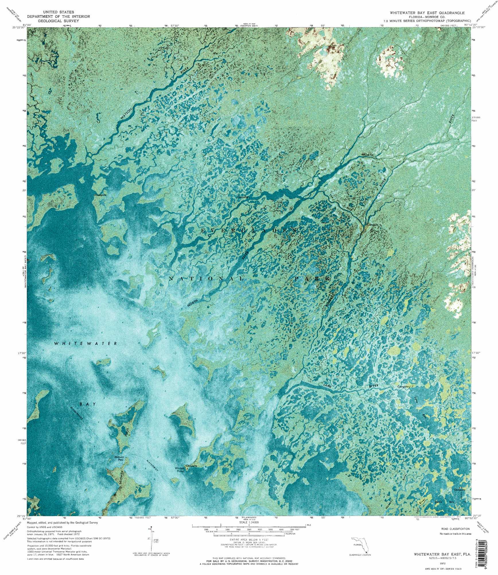
Whitewater Bay East Topo Map Florida
To zoom in, hover over the map of Whitewater Bay East
USGS Topo Quad 25080c8 - 1:24,000 scale
| Topo Map Name: | Whitewater Bay East |
| USGS Topo Quad ID: | 25080c8 |
| Print Size: | ca. 21 1/4" wide x 27" high |
| Southeast Coordinates: | 25.25° N latitude / 80.875° W longitude |
| Map Center Coordinates: | 25.3125° N latitude / 80.9375° W longitude |
| U.S. State: | FL |
| Filename: | P25080C8.jpg |
| Download Map JPG Image: | Whitewater Bay East topo map 1:24,000 scale |
| Map Type: | Orthophoto |
| Topo Series: | 7.5´ |
| Map Scale: | 1:24,000 |
| Source of Map Images: | United States Geological Survey (USGS) |
| Alternate Map Versions: |
Whitewater Bay East FL 1972, updated 1975 Download PDF Buy paper map Whitewater Bay East FL 1972, updated 1975 Download PDF Buy paper map Whitewater Bay East FL 2012 Download PDF Buy paper map Whitewater Bay East FL 2015 Download PDF Buy paper map |
1:24,000 Topo Quads surrounding Whitewater Bay East
Lostmans River Ranger Station |
Big Lostmans Bay |
Indian Camp Creek |
Panther Mound |
Black Hammock |
Shark Point |
Harney River |
Tarpon Bay |
Pa-Hay-Okee Lookout Tower |
Long Pine Key |
Shark River Island |
Whitewater Bay West |
Whitewater Bay East |
Mahogany Hammock |
Taylor Slough |
Lake Ingraham West |
Lake Ingraham East |
Flamingo |
West Lake |
Madeira Bay |
Sandy Key |
Clive Key |
Pelican Keys |
Calusa Keys |
> Back to 25080a1 at 1:100,000 scale
> Back to 25080a1 at 1:250,000 scale
> Back to U.S. Topo Maps home
Whitewater Bay East topo map: Gazetteer
Whitewater Bay East: Bays
Hells Bay elevation 0m 0′Lane Bay elevation -1m -4′
Whitewater Bay elevation 0m 0′
Whitewater Bay East: Capes
Wedge Point elevation 0m 0′Whitewater Bay East: Channels
Midway Pass elevation 0m 0′The Cutoff elevation 0m 0′
Whitewater Bay East: Islands
Midway Keys elevation 0m 0′Whitewater Bay East: Parks
Everglades National Park elevation 0m 0′Whitewater Bay East: Streams
Lane River elevation 0m 0′North River elevation 0m 0′
Roberts River elevation 0m 0′
Watson River elevation 0m 0′
Whitewater Bay East digital topo map on disk
Buy this Whitewater Bay East topo map showing relief, roads, GPS coordinates and other geographical features, as a high-resolution digital map file on DVD: