Pa-Hay-Okee Lookout Tower Topo Map Florida
To zoom in, hover over the map of Pa-Hay-Okee Lookout Tower
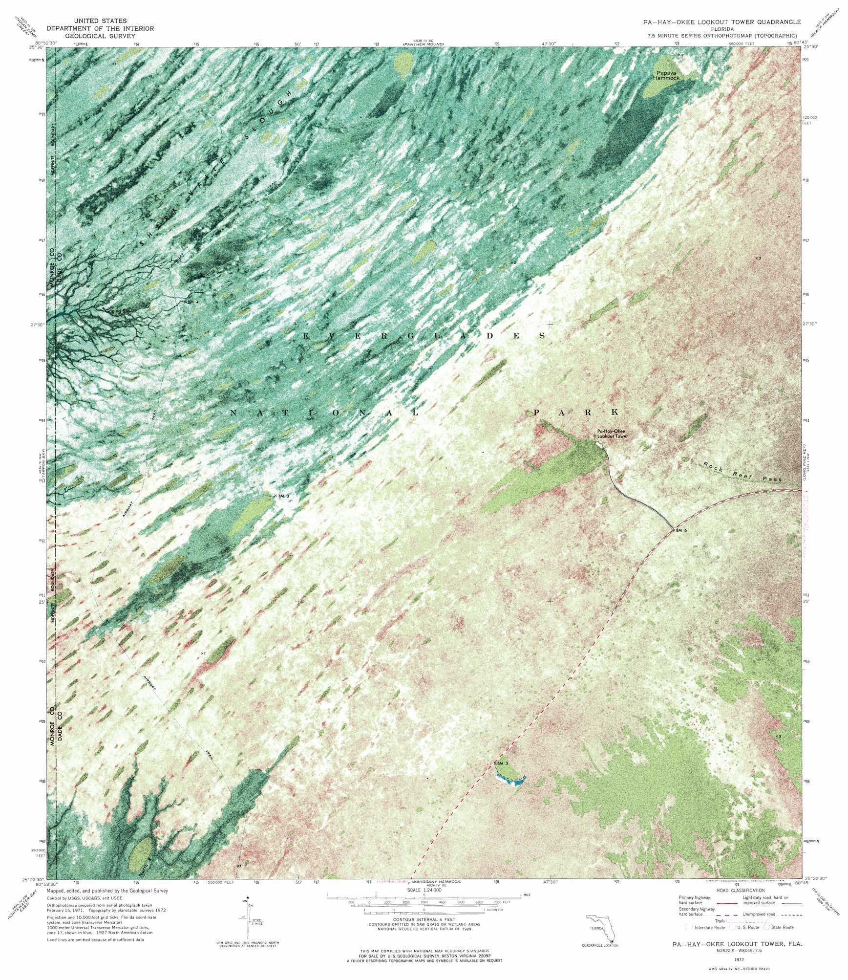
USGS Topo Quad 25080d7 - 1:24,000 scale
| Topo Map Name: | Pa-Hay-Okee Lookout Tower |
| USGS Topo Quad ID: | 25080d7 |
| Print Size: | ca. 21 1/4" wide x 27" high |
| Southeast Coordinates: | 25.375° N latitude / 80.75° W longitude |
| Map Center Coordinates: | 25.4375° N latitude / 80.8125° W longitude |
| U.S. State: | FL |
| Filename: | P25080D7.jpg |
| Download Map JPG Image: | Pa-Hay-Okee Lookout Tower topo map 1:24,000 scale |
| Map Type: | Orthophoto |
| Topo Series: | 7.5´ |
| Map Scale: | 1:24,000 |
| Source of Map Images: | United States Geological Survey (USGS) |
| Alternate Map Versions: |
Pa Hay Okee Lookout Tower FL 1972, updated 1976 Download PDF Buy paper map Pa-Hay-Okee Lookout Tower FL 2012 Download PDF Buy paper map Pa-Hay-Okee Lookout Tower FL 2015 Download PDF Buy paper map |
1:24,000 Topo Quads surrounding Pa-Hay-Okee Lookout Tower
Big Boy Lake |
Lostmans Trail |
Shark Valley Lookout Tower |
Chekika Island |
South Of Coopertown |
Big Lostmans Bay |
Indian Camp Creek |
Panther Mound |
Black Hammock |
Grossman Hammock |
Harney River |
Tarpon Bay |
Pa-Hay-Okee Lookout Tower |
Long Pine Key |
Royal Palm Ranger Station |
Whitewater Bay West |
Whitewater Bay East |
Mahogany Hammock |
Taylor Slough |
Royal Palm Ranger Station Se |
Lake Ingraham East |
Flamingo |
West Lake |
Madeira Bay |
Joe Bay |
> Back to 25080a1 at 1:100,000 scale
> Back to 25080a1 at 1:250,000 scale
> Back to U.S. Topo Maps home
Pa-Hay-Okee Lookout Tower topo map: Gazetteer
Pa-Hay-Okee Lookout Tower: Islands
Papaya Hammock elevation 1m 3′Pa-Hay-Okee Lookout Tower: Ridges
Rock Reef Pass elevation 1m 3′Pa-Hay-Okee Lookout Tower digital topo map on disk
Buy this Pa-Hay-Okee Lookout Tower topo map showing relief, roads, GPS coordinates and other geographical features, as a high-resolution digital map file on DVD: