Monroe Station Topo Map Florida
To zoom in, hover over the map of Monroe Station
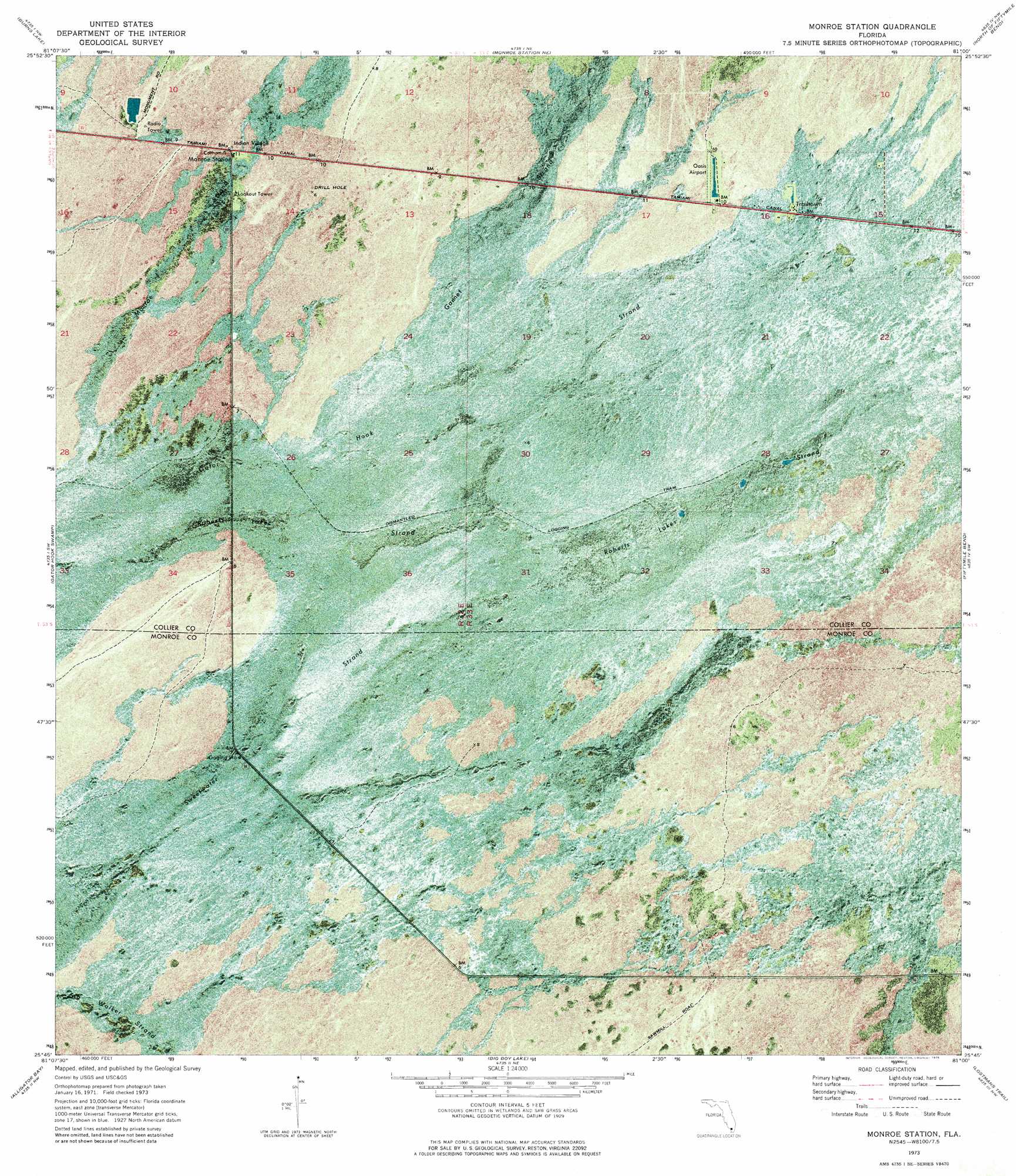
USGS Topo Quad 25081g1 - 1:24,000 scale
| Topo Map Name: | Monroe Station |
| USGS Topo Quad ID: | 25081g1 |
| Print Size: | ca. 21 1/4" wide x 27" high |
| Southeast Coordinates: | 25.75° N latitude / 81° W longitude |
| Map Center Coordinates: | 25.8125° N latitude / 81.0625° W longitude |
| U.S. State: | FL |
| Filename: | P25081G1.jpg |
| Download Map JPG Image: | Monroe Station topo map 1:24,000 scale |
| Map Type: | Orthophoto |
| Topo Series: | 7.5´ |
| Map Scale: | 1:24,000 |
| Source of Map Images: | United States Geological Survey (USGS) |
| Alternate Map Versions: |
Monroe Station FL 1973, updated 1976 Download PDF Buy paper map Monroe Station FL 1995, updated 1999 Download PDF Buy paper map Monroe Station FL 2012 Download PDF Buy paper map Monroe Station FL 2015 Download PDF Buy paper map |
1:24,000 Topo Quads surrounding Monroe Station
Deep Lake |
Immokalee 4 Sw |
Immokalee 4 Se |
Everglades 3 Sw |
Everglades 3 Se |
Ochopee |
Burns Lake |
Monroe Station Ne |
North Of Fiftymile Bend |
North Of Fortymile Bend |
Chokoloskee |
Gator Hook Swamp |
Monroe Station |
Fiftymile Bend |
Fortymile Bend |
Pavilion Key |
Alligator Bay |
Big Boy Lake |
Lostmans Trail |
Shark Valley Lookout Tower |
Plover Key |
Lostmans River Ranger Station |
Big Lostmans Bay |
Indian Camp Creek |
Panther Mound |
> Back to 25081e1 at 1:100,000 scale
> Back to 25080a1 at 1:250,000 scale
> Back to U.S. Topo Maps home
Monroe Station topo map: Gazetteer
Monroe Station: Airports
Oasis Ranger Station-U S Government Airport elevation 2m 6′Monroe Station: Populated Places
Trailtown elevation 2m 6′Monroe Station: Swamps
Gannet Strand elevation 2m 6′Gator Hook Strand elevation 2m 6′
Roberts Lakes Strand elevation 1m 3′
Sweetwater Strand elevation 1m 3′
Monroe Station digital topo map on disk
Buy this Monroe Station topo map showing relief, roads, GPS coordinates and other geographical features, as a high-resolution digital map file on DVD: