Cooper City Ne Topo Map Florida
To zoom in, hover over the map of Cooper City Ne
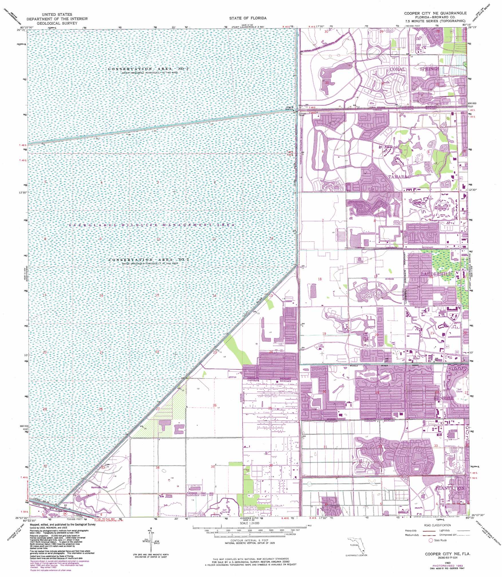
USGS Topo Quad 26080b3 - 1:24,000 scale
| Topo Map Name: | Cooper City Ne |
| USGS Topo Quad ID: | 26080b3 |
| Print Size: | ca. 21 1/4" wide x 27" high |
| Southeast Coordinates: | 26.125° N latitude / 80.25° W longitude |
| Map Center Coordinates: | 26.1875° N latitude / 80.3125° W longitude |
| U.S. State: | FL |
| Filename: | O26080B3.jpg |
| Download Map JPG Image: | Cooper City Ne topo map 1:24,000 scale |
| Map Type: | Topographic |
| Topo Series: | 7.5´ |
| Map Scale: | 1:24,000 |
| Source of Map Images: | United States Geological Survey (USGS) |
| Alternate Map Versions: |
Cooper City NE FL 1963, updated 1964 Download PDF Buy paper map Cooper City NE FL 1963, updated 1970 Download PDF Buy paper map Cooper City NE FL 1963, updated 1974 Download PDF Buy paper map Cooper City NE FL 1963, updated 1983 Download PDF Buy paper map Cooper City NE FL 2012 Download PDF Buy paper map Cooper City NE FL 2015 Download PDF Buy paper map |
1:24,000 Topo Quads surrounding Cooper City Ne
Everglades 1 Ne |
Fort Lauderdale 2 Nw |
Fort Lauderdale 2 Ne |
University Park |
Delray Beach |
Everglades 1 Se |
Fort Lauderdale 2 Sw |
Fort Lauderdale 2 Se |
West Dixie Bend |
Boca Raton |
Everglades 4 Ne |
Andytown |
Cooper City Ne |
Fort Lauderdale North |
Pompano Beach |
Everglades 4 Se |
Cooper City Sw |
Cooper City |
Fort Lauderdale South |
Port Everglades |
West Of Pennsuco |
Pennsuco |
Opa-Locka |
North Miami |
> Back to 26080a1 at 1:100,000 scale
> Back to 26080a1 at 1:250,000 scale
> Back to U.S. Topo Maps home
Cooper City Ne topo map: Gazetteer
Cooper City Ne: Airports
Broward County Civic Arena Heliport elevation 1m 3′Cooper City Ne: Levees
Levee Number 35A elevation 1m 3′Cooper City Ne: Parks
Everglades Wildlife Management Area Conservation Area Number 2A elevation 3m 9′Everglades Wildlife Management Area Conservation Area Number 2B elevation 3m 9′
Markham Park elevation 1m 3′
Cooper City Ne: Populated Places
Plantation Acres elevation 1m 3′Sunrise elevation 2m 6′
Cooper City Ne: Post Offices
Lauderhill Post Office elevation 3m 9′Sunrise Post Office elevation 2m 6′
Tamarac Post Office elevation 3m 9′
Cooper City Ne digital topo map on disk
Buy this Cooper City Ne topo map showing relief, roads, GPS coordinates and other geographical features, as a high-resolution digital map file on DVD: