University Park Topo Map Florida
To zoom in, hover over the map of University Park
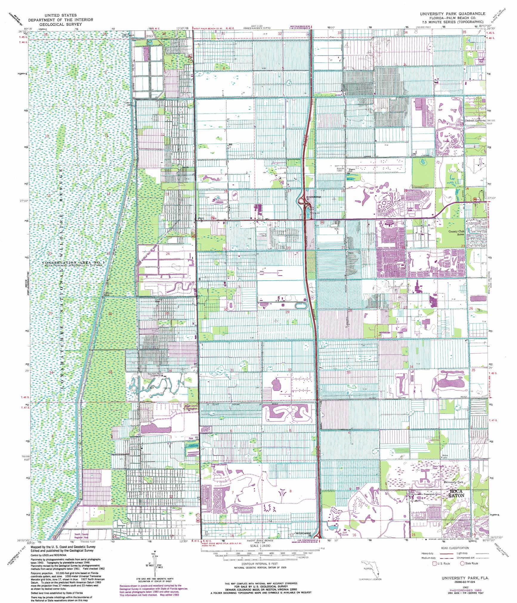
USGS Topo Quad 26080d2 - 1:24,000 scale
| Topo Map Name: | University Park |
| USGS Topo Quad ID: | 26080d2 |
| Print Size: | ca. 21 1/4" wide x 27" high |
| Southeast Coordinates: | 26.375° N latitude / 80.125° W longitude |
| Map Center Coordinates: | 26.4375° N latitude / 80.1875° W longitude |
| U.S. State: | FL |
| Filename: | O26080D2.jpg |
| Download Map JPG Image: | University Park topo map 1:24,000 scale |
| Map Type: | Topographic |
| Topo Series: | 7.5´ |
| Map Scale: | 1:24,000 |
| Source of Map Images: | United States Geological Survey (USGS) |
| Alternate Map Versions: |
Delmar Farms FL 1947, updated 1961 Download PDF Buy paper map Delmar Farms FL 1949 Download PDF Buy paper map University Park FL 1962, updated 1966 Download PDF Buy paper map University Park FL 1962, updated 1970 Download PDF Buy paper map University Park FL 1962, updated 1983 Download PDF Buy paper map University Park FL 2012 Download PDF Buy paper map University Park FL 2015 Download PDF Buy paper map |
1:24,000 Topo Quads surrounding University Park
Loxahatchee Nw |
Loxahatchee |
Palm Beach Farms |
Palm Beach |
|
Loxahatchee Sw |
Loxahatchee Se |
Greenacres City |
Lake Worth |
|
Fort Lauderdale 2 Nw |
Fort Lauderdale 2 Ne |
University Park |
Delray Beach |
|
Fort Lauderdale 2 Sw |
Fort Lauderdale 2 Se |
West Dixie Bend |
Boca Raton |
|
Andytown |
Cooper City Ne |
Fort Lauderdale North |
Pompano Beach |
> Back to 26080a1 at 1:100,000 scale
> Back to 26080a1 at 1:250,000 scale
> Back to U.S. Topo Maps home
University Park topo map: Gazetteer
University Park: Airports
AIM Heliport elevation 5m 16′Antiquers Aerodrome elevation 6m 19′
Delray Community Hospital Emergency Helistop elevation 5m 16′
Delray Training Center Heliport elevation 6m 19′
Le Lac Heliport elevation 4m 13′
Snow Heliport elevation 5m 16′
University Park: Crossings
Interchange 7 elevation 6m 19′University Park: Levees
Levee Number 40 elevation 4m 13′University Park: Parks
American Homes Park elevation 5m 16′Boca Tierra Park elevation 4m 13′
Loxahatchee National Wildlife Refuge elevation 3m 9′
Morakami Park elevation 6m 19′
Morikami Gardens elevation 6m 19′
South County Regional Park elevation 4m 13′
South County Triplex Park elevation 5m 16′
University Park: Populated Places
Boca West elevation 5m 16′County Club Acres elevation 5m 16′
Hamptons at Boca Raton elevation 5m 16′
High Point elevation 6m 19′
Kings Point elevation 5m 16′
University Park elevation 4m 13′
Villages of Oriole elevation 6m 19′
Whisper Walk elevation 5m 16′
University Park: Post Offices
West Delray Beach Post Office elevation 4m 13′University Park digital topo map on disk
Buy this University Park topo map showing relief, roads, GPS coordinates and other geographical features, as a high-resolution digital map file on DVD: