Everglades 2 Nw Topo Map Florida
To zoom in, hover over the map of Everglades 2 Nw
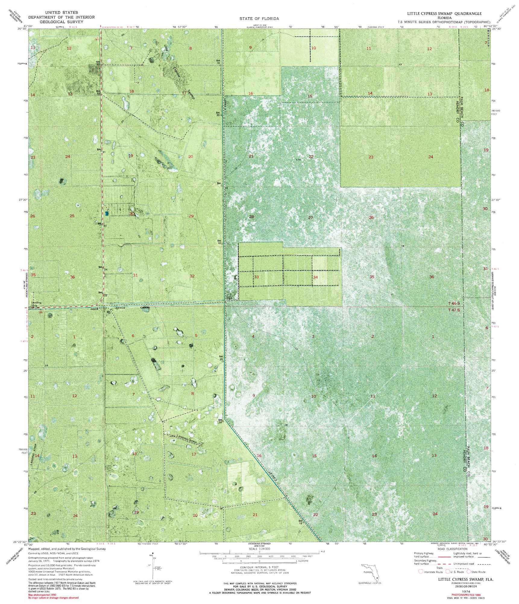
USGS Topo Quad 26080d8 - 1:24,000 scale
| Topo Map Name: | Everglades 2 Nw |
| USGS Topo Quad ID: | 26080d8 |
| Print Size: | ca. 21 1/4" wide x 27" high |
| Southeast Coordinates: | 26.375° N latitude / 80.875° W longitude |
| Map Center Coordinates: | 26.4375° N latitude / 80.9375° W longitude |
| U.S. State: | FL |
| Filename: | P26080D8.jpg |
| Download Map JPG Image: | Everglades 2 Nw topo map 1:24,000 scale |
| Map Type: | Orthophoto |
| Topo Series: | 7.5´ |
| Map Scale: | 1:24,000 |
| Source of Map Images: | United States Geological Survey (USGS) |
| Alternate Map Versions: |
Everglades 2 NW FL 1974, updated 1976 Download PDF Buy paper map Little Cypress Swamp FL 1974, updated 1993 Download PDF Buy paper map Little Cypress Swamp FL 2012 Download PDF Buy paper map Little Cypress Swamp FL 2015 Download PDF Buy paper map |
1:24,000 Topo Quads surrounding Everglades 2 Nw
La Belle 4 Nw |
La Belle 4 Ne |
Clewiston South |
Lake Harbor |
Belle Glade |
La Belle 4 Sw |
La Belle 4 Se |
Lake Harbor Sw |
Lake Harbor Se |
Okeelanta |
Immokalee 1 Nw |
Immokalee 1 Ne |
Everglades 2 Nw |
Everglades 2 Ne |
Everglades 1 Nw |
Immokalee 1 Sw |
Immokalee 1 Se |
Everglades 2 Sw |
Everglades 2 Se |
Everglades 1 Sw |
Immokalee 4 Nw |
Immokalee 4 Ne |
Everglades 3 Nw |
Everglades 3 Ne |
Everglades 4 Nw |
> Back to 26080a1 at 1:100,000 scale
> Back to 26080a1 at 1:250,000 scale
> Back to U.S. Topo Maps home
Everglades 2 Nw topo map: Gazetteer
Everglades 2 Nw: Airports
Southern Ranch Airport elevation 5m 16′Everglades 2 Nw: Levees
Levee 3 elevation 5m 16′Everglades 2 Nw: Swamps
Little Cypress Swamp elevation 5m 16′Everglades 2 Nw digital topo map on disk
Buy this Everglades 2 Nw topo map showing relief, roads, GPS coordinates and other geographical features, as a high-resolution digital map file on DVD: