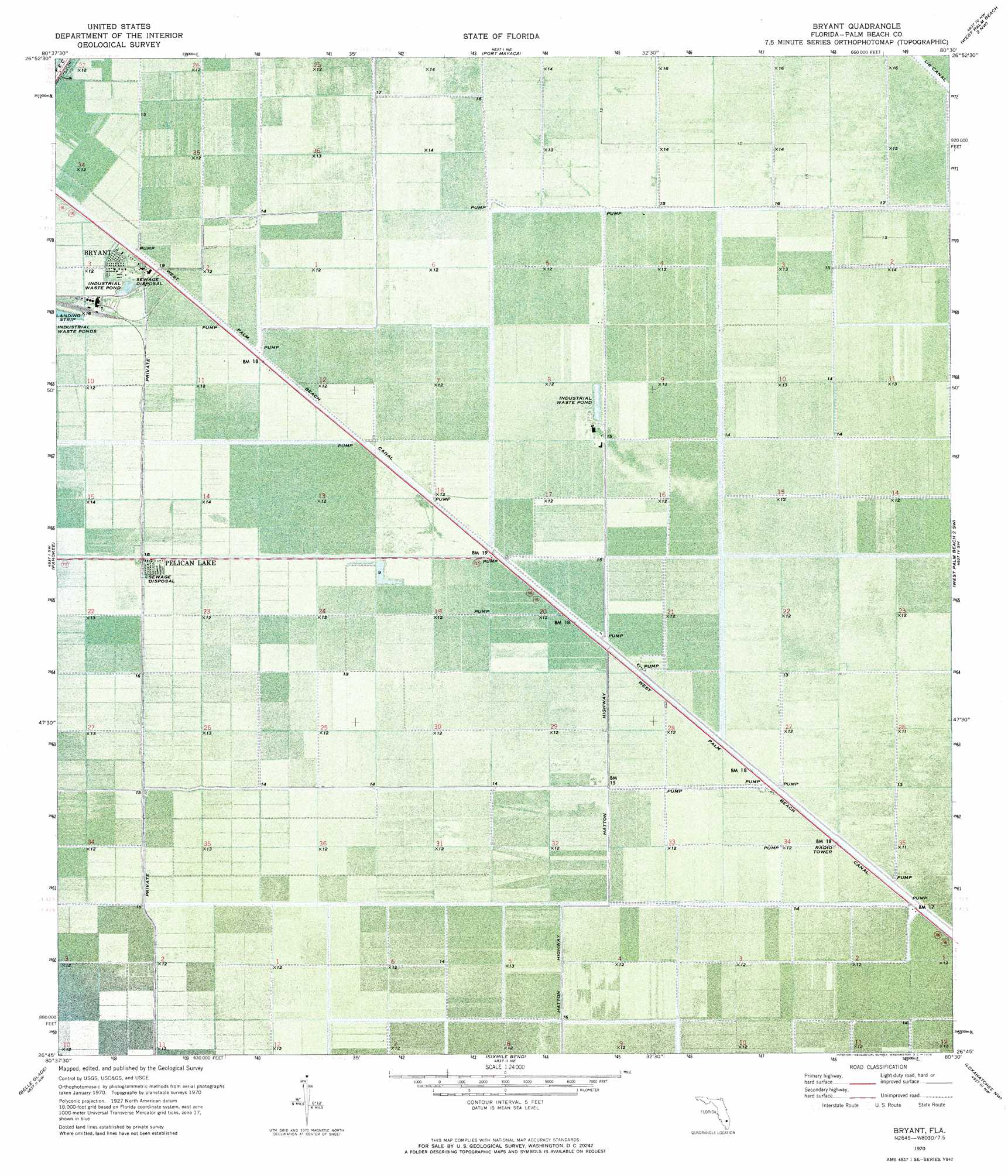
Bryant Topo Map Florida
To zoom in, hover over the map of Bryant
USGS Topo Quad 26080g5 - 1:24,000 scale
| Topo Map Name: | Bryant |
| USGS Topo Quad ID: | 26080g5 |
| Print Size: | ca. 21 1/4" wide x 27" high |
| Southeast Coordinates: | 26.75° N latitude / 80.5° W longitude |
| Map Center Coordinates: | 26.8125° N latitude / 80.5625° W longitude |
| U.S. State: | FL |
| Filename: | P26080G5.jpg |
| Download Map JPG Image: | Bryant topo map 1:24,000 scale |
| Map Type: | Orthophoto |
| Topo Series: | 7.5´ |
| Map Scale: | 1:24,000 |
| Source of Map Images: | United States Geological Survey (USGS) |
| Alternate Map Versions: |
Bryant FL 1970, updated 1976 Download PDF Buy paper map Bryant FL 2012 Download PDF Buy paper map Bryant FL 2015 Download PDF Buy paper map |
1:24,000 Topo Quads surrounding Bryant
Okeechobee Se |
Okeechobee 4 Sw |
Okeechobee 4 Se |
Indian Town |
Indiantown Se |
Port Mayaca |
West Palm Beach 2 Nw |
West Palm Beach 2 Ne |
||
Pahokee |
Bryant |
Big Mound South |
West of Delta |
|
Lake Harbor |
Belle Glade |
Sixmile Bend |
Loxahatchee Nw |
Loxahatchee |
Lake Harbor Se |
Okeelanta |
Shawano |
Loxahatchee Sw |
Loxahatchee Se |
> Back to 26080e1 at 1:100,000 scale
> Back to 26080a1 at 1:250,000 scale
> Back to U.S. Topo Maps home
Bryant topo map: Gazetteer
Bryant: Airports
Bryant Air Strip elevation 4m 13′Bryant: Populated Places
Bryant elevation 4m 13′Pelican Lake elevation 4m 13′
Bryant digital topo map on disk
Buy this Bryant topo map showing relief, roads, GPS coordinates and other geographical features, as a high-resolution digital map file on DVD: