Deep Lake Topo Map Florida
To zoom in, hover over the map of Deep Lake
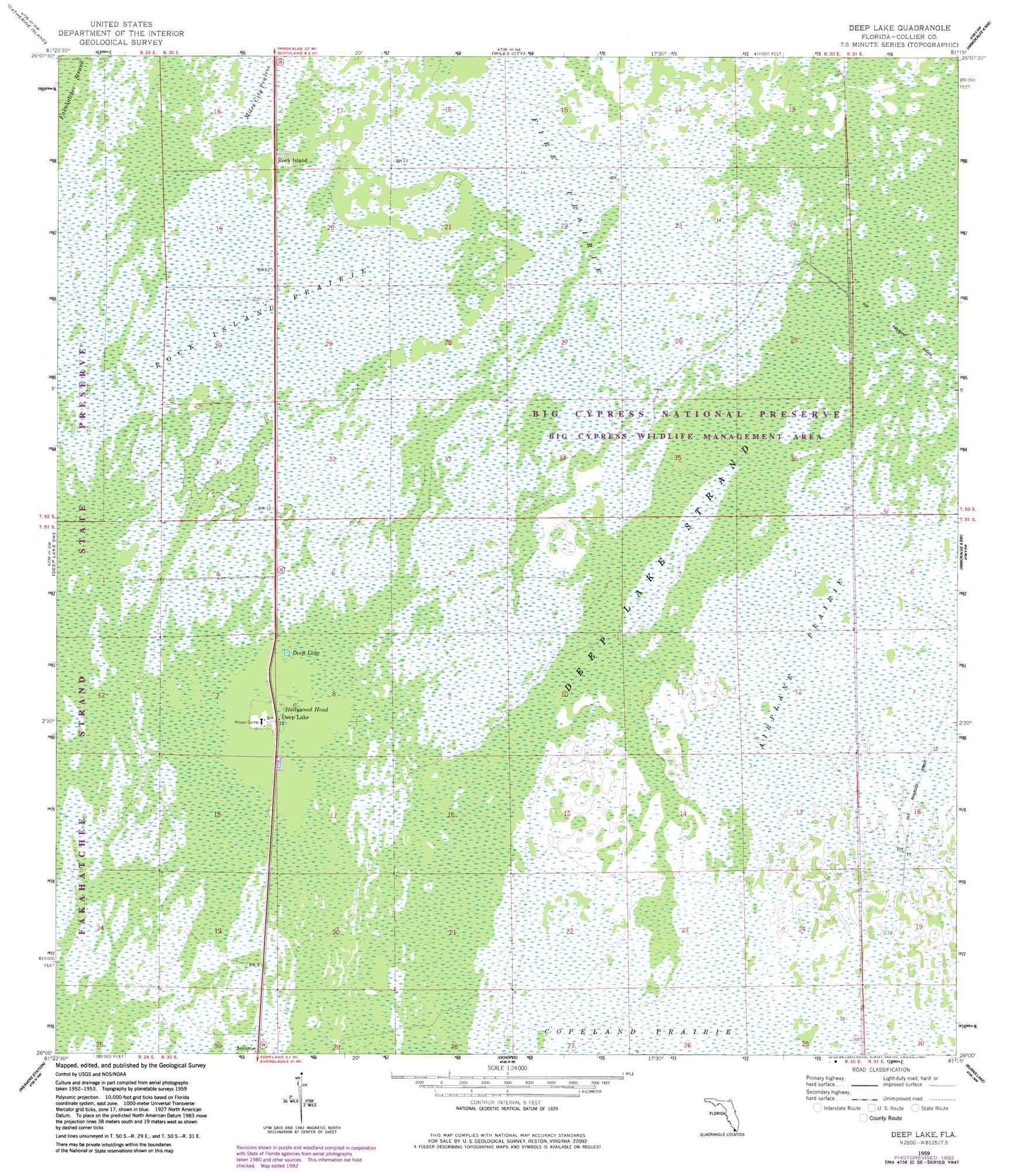
USGS Topo Quad 26081a3 - 1:24,000 scale
| Topo Map Name: | Deep Lake |
| USGS Topo Quad ID: | 26081a3 |
| Print Size: | ca. 21 1/4" wide x 27" high |
| Southeast Coordinates: | 26° N latitude / 81.25° W longitude |
| Map Center Coordinates: | 26.0625° N latitude / 81.3125° W longitude |
| U.S. State: | FL |
| Filename: | O26081A3.jpg |
| Download Map JPG Image: | Deep Lake topo map 1:24,000 scale |
| Map Type: | Topographic |
| Topo Series: | 7.5´ |
| Map Scale: | 1:24,000 |
| Source of Map Images: | United States Geological Survey (USGS) |
| Alternate Map Versions: |
Deep Lake FL 1959, updated 1960 Download PDF Buy paper map Deep Lake FL 1959, updated 1968 Download PDF Buy paper map Deep Lake FL 1959, updated 1983 Download PDF Buy paper map Deep Lake FL 2012 Download PDF Buy paper map Deep Lake FL 2015 Download PDF Buy paper map |
1:24,000 Topo Quads surrounding Deep Lake
Corkscrew Se |
Immokalee Sw |
Sunniland |
Immokalee 1 Sw |
Immokalee 1 Se |
Belle Meade Ne |
Catherine Island |
Miles City |
Immokalee 4 Nw |
Immokalee 4 Ne |
Belle Meade Se |
Deep Lake Sw |
Deep Lake |
Immokalee 4 Sw |
Immokalee 4 Se |
Royal Palm Hammock |
Weavers Station |
Ochopee |
Burns Lake |
Monroe Station Ne |
Panther Key |
Everglades City |
Chokoloskee |
Gator Hook Swamp |
Monroe Station |
> Back to 26081a1 at 1:100,000 scale
> Back to 26080a1 at 1:250,000 scale
> Back to U.S. Topo Maps home
Deep Lake topo map: Gazetteer
Deep Lake: Flats
Airplane Prairie elevation 3m 9′Rock Island Prairie elevation 3m 9′
Deep Lake: Lakes
Deep Lake elevation 3m 9′Deep Lake: Populated Places
Deep Lake elevation 3m 9′Rock Island elevation 3m 9′
Deep Lake: Summits
Hollywood Head elevation 3m 9′Deep Lake: Swamps
Deep Lake Strand elevation 4m 13′Fire Prairie elevation 3m 9′
Deep Lake digital topo map on disk
Buy this Deep Lake topo map showing relief, roads, GPS coordinates and other geographical features, as a high-resolution digital map file on DVD: