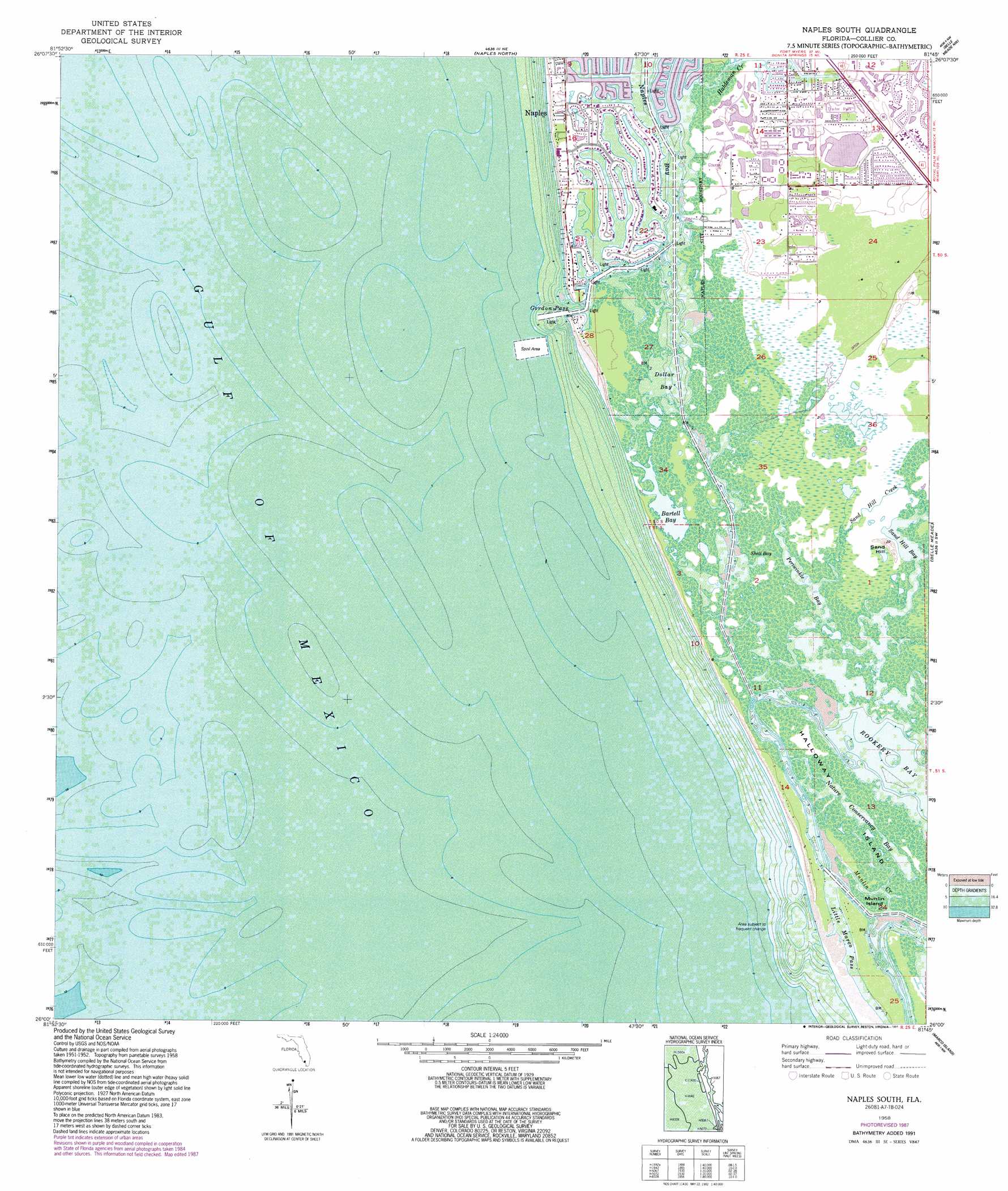
Naples South Topo Map Florida
To zoom in, hover over the map of Naples South
USGS Topo Quad 26081a7 - 1:24,000 scale
| Topo Map Name: | Naples South |
| USGS Topo Quad ID: | 26081a7 |
| Print Size: | ca. 21 1/4" wide x 27" high |
| Southeast Coordinates: | 26° N latitude / 81.75° W longitude |
| Map Center Coordinates: | 26.0625° N latitude / 81.8125° W longitude |
| U.S. State: | FL |
| Filename: | O26081A7.jpg |
| Download Map JPG Image: | Naples South topo map 1:24,000 scale |
| Map Type: | Topographic |
| Topo Series: | 7.5´ |
| Map Scale: | 1:24,000 |
| Source of Map Images: | United States Geological Survey (USGS) |
| Alternate Map Versions: |
Naples South FL 1958, updated 1959 Download PDF Buy paper map Naples South FL 1958, updated 1964 Download PDF Buy paper map Naples South FL 1958, updated 1973 Download PDF Buy paper map Naples South FL 1958, updated 1988 Download PDF Buy paper map Naples South FL 1958, updated 1991 Download PDF Buy paper map Naples South FL 2012 Download PDF Buy paper map Naples South FL 2015 Download PDF Buy paper map |
1:24,000 Topo Quads surrounding Naples South
Bonita Springs |
Corkscrew Sw |
Corkscrew Se |
||
Naples North |
Belle Meade Nw |
Belle Meade Ne |
||
Naples South |
Belle Meade |
Belle Meade Se |
||
Marco Island |
Royal Palm Hammock |
|||
Cape Romano |
Panther Key |
> Back to 26081a1 at 1:100,000 scale
> Back to 26080a1 at 1:250,000 scale
> Back to U.S. Topo Maps home
Naples South topo map: Gazetteer
Naples South: Bays
Bartell Bay elevation 0m 0′Dollar Bay elevation 0m 0′
Naples Bay elevation 0m 0′
Nature Conservancy Bay elevation 0m 0′
Periwinkle Bay elevation 0m 0′
Sand Hill Bay elevation 0m 0′
Shell Bay elevation 0m 0′
The First National elevation 0m 0′
Naples South: Channels
Calhoun Channel elevation 0m 0′Gordon Pass elevation 0m 0′
Little Marco Pass elevation 0m 0′
New Pass (historical) elevation 0m 0′
Naples South: Guts
Munlin Creek elevation 0m 0′Rookery Channel elevation 0m 0′
Naples South: Islands
Halloway Island elevation 0m 0′Keewaydin Island elevation 0m 0′
Little Marco Island elevation 0m 0′
Munlin Island elevation 0m 0′
Naples South: Populated Places
Enchanting Acres Mobile Home Park elevation 1m 3′Port Royal elevation 1m 3′
Royal Harbor elevation 0m 0′
Naples South: Streams
Haldeman Creek elevation 0m 0′Sand Hill Creek elevation 0m 0′
Stopper Creek elevation 0m 0′
Naples South: Summits
Sand Hill elevation 5m 16′Naples South digital topo map on disk
Buy this Naples South topo map showing relief, roads, GPS coordinates and other geographical features, as a high-resolution digital map file on DVD: