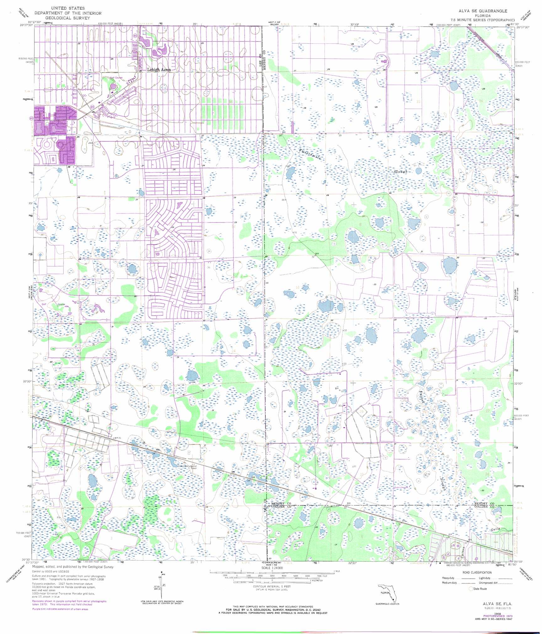
Alva Se Topo Map Florida
To zoom in, hover over the map of Alva Se
USGS Topo Quad 26081e5 - 1:24,000 scale
| Topo Map Name: | Alva Se |
| USGS Topo Quad ID: | 26081e5 |
| Print Size: | ca. 21 1/4" wide x 27" high |
| Southeast Coordinates: | 26.5° N latitude / 81.5° W longitude |
| Map Center Coordinates: | 26.5625° N latitude / 81.5625° W longitude |
| U.S. State: | FL |
| Filename: | O26081E5.jpg |
| Download Map JPG Image: | Alva Se topo map 1:24,000 scale |
| Map Type: | Topographic |
| Topo Series: | 7.5´ |
| Map Scale: | 1:24,000 |
| Source of Map Images: | United States Geological Survey (USGS) |
| Alternate Map Versions: |
Alva SE FL 1958, updated 1959 Download PDF Buy paper map Alva SE FL 1958, updated 1971 Download PDF Buy paper map Alva SE FL 1958, updated 1984 Download PDF Buy paper map Alva SE FL 2012 Download PDF Buy paper map Alva SE FL 2015 Download PDF Buy paper map |
1:24,000 Topo Quads surrounding Alva Se
Tuckers Corner |
Telegraph Swamp |
Telegraph Swamp Se |
La Belle |
Goodno |
Fort Myers |
Olga |
Alva |
Sears |
Felda Ne |
Fort Myers Se |
Alva Sw |
Alva Se |
Felda |
Felda Se |
Estero |
Corkscrew Nw |
Corkscrew |
Immokalee |
Immokalee Ne |
Bonita Springs |
Corkscrew Sw |
Corkscrew Se |
Immokalee Sw |
Sunniland |
> Back to 26081e1 at 1:100,000 scale
> Back to 26080a1 at 1:250,000 scale
> Back to U.S. Topo Maps home
Alva Se digital topo map on disk
Buy this Alva Se topo map showing relief, roads, GPS coordinates and other geographical features, as a high-resolution digital map file on DVD: