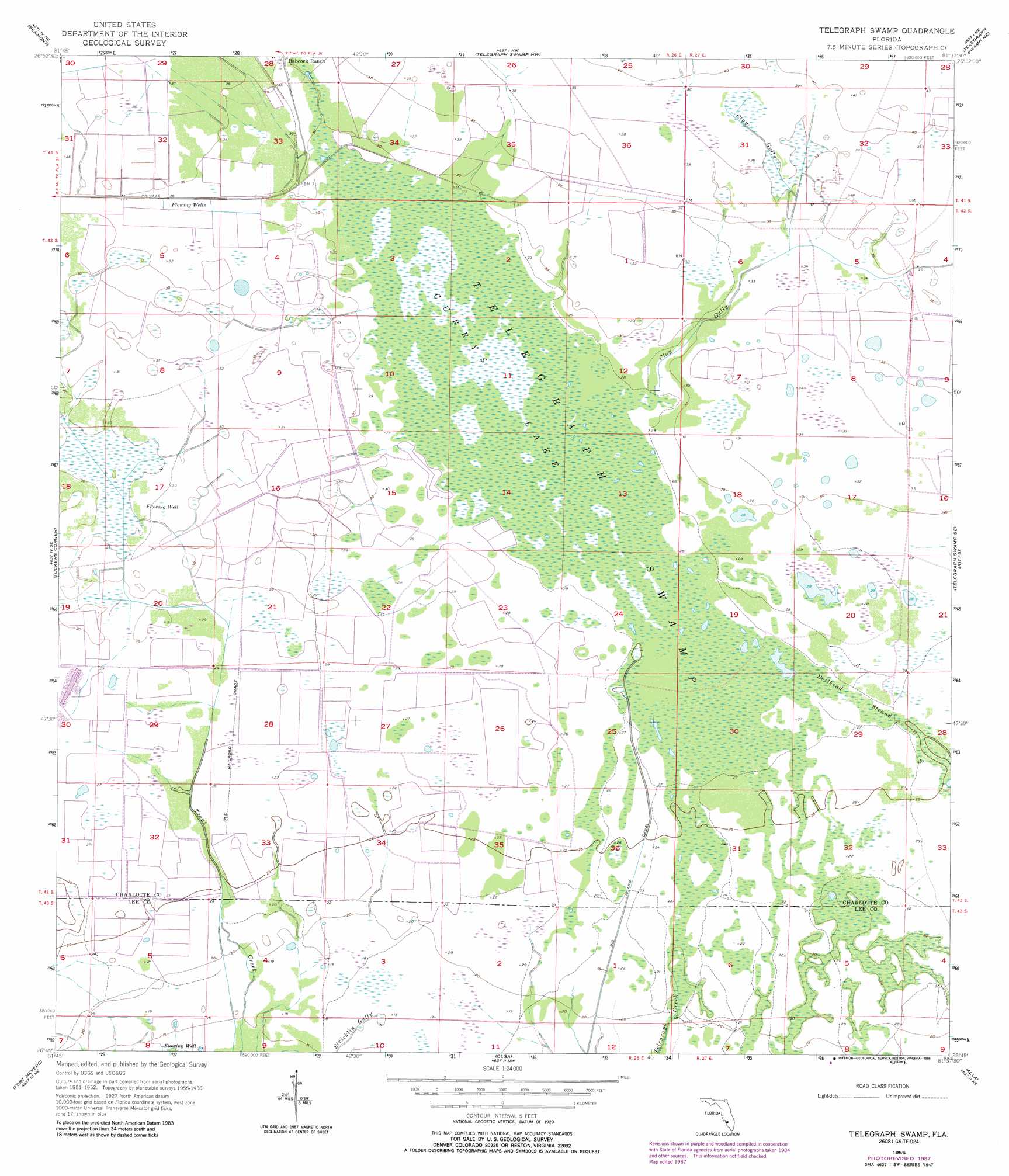
Telegraph Swamp Topo Map Florida
To zoom in, hover over the map of Telegraph Swamp
USGS Topo Quad 26081g6 - 1:24,000 scale
| Topo Map Name: | Telegraph Swamp |
| USGS Topo Quad ID: | 26081g6 |
| Print Size: | ca. 21 1/4" wide x 27" high |
| Southeast Coordinates: | 26.75° N latitude / 81.625° W longitude |
| Map Center Coordinates: | 26.8125° N latitude / 81.6875° W longitude |
| U.S. State: | FL |
| Filename: | O26081G6.jpg |
| Download Map JPG Image: | Telegraph Swamp topo map 1:24,000 scale |
| Map Type: | Topographic |
| Topo Series: | 7.5´ |
| Map Scale: | 1:24,000 |
| Source of Map Images: | United States Geological Survey (USGS) |
| Alternate Map Versions: |
Telegraph Swamp FL 1956, updated 1957 Download PDF Buy paper map Telegraph Swamp FL 1956, updated 1974 Download PDF Buy paper map Telegraph Swamp FL 1956, updated 1988 Download PDF Buy paper map Telegraph Swamp FL 2012 Download PDF Buy paper map Telegraph Swamp FL 2015 Download PDF Buy paper map |
1:24,000 Topo Quads surrounding Telegraph Swamp
Fort Ogden |
Arcadia Se |
Long Island Marsh Sw |
Long Island Marsh Se |
Venus Sw |
Cleveland |
Bermont |
Telegraph Swamp Nw |
Telegraph Swamp Ne |
La Belle Nw |
Gilchrist |
Tuckers Corner |
Telegraph Swamp |
Telegraph Swamp Se |
La Belle |
Fort Myers Nw |
Fort Myers |
Olga |
Alva |
Sears |
Fort Myers Sw |
Fort Myers Se |
Alva Sw |
Alva Se |
Felda |
> Back to 26081e1 at 1:100,000 scale
> Back to 26080a1 at 1:250,000 scale
> Back to U.S. Topo Maps home
Telegraph Swamp topo map: Gazetteer
Telegraph Swamp: Airports
Babcock HQ Airport elevation 10m 32′Telegraph Swamp: Guts
Clay Gully elevation 10m 32′Telegraph Swamp: Swamps
Bullhead Strand elevation 8m 26′Currys Lake elevation 8m 26′
Telegraph Swamp elevation 8m 26′
Telegraph Swamp digital topo map on disk
Buy this Telegraph Swamp topo map showing relief, roads, GPS coordinates and other geographical features, as a high-resolution digital map file on DVD: