Lakeport Topo Map Florida
To zoom in, hover over the map of Lakeport
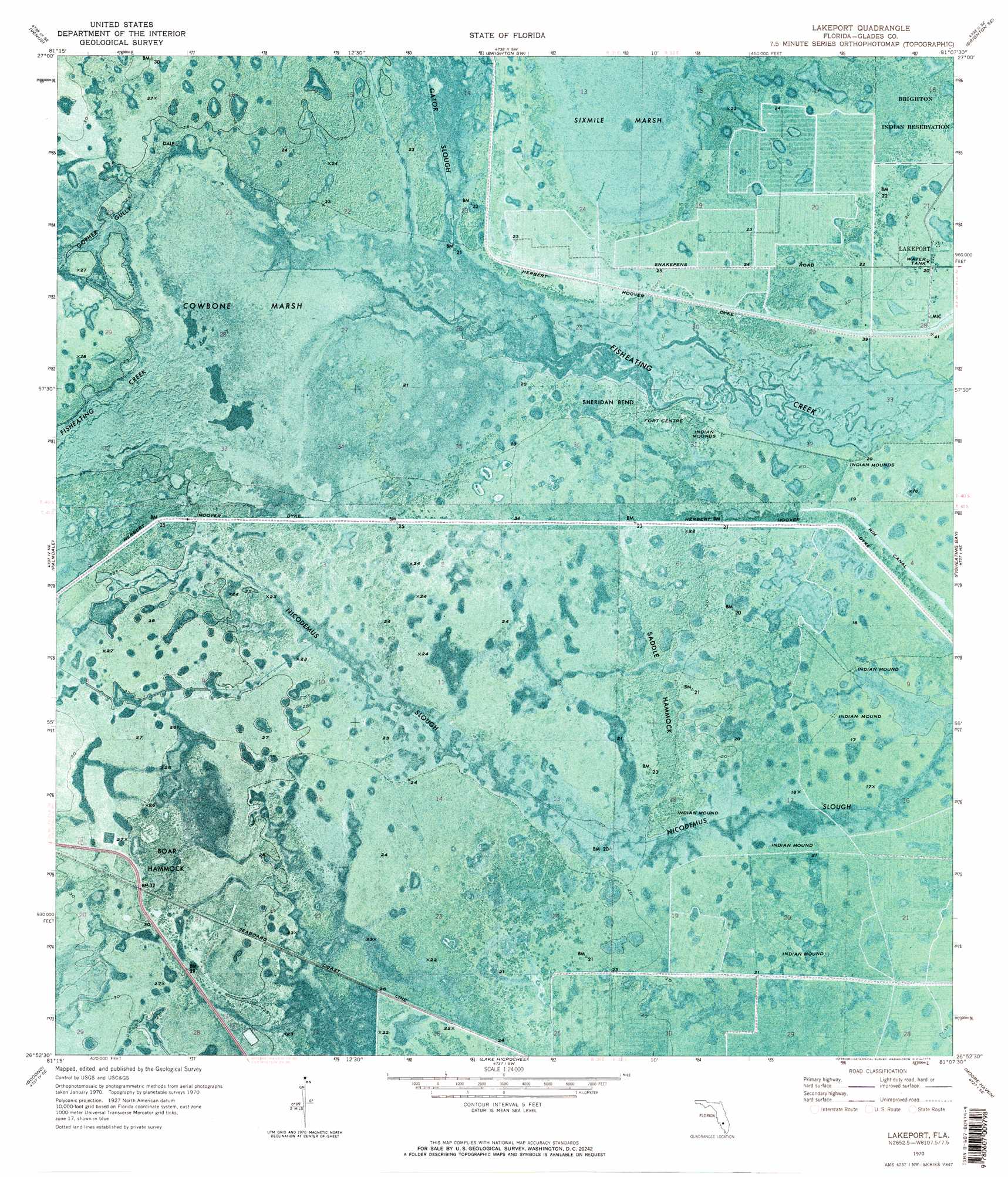
USGS Topo Quad 26081h2 - 1:24,000 scale
| Topo Map Name: | Lakeport |
| USGS Topo Quad ID: | 26081h2 |
| Print Size: | ca. 21 1/4" wide x 27" high |
| Southeast Coordinates: | 26.875° N latitude / 81.125° W longitude |
| Map Center Coordinates: | 26.9375° N latitude / 81.1875° W longitude |
| U.S. State: | FL |
| Filename: | P26081H2.jpg |
| Download Map JPG Image: | Lakeport topo map 1:24,000 scale |
| Map Type: | Orthophoto |
| Topo Series: | 7.5´ |
| Map Scale: | 1:24,000 |
| Source of Map Images: | United States Geological Survey (USGS) |
| Alternate Map Versions: |
Lakeport FL 1970, updated 1976 Download PDF Buy paper map Lakeport FL 1970, updated 1976 Download PDF Buy paper map Lakeport FL 2012 Download PDF Buy paper map Lakeport FL 2015 Download PDF Buy paper map |
1:24,000 Topo Quads surrounding Lakeport
Venus Nw |
Childs |
Brighton Nw |
Brighton |
Okeechobee Nw |
Venus Sw |
Venus |
Brighton Sw |
Brighton Se |
Okeechobee Sw |
La Belle Nw |
Palmdale |
Lakeport |
Fisheating Bay |
Cochrans Pass |
La Belle |
Goodno |
Lake Hicpochee |
Moore Haven |
Clewiston North |
Sears |
Felda Ne |
La Belle 4 Nw |
La Belle 4 Ne |
Clewiston South |
> Back to 26081e1 at 1:100,000 scale
> Back to 26080a1 at 1:250,000 scale
> Back to U.S. Topo Maps home
Lakeport topo map: Gazetteer
Lakeport: Bends
Sheridan Bend elevation 6m 19′Lakeport: Guts
Nicodemus Slough elevation 7m 22′Lakeport: Islands
Boar Hammock elevation 8m 26′Saddle Hammock elevation 6m 19′
Lakeport: Populated Places
Fort Centre elevation 6m 19′Lakeport elevation 5m 16′
Lakeport: Streams
Gopher Gully elevation 7m 22′Lakeport: Swamps
Cowbone Marsh elevation 7m 22′Sixmile Marsh elevation 6m 19′
Lakeport digital topo map on disk
Buy this Lakeport topo map showing relief, roads, GPS coordinates and other geographical features, as a high-resolution digital map file on DVD: