Matlacha Topo Map Florida
To zoom in, hover over the map of Matlacha
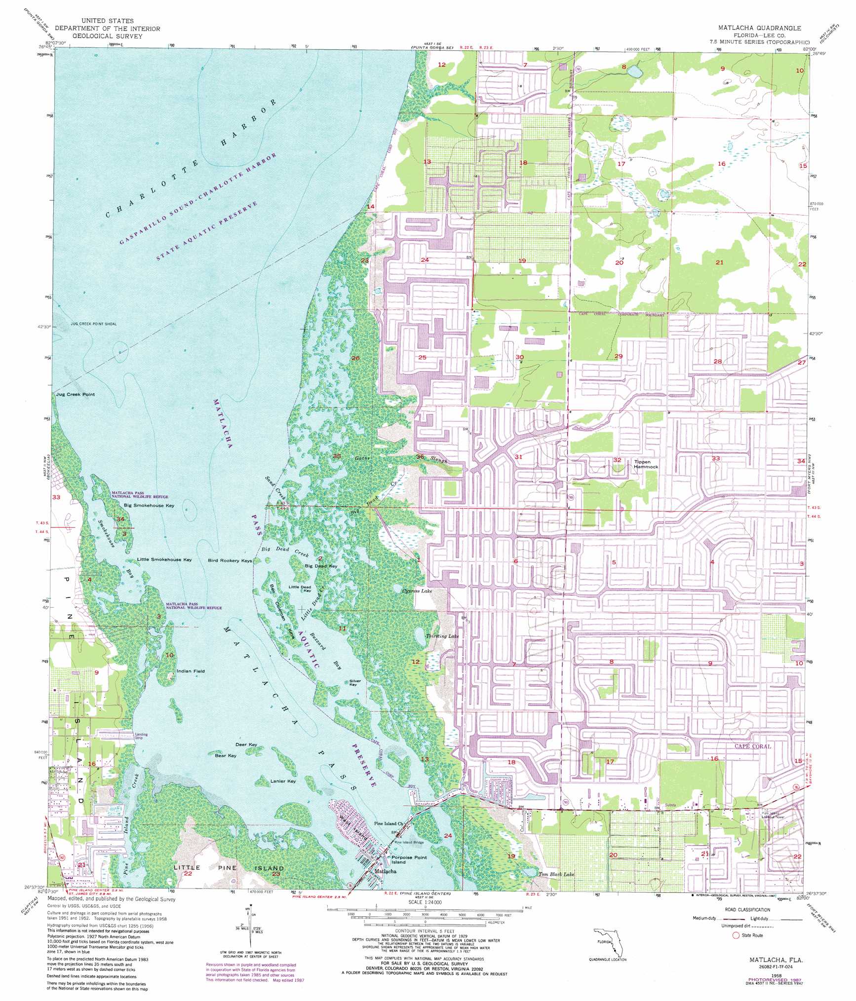
USGS Topo Quad 26082f1 - 1:24,000 scale
| Topo Map Name: | Matlacha |
| USGS Topo Quad ID: | 26082f1 |
| Print Size: | ca. 21 1/4" wide x 27" high |
| Southeast Coordinates: | 26.625° N latitude / 82° W longitude |
| Map Center Coordinates: | 26.6875° N latitude / 82.0625° W longitude |
| U.S. State: | FL |
| Filename: | O26082F1.jpg |
| Download Map JPG Image: | Matlacha topo map 1:24,000 scale |
| Map Type: | Topographic |
| Topo Series: | 7.5´ |
| Map Scale: | 1:24,000 |
| Source of Map Images: | United States Geological Survey (USGS) |
| Alternate Map Versions: |
Matlacha FL 1958, updated 1958 Download PDF Buy paper map Matlacha FL 1958, updated 1959 Download PDF Buy paper map Matlacha FL 1958, updated 1973 Download PDF Buy paper map Matlacha FL 1958, updated 1987 Download PDF Buy paper map Matlacha FL 2012 Download PDF Buy paper map Matlacha FL 2015 Download PDF Buy paper map |
1:24,000 Topo Quads surrounding Matlacha
Englewood |
El Jobean |
Punta Gorda |
Cleveland |
Bermont |
Placida |
Punta Gorda Sw |
Punta Gorda Se |
Gilchrist |
Tuckers Corner |
Port Boca Grande |
Bokeelia |
Matlacha |
Fort Myers Nw |
Fort Myers |
Captiva |
Pine Island Center |
Fort Myers Sw |
Fort Myers Se |
|
Wulfert |
Sanibel |
Fort Myers Beach |
Estero |
> Back to 26082e1 at 1:100,000 scale
> Back to 26082a1 at 1:250,000 scale
> Back to U.S. Topo Maps home
Matlacha topo map: Gazetteer
Matlacha: Airports
Morning Star South Airport elevation 3m 9′Tranquility Bay Strip elevation 1m 3′
Matlacha: Bays
Buzzard Bay elevation 0m 0′Smokehouse Bay elevation 0m 0′
Matlacha: Bridges
Pine Island Bridge elevation 0m 0′Matlacha: Capes
Jug Creek Point elevation 0m 0′Matlacha: Guts
Big Dead Creek elevation 0m 0′Little Dead Creek elevation 0m 0′
Sand Creek elevation 0m 0′
Matlacha: Islands
Bear Key elevation 0m 0′Ben Coleman Keys elevation 0m 0′
Big Dead Key elevation 0m 0′
Big Smokehouse Key elevation 0m 0′
Bird Rookery Keys elevation 0m 0′
Deer Key elevation 0m 0′
Indian Field elevation 2m 6′
Lanier Key elevation 0m 0′
Little Dead Key elevation 0m 0′
Little Smokehouse Key elevation 0m 0′
Porpoise Point Island elevation 0m 0′
Silver Key elevation 0m 0′
Tippen Hammock elevation 2m 6′
West Island elevation 0m 0′
Matlacha: Lakes
Cypress Lake elevation 0m 0′Thirsting Lake elevation 0m 0′
Tom Black Lake elevation 1m 3′
Matlacha: Parks
Matlacha Pass Aquatic Preserve elevation 0m 0′Matlacha: Populated Places
Matlacha elevation 0m 0′Matlacha Isles elevation 0m 0′
Matlacha Shores elevation 1m 3′
Matlacha: Streams
Gator Slough elevation 0m 0′Matlacha digital topo map on disk
Buy this Matlacha topo map showing relief, roads, GPS coordinates and other geographical features, as a high-resolution digital map file on DVD: