Englewood Nw Topo Map Florida
To zoom in, hover over the map of Englewood Nw
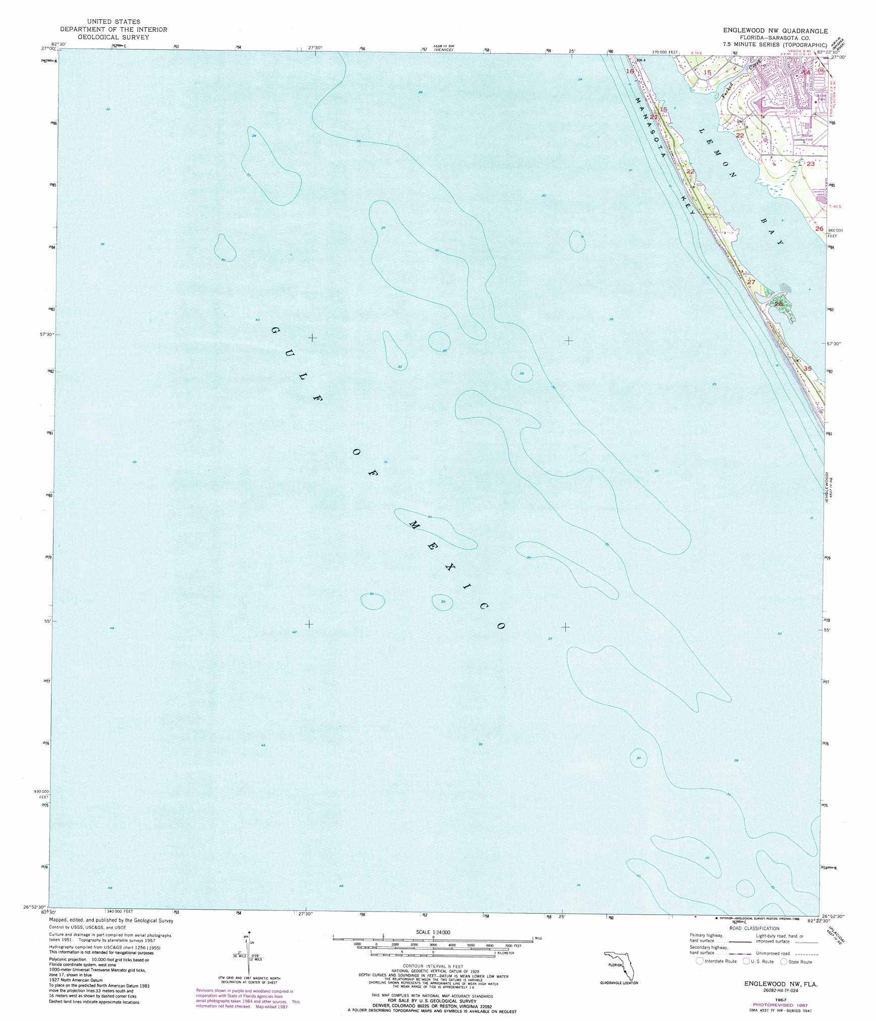
USGS Topo Quad 26082h4 - 1:24,000 scale
| Topo Map Name: | Englewood Nw |
| USGS Topo Quad ID: | 26082h4 |
| Print Size: | ca. 21 1/4" wide x 27" high |
| Southeast Coordinates: | 26.875° N latitude / 82.375° W longitude |
| Map Center Coordinates: | 26.9375° N latitude / 82.4375° W longitude |
| U.S. State: | FL |
| Filename: | O26082H4.jpg |
| Download Map JPG Image: | Englewood Nw topo map 1:24,000 scale |
| Map Type: | Topographic |
| Topo Series: | 7.5´ |
| Map Scale: | 1:24,000 |
| Source of Map Images: | United States Geological Survey (USGS) |
| Alternate Map Versions: |
Englewood NW FL 1957, updated 1957 Download PDF Buy paper map Englewood NW FL 1957, updated 1971 Download PDF Buy paper map Englewood NW FL 1957, updated 1973 Download PDF Buy paper map Englewood NW FL 1994, updated 1998 Download PDF Buy paper map Englewood NW FL 2012 Download PDF Buy paper map Englewood NW FL 2015 Download PDF Buy paper map |
1:24,000 Topo Quads surrounding Englewood Nw
Bird Keys |
Laurel |
Lower Myakka Lake |
Murdock Nw |
|
Venice |
Myakka River |
Murdock |
||
Englewood Nw |
Englewood |
El Jobean |
||
Placida |
Punta Gorda Sw |
|||
Port Boca Grande |
Bokeelia |
> Back to 26082e1 at 1:100,000 scale
> Back to 26082a1 at 1:250,000 scale
> Back to U.S. Topo Maps home
Englewood Nw topo map: Gazetteer
Englewood Nw: Islands
Leachs Key elevation 0m 0′Manasota Key elevation 2m 6′
Englewood Nw: Streams
Forked Creek elevation 0m 0′Englewood Nw digital topo map on disk
Buy this Englewood Nw topo map showing relief, roads, GPS coordinates and other geographical features, as a high-resolution digital map file on DVD: