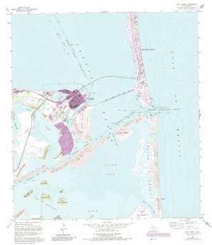
Port Isabel Topo Map Texas
To zoom in, hover over the map of Port Isabel
USGS Topo Quad 26097a2 - 1:24,000 scale
| Topo Map Name: | Port Isabel |
| USGS Topo Quad ID: | 26097a2 |
| Print Size: | ca. 21 1/4" wide x 27" high |
| Southeast Coordinates: | 26° N latitude / 97.125° W longitude |
| Map Center Coordinates: | 26.0625° N latitude / 97.1875° W longitude |
| U.S. State: | TX |
| Filename: | o26097a2.jpg |
| Download Map JPG Image: | Port Isabel topo map 1:24,000 scale |
| Map Type: | Topographic |
| Topo Series: | 7.5´ |
| Map Scale: | 1:24,000 |
| Source of Map Images: | United States Geological Survey (USGS) |
| Alternate Map Versions: |
Point Isabel TX 1929 Download PDF Buy paper map Port Isabel TX 1955, updated 1957 Download PDF Buy paper map Port Isabel TX 1955, updated 1971 Download PDF Buy paper map Port Isabel TX 1955, updated 1980 Download PDF Buy paper map Port Isabel TX 1955, updated 1984 Download PDF Buy paper map Port Isabel TX 2010 Download PDF Buy paper map Port Isabel TX 2013 Download PDF Buy paper map Port Isabel TX 2016 Download PDF Buy paper map |
1:24,000 Topo Quads surrounding Port Isabel
La Leona |
Three Islands |
North Of Port Isabel Sw |
||
Laguna Atascosa |
La Coma |
Port Isabel Nw |
||
Los Fresnos |
Laguna Vista |
Port Isabel |
||
East Brownsville |
Palmito Hill |
Mouth Of Rio Grande |
||
Southmost |
> Back to 26097a1 at 1:100,000 scale
> Back to 26096a1 at 1:250,000 scale
> Back to U.S. Topo Maps home
Port Isabel topo map: Gazetteer
Port Isabel: Airports
United States Coast Guard Station Heliport elevation 1m 3′Port Isabel: Bays
Back Bay elevation 0m 0′Boca Chica Bay elevation 0m 0′
South Bay elevation 0m 0′
Port Isabel: Beaches
Del Mar Beach elevation 0m 0′Port Isabel: Bridges
Queen Isabella Causeway elevation 0m 0′Port Isabel: Channels
Brazos Santiago Pass elevation 0m 0′Port Isabel Channel elevation 0m 0′
Port Isabel Side Channel elevation 0m 0′
South Bay Pass elevation 0m 0′
Port Isabel: Dams
North Jetty elevation 0m 0′South Jetty elevation 0m 0′
Port Isabel: Harbors
Port Isabel Turning Basin elevation 0m 0′Port Isabel: Islands
Brazos Island elevation 1m 3′Clark Island elevation 2m 6′
Long Island elevation 0m 0′
Port Isabel: Lakes
Vadia Ancha elevation 5m 16′Port Isabel: Parks
Isla Blanca Park elevation 1m 3′Lighthouse Park elevation 4m 13′
Texas State Park elevation 3m 9′
Port Isabel: Populated Places
Del Mar elevation 3m 9′Port Isabel elevation 2m 6′
South Padre Island elevation 2m 6′
Port Isabel: Summits
Loma de la Blanderita elevation 4m 13′Loma de la Draga elevation 1m 3′
Loma de la Palangana elevation 2m 6′
Loma de las Gachupines elevation 8m 26′
Loma de los Tequios elevation 6m 19′
Loma del Burro elevation 7m 22′
Loma del Gato elevation 8m 26′
Loma del Islote elevation 6m 19′
Loma del Mesquite elevation 8m 26′
Loma del Rincon Chiquito elevation 8m 26′
Loma Ochoa elevation 8m 26′
Loma Pelona elevation 9m 29′
Loma Plata elevation 1m 3′
Loma Silvan elevation 5m 16′
Los Montes elevation 1m 3′
Port Isabel digital topo map on disk
Buy this Port Isabel topo map showing relief, roads, GPS coordinates and other geographical features, as a high-resolution digital map file on DVD:


