Green Island Topo Map Texas
To zoom in, hover over the map of Green Island
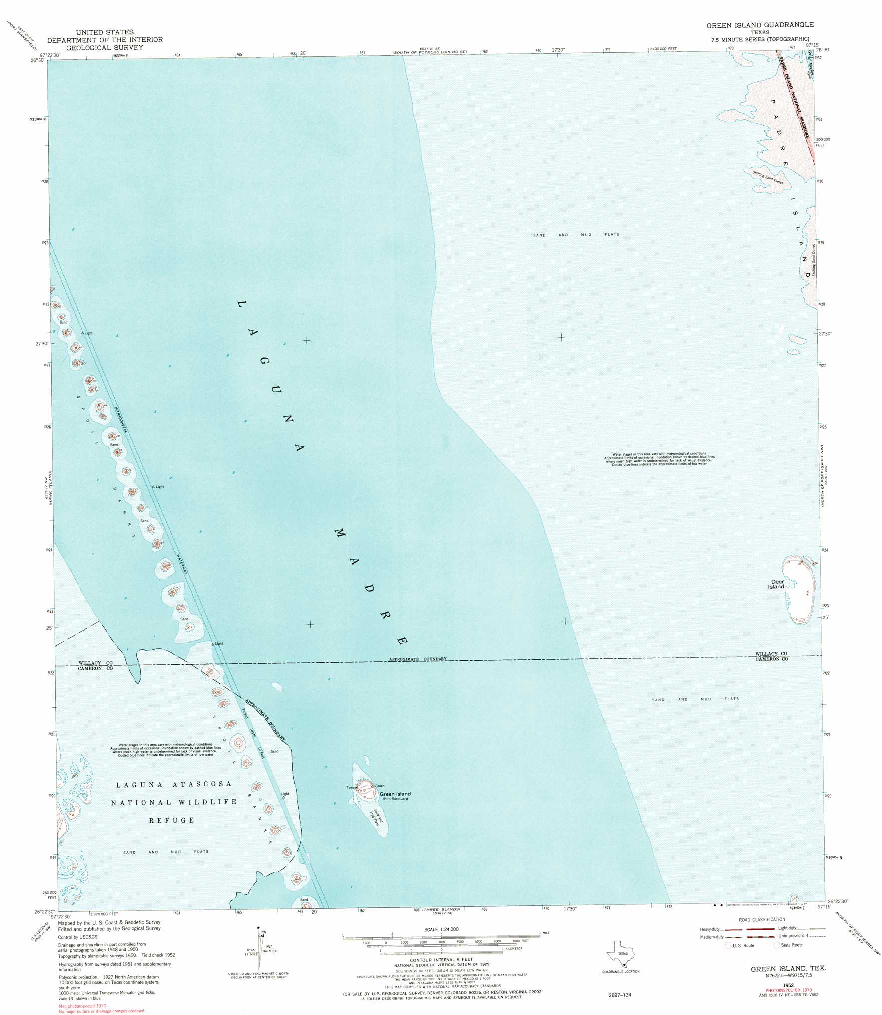
USGS Topo Quad 26097d3 - 1:24,000 scale
| Topo Map Name: | Green Island |
| USGS Topo Quad ID: | 26097d3 |
| Print Size: | ca. 21 1/4" wide x 27" high |
| Southeast Coordinates: | 26.375° N latitude / 97.25° W longitude |
| Map Center Coordinates: | 26.4375° N latitude / 97.3125° W longitude |
| U.S. State: | TX |
| Filename: | o26097d3.jpg |
| Download Map JPG Image: | Green Island topo map 1:24,000 scale |
| Map Type: | Topographic |
| Topo Series: | 7.5´ |
| Map Scale: | 1:24,000 |
| Source of Map Images: | United States Geological Survey (USGS) |
| Alternate Map Versions: |
Green Island TX 1952, updated 1953 Download PDF Buy paper map Green Island TX 1952, updated 1977 Download PDF Buy paper map Green Island TX 2010 Download PDF Buy paper map Green Island TX 2012 Download PDF Buy paper map Green Island TX 2016 Download PDF Buy paper map |
1:24,000 Topo Quads surrounding Green Island
Rosita Lake Ne |
South Of Potrero Lopeno Nw |
South Of Potrero Lopeno Ne |
||
El Jardin |
Port Mansfield |
South Of Potrero Lopeno Se |
||
Willamar |
Hawk Island |
Green Island |
North Of Port Isabel Nw |
|
Paso Real |
La Leona |
Three Islands |
North Of Port Isabel Sw |
|
Rio Hondo |
Laguna Atascosa |
La Coma |
Port Isabel Nw |
> Back to 26097a1 at 1:100,000 scale
> Back to 26096a1 at 1:250,000 scale
> Back to U.S. Topo Maps home
Green Island topo map: Gazetteer
Green Island: Islands
Deer Island elevation 1m 3′Green Island elevation 3m 9′
Green Island: Streams
Arroyo Colorado elevation 1m 3′Green Island digital topo map on disk
Buy this Green Island topo map showing relief, roads, GPS coordinates and other geographical features, as a high-resolution digital map file on DVD: