Rosita Lake Topo Map Texas
To zoom in, hover over the map of Rosita Lake
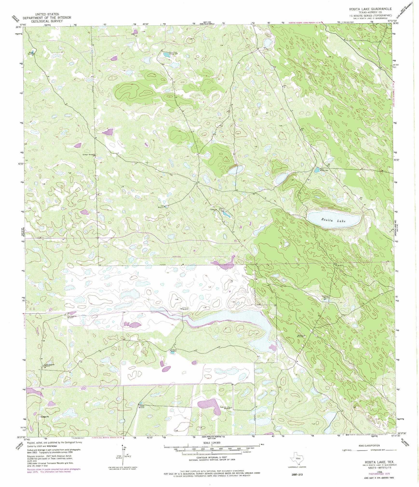
USGS Topo Quad 26097f6 - 1:24,000 scale
| Topo Map Name: | Rosita Lake |
| USGS Topo Quad ID: | 26097f6 |
| Print Size: | ca. 21 1/4" wide x 27" high |
| Southeast Coordinates: | 26.625° N latitude / 97.625° W longitude |
| Map Center Coordinates: | 26.6875° N latitude / 97.6875° W longitude |
| U.S. State: | TX |
| Filename: | o26097f6.jpg |
| Download Map JPG Image: | Rosita Lake topo map 1:24,000 scale |
| Map Type: | Topographic |
| Topo Series: | 7.5´ |
| Map Scale: | 1:24,000 |
| Source of Map Images: | United States Geological Survey (USGS) |
| Alternate Map Versions: |
Rosita Lake TX 1956, updated 1958 Download PDF Buy paper map Rosita Lake TX 1956, updated 1977 Download PDF Buy paper map Rosita Lake TX 2010 Download PDF Buy paper map Rosita Lake TX 2013 Download PDF Buy paper map Rosita Lake TX 2016 Download PDF Buy paper map |
1:24,000 Topo Quads surrounding Rosita Lake
Pita Camp |
Armstrong |
San Pedro Ranch |
Maria Estella Well |
Potrero Lopeno Nw |
Julian |
Norias |
Saltillo Well |
Los Amigos Windmill |
Potrero Lopeno Sw |
Andrea Ranch |
Rudolph |
Rosita Lake |
Rosita Lake Ne |
South Of Potrero Lopeno Nw |
La Sal Vieja |
Yturria |
San Perlita North |
El Jardin |
Port Mansfield |
Lasara |
Raymondville |
San Perlita South |
Willamar |
Hawk Island |
> Back to 26097e1 at 1:100,000 scale
> Back to 26096a1 at 1:250,000 scale
> Back to U.S. Topo Maps home
Rosita Lake topo map: Gazetteer
Rosita Lake: Lakes
Rosita Lake elevation 0m 0′Rosita Lake: Wells
Burro Pinto Artesian Well elevation 5m 16′Caldero Artesian Well elevation 6m 19′
Rosita Artesian Well elevation 5m 16′
Rosita Lake digital topo map on disk
Buy this Rosita Lake topo map showing relief, roads, GPS coordinates and other geographical features, as a high-resolution digital map file on DVD: