Andrea Ranch Topo Map Texas
To zoom in, hover over the map of Andrea Ranch
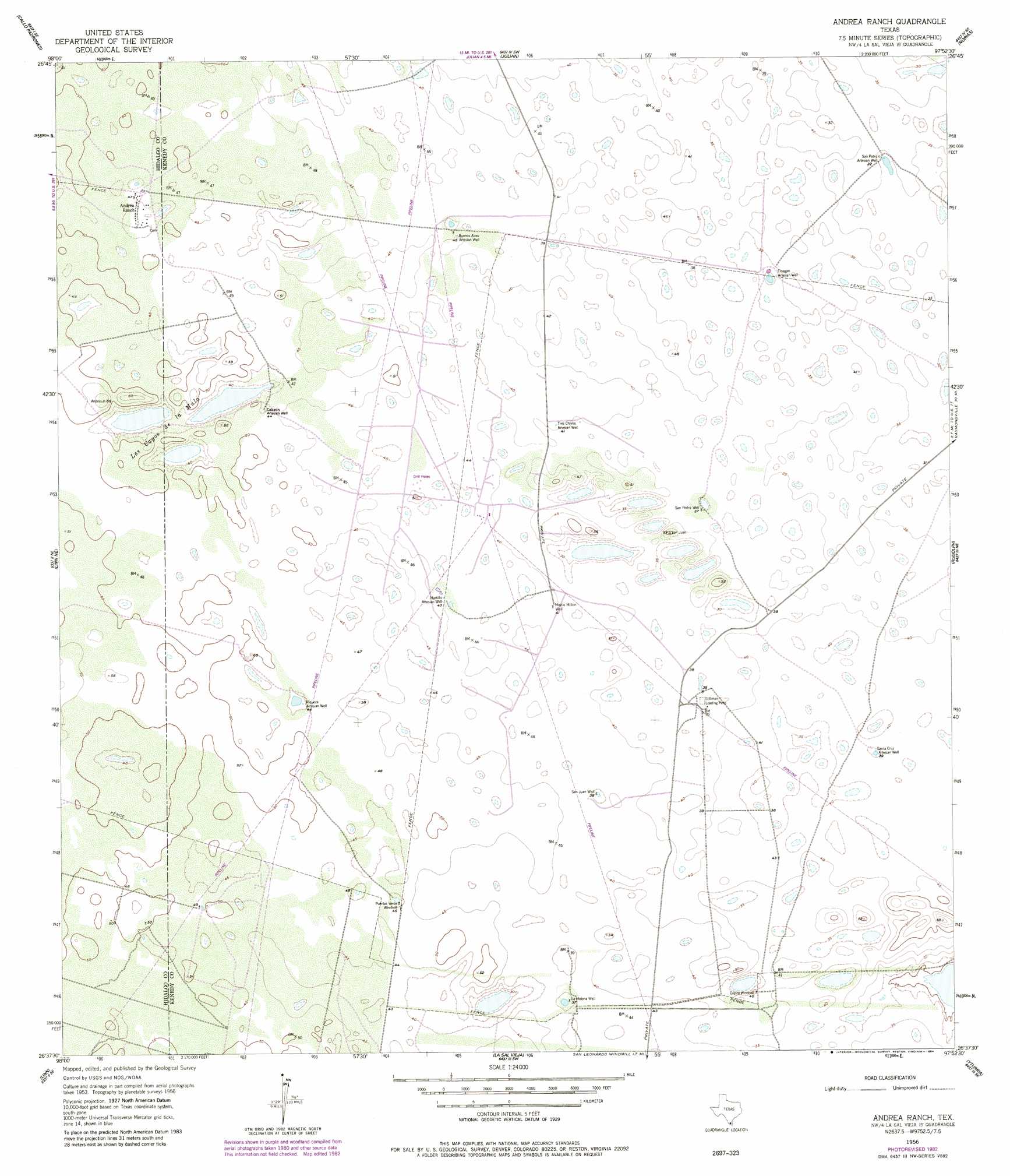
USGS Topo Quad 26097f8 - 1:24,000 scale
| Topo Map Name: | Andrea Ranch |
| USGS Topo Quad ID: | 26097f8 |
| Print Size: | ca. 21 1/4" wide x 27" high |
| Southeast Coordinates: | 26.625° N latitude / 97.875° W longitude |
| Map Center Coordinates: | 26.6875° N latitude / 97.9375° W longitude |
| U.S. State: | TX |
| Filename: | o26097f8.jpg |
| Download Map JPG Image: | Andrea Ranch topo map 1:24,000 scale |
| Map Type: | Topographic |
| Topo Series: | 7.5´ |
| Map Scale: | 1:24,000 |
| Source of Map Images: | United States Geological Survey (USGS) |
| Alternate Map Versions: |
Andrea Ranch TX 1956, updated 1957 Download PDF Buy paper map Andrea Ranch TX 1956, updated 1984 Download PDF Buy paper map Andrea Ranch TX 2010 Download PDF Buy paper map Andrea Ranch TX 2013 Download PDF Buy paper map Andrea Ranch TX 2016 Download PDF Buy paper map |
1:24,000 Topo Quads surrounding Andrea Ranch
Encino |
San Tomas Camp |
Pita Camp |
Armstrong |
San Pedro Ranch |
Hartland |
Callo Padrones |
Julian |
Norias |
Saltillo Well |
Linn Nw |
Linn Ne |
Andrea Ranch |
Rudolph |
Rosita Lake |
Linn Siding |
Linn |
La Sal Vieja |
Yturria |
San Perlita North |
Faysville |
Hargill |
Lasara |
Raymondville |
San Perlita South |
> Back to 26097e1 at 1:100,000 scale
> Back to 26096a1 at 1:250,000 scale
> Back to U.S. Topo Maps home
Andrea Ranch topo map: Gazetteer
Andrea Ranch: Lakes
Los Cayos de la Mula elevation 11m 36′Andrea Ranch: Wells
Buenos Aires Artesian Well elevation 13m 42′Calcetin Artesian Well elevation 14m 45′
Finegan Artesian Well elevation 10m 32′
Martillo Artesian Well elevation 13m 42′
Medio Millon Well elevation 12m 39′
Riqueza Artesian Well elevation 14m 45′
San Juan Well elevation 12m 39′
San Patricio Artesian Well elevation 11m 36′
San Pedro Well elevation 11m 36′
Santa Cruz Artesian Well elevation 12m 39′
Tres Chivos Artesian Well elevation 12m 39′
Andrea Ranch digital topo map on disk
Buy this Andrea Ranch topo map showing relief, roads, GPS coordinates and other geographical features, as a high-resolution digital map file on DVD: