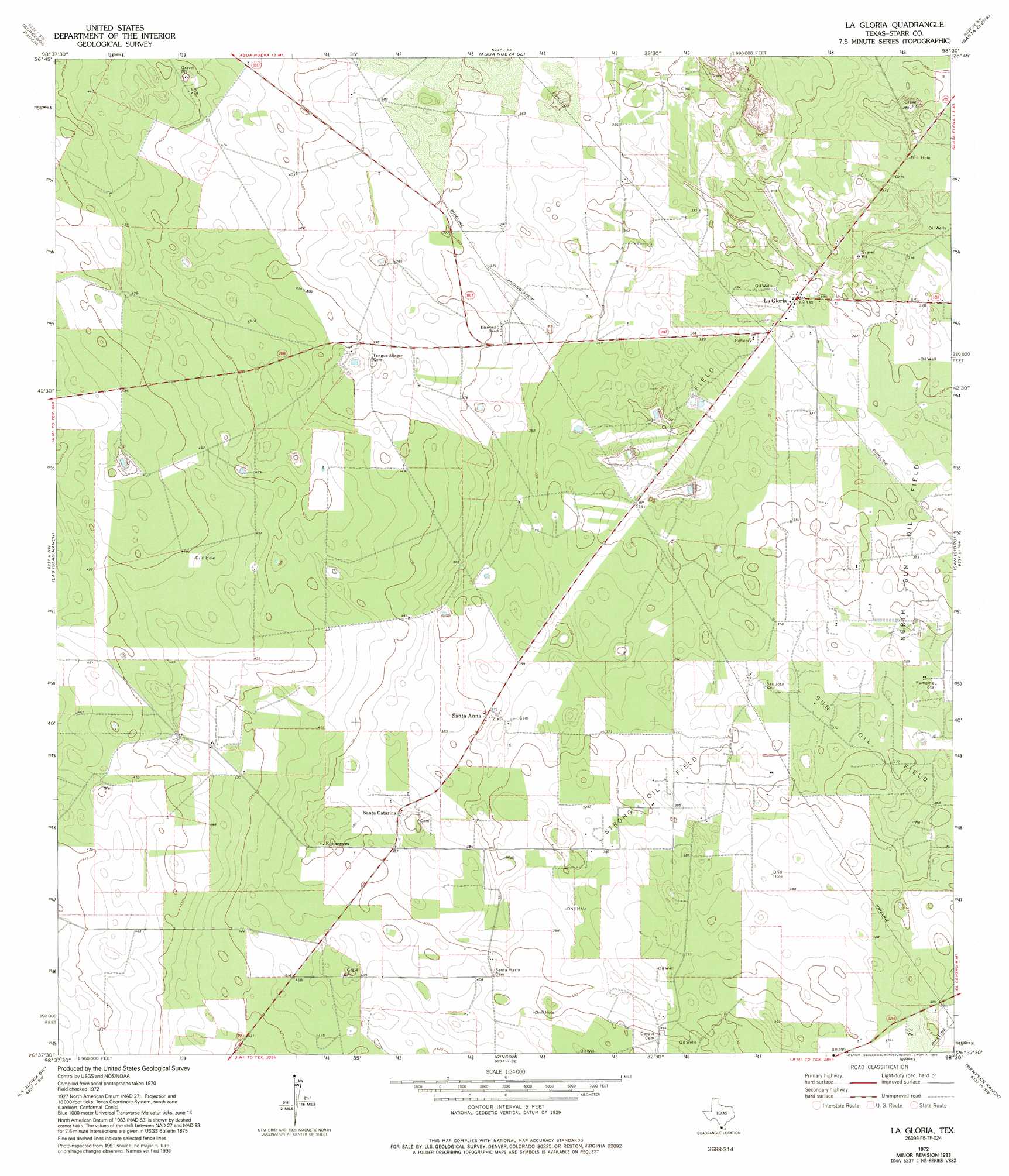
La Gloria Topo Map Texas
To zoom in, hover over the map of La Gloria
USGS Topo Quad 26098f5 - 1:24,000 scale
| Topo Map Name: | La Gloria |
| USGS Topo Quad ID: | 26098f5 |
| Print Size: | ca. 21 1/4" wide x 27" high |
| Southeast Coordinates: | 26.625° N latitude / 98.5° W longitude |
| Map Center Coordinates: | 26.6875° N latitude / 98.5625° W longitude |
| U.S. State: | TX |
| Filename: | o26098f5.jpg |
| Download Map JPG Image: | La Gloria topo map 1:24,000 scale |
| Map Type: | Topographic |
| Topo Series: | 7.5´ |
| Map Scale: | 1:24,000 |
| Source of Map Images: | United States Geological Survey (USGS) |
| Alternate Map Versions: |
La Gloria TX 1972, updated 1993 Download PDF Buy paper map La Gloria TX 2010 Download PDF Buy paper map La Gloria TX 2012 Download PDF Buy paper map La Gloria TX 2016 Download PDF Buy paper map |
1:24,000 Topo Quads surrounding La Gloria
San Antonio Viejo |
Agua Nueva Nw |
Agua Nueva |
Santa Elena Nw |
Tacubaya |
Cuevitas |
Borregos Ranch |
Agua Nueva Se |
Santa Elena |
Santa Elena Se |
Viboras |
Las Islas Ranch |
La Gloria |
San Isidro |
La Reforma |
El Sauz |
La Gloria Sw |
Rincon |
Bentsen Ranch |
Mcallen Ranch |
Rio Grande City North |
Sagunada Ranch |
Camp Garcia |
Mccook |
Monte Christo |
> Back to 26098e1 at 1:100,000 scale
> Back to 26098a1 at 1:250,000 scale
> Back to U.S. Topo Maps home
La Gloria topo map: Gazetteer
La Gloria: Airports
Diamond O Ranch Airport elevation 110m 360′La Gloria: Oilfields
Strong Oil Field elevation 117m 383′La Gloria: Populated Places
La Gloria elevation 101m 331′Robberson elevation 121m 396′
Santa Anna elevation 113m 370′
Santa Catarina elevation 116m 380′
La Gloria digital topo map on disk
Buy this La Gloria topo map showing relief, roads, GPS coordinates and other geographical features, as a high-resolution digital map file on DVD: