Hartland Topo Map Texas
To zoom in, hover over the map of Hartland
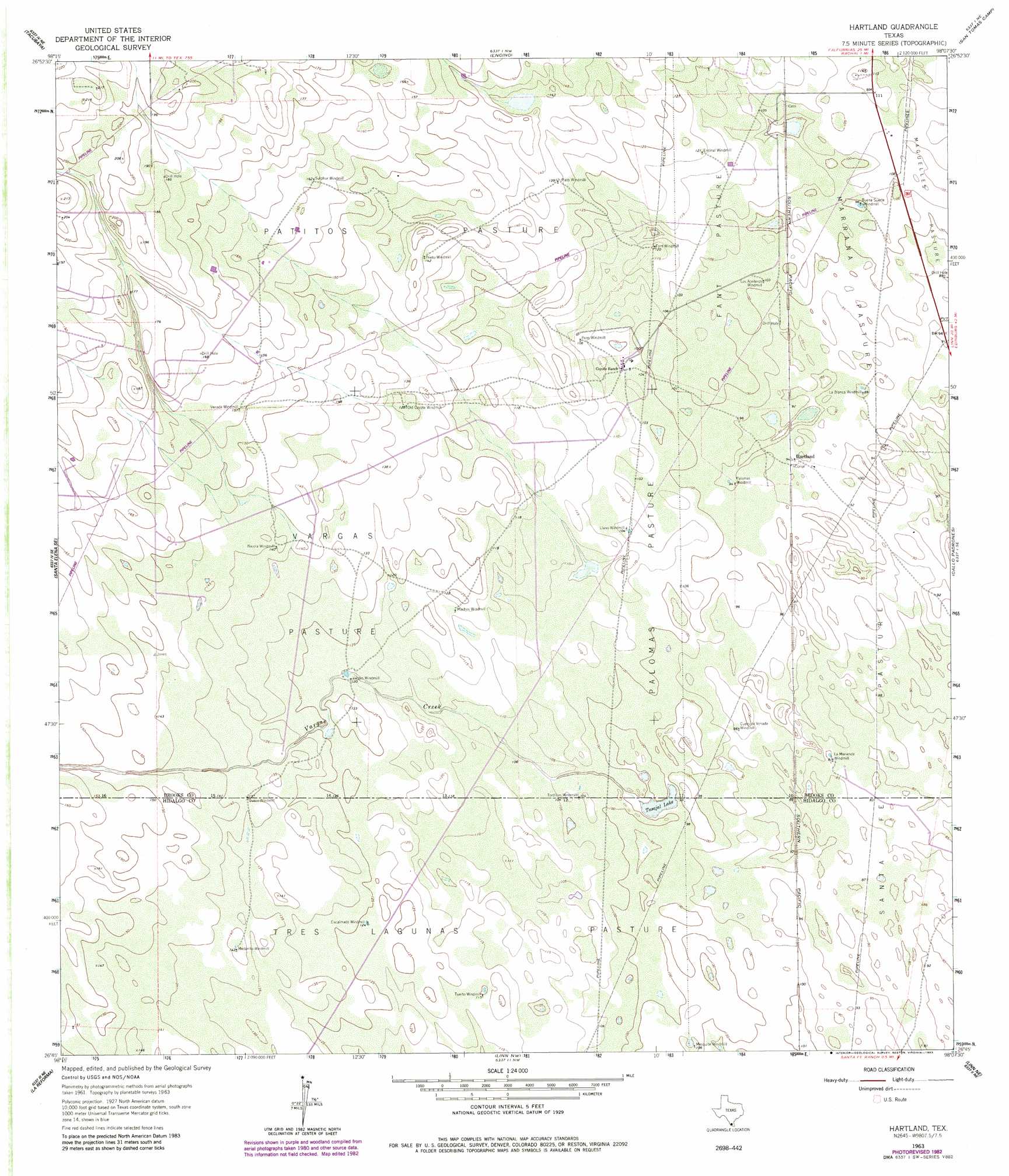
USGS Topo Quad 26098g2 - 1:24,000 scale
| Topo Map Name: | Hartland |
| USGS Topo Quad ID: | 26098g2 |
| Print Size: | ca. 21 1/4" wide x 27" high |
| Southeast Coordinates: | 26.75° N latitude / 98.125° W longitude |
| Map Center Coordinates: | 26.8125° N latitude / 98.1875° W longitude |
| U.S. State: | TX |
| Filename: | o26098g2.jpg |
| Download Map JPG Image: | Hartland topo map 1:24,000 scale |
| Map Type: | Topographic |
| Topo Series: | 7.5´ |
| Map Scale: | 1:24,000 |
| Source of Map Images: | United States Geological Survey (USGS) |
| Alternate Map Versions: |
Hartland TX 1963, updated 1965 Download PDF Buy paper map Hartland TX 1963, updated 1983 Download PDF Buy paper map Hartland TX 2010 Download PDF Buy paper map Hartland TX 2012 Download PDF Buy paper map Hartland TX 2016 Download PDF Buy paper map |
1:24,000 Topo Quads surrounding Hartland
Palomas Ranch Sw |
Palomas Ranch Se |
Cage Ranch |
Falfurrias Se |
Sarita Sw |
Santa Elena Nw |
Tacubaya |
Encino |
San Tomas Camp |
Pita Camp |
Santa Elena |
Santa Elena Se |
Hartland |
Callo Padrones |
Julian |
San Isidro |
La Reforma |
Linn Nw |
Linn Ne |
Andrea Ranch |
Bentsen Ranch |
Mcallen Ranch |
Linn Siding |
Linn |
La Sal Vieja |
> Back to 26098e1 at 1:100,000 scale
> Back to 26098a1 at 1:250,000 scale
> Back to U.S. Topo Maps home
Hartland topo map: Gazetteer
Hartland: Airports
El Coyote Ranch Airport elevation 52m 170′Hartland: Flats
Fant Pasture elevation 32m 104′Marrana Pasture elevation 30m 98′
Palomas Pasture elevation 31m 101′
Patitos Pasture elevation 44m 144′
Tres Lagunas Pasture elevation 35m 114′
Vargas Pasture elevation 39m 127′
Hartland: Lakes
Tasajal Lake elevation 28m 91′Hartland: Populated Places
Hartland elevation 28m 91′Hartland: Streams
Vargas Creek elevation 29m 95′Hartland digital topo map on disk
Buy this Hartland topo map showing relief, roads, GPS coordinates and other geographical features, as a high-resolution digital map file on DVD: