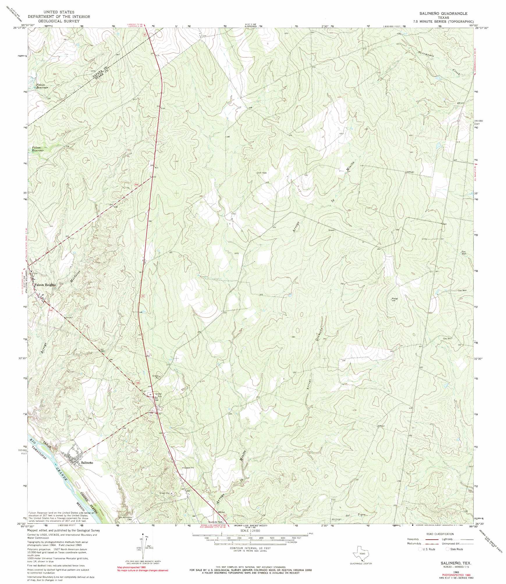
Salineno Topo Map Texas
To zoom in, hover over the map of Salineno
USGS Topo Quad 26099e1 - 1:24,000 scale
| Topo Map Name: | Salineno |
| USGS Topo Quad ID: | 26099e1 |
| Print Size: | ca. 21 1/4" wide x 27" high |
| Southeast Coordinates: | 26.5° N latitude / 99° W longitude |
| Map Center Coordinates: | 26.5625° N latitude / 99.0625° W longitude |
| U.S. State: | TX |
| Filename: | o26099e1.jpg |
| Download Map JPG Image: | Salineno topo map 1:24,000 scale |
| Map Type: | Topographic |
| Topo Series: | 7.5´ |
| Map Scale: | 1:24,000 |
| Source of Map Images: | United States Geological Survey (USGS) |
| Alternate Map Versions: |
Salineno TX 1965, updated 1968 Download PDF Buy paper map Salineno TX 1965, updated 1990 Download PDF Buy paper map Salineno TX 2010 Download PDF Buy paper map Salineno TX 2012 Download PDF Buy paper map Salineno TX 2016 Download PDF Buy paper map |
1:24,000 Topo Quads surrounding Salineno
Zapata Se |
Arroyo Clareno |
Arroyo Miguel |
Cuevitas Sw |
Cuevitas |
Beckwith Arm |
Lopeno |
Las Escobas Ranch |
Viboras |
|
Falcon Village |
Salineno |
El Chapote Creek |
El Sauz |
|
Roma-Los Saenz West |
Roma-Los Saenz East |
Rio Grande City North |
||
Los Garzas |
Rio Grande City South |
> Back to 26099e1 at 1:100,000 scale
> Back to 26098a1 at 1:250,000 scale
> Back to U.S. Topo Maps home
Salineno topo map: Gazetteer
Salineno: Dams
Mangus Lake Dam elevation 96m 314′Salineno: Populated Places
Falcon Heights elevation 84m 275′Falconaire Colonia elevation 84m 275′
Indio Number 1 Colonia elevation 108m 354′
Indio Number 2 Colonia elevation 107m 351′
Jardin de San Julian Colonia elevation 80m 262′
Lago Vista Colonia elevation 94m 308′
Salineño elevation 67m 219′
Salineno: Reservoirs
Mangus Lake elevation 96m 314′Salineno: Streams
Arroyo Quemado elevation 77m 252′Salineno digital topo map on disk
Buy this Salineno topo map showing relief, roads, GPS coordinates and other geographical features, as a high-resolution digital map file on DVD: