Falcon Village Topo Map Texas
To zoom in, hover over the map of Falcon Village
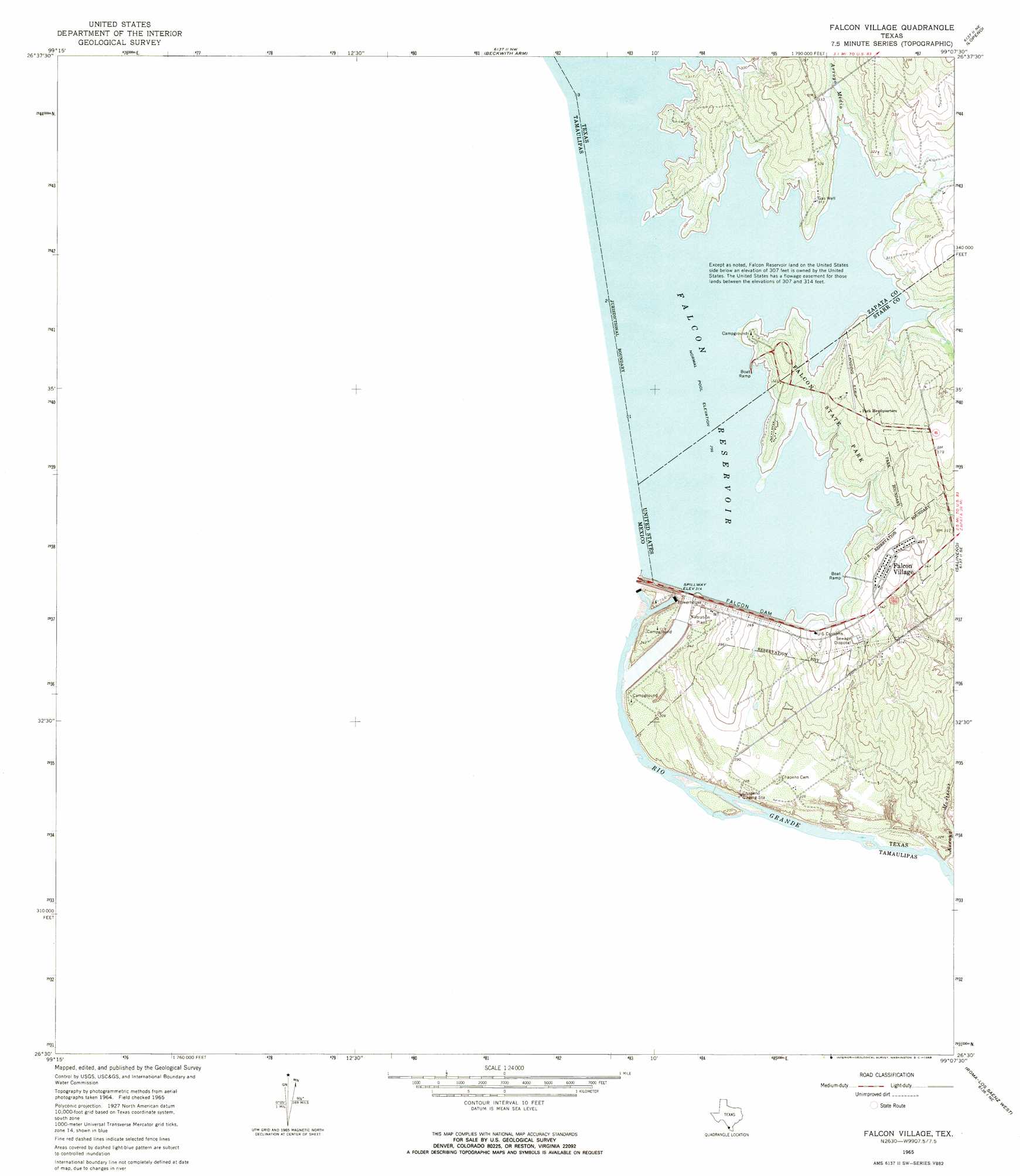
USGS Topo Quad 26099e2 - 1:24,000 scale
| Topo Map Name: | Falcon Village |
| USGS Topo Quad ID: | 26099e2 |
| Print Size: | ca. 21 1/4" wide x 27" high |
| Southeast Coordinates: | 26.5° N latitude / 99.125° W longitude |
| Map Center Coordinates: | 26.5625° N latitude / 99.1875° W longitude |
| U.S. State: | TX |
| Filename: | o26099e2.jpg |
| Download Map JPG Image: | Falcon Village topo map 1:24,000 scale |
| Map Type: | Topographic |
| Topo Series: | 7.5´ |
| Map Scale: | 1:24,000 |
| Source of Map Images: | United States Geological Survey (USGS) |
| Alternate Map Versions: |
Falcon Village TX 1965, updated 1968 Download PDF Buy paper map Falcon Village TX 2010 Download PDF Buy paper map Falcon Village TX 2012 Download PDF Buy paper map Falcon Village TX 2016 Download PDF Buy paper map |
1:24,000 Topo Quads surrounding Falcon Village
Zapata Se |
Arroyo Clareno |
Arroyo Miguel |
Cuevitas Sw |
|
Beckwith Arm |
Lopeno |
Las Escobas Ranch |
||
Falcon Village |
Salineno |
El Chapote Creek |
||
Roma-Los Saenz West |
Roma-Los Saenz East |
|||
Los Garzas |
> Back to 26099e1 at 1:100,000 scale
> Back to 26098a1 at 1:250,000 scale
> Back to U.S. Topo Maps home
Falcon Village topo map: Gazetteer
Falcon Village: Airports
Falcon State Park Airport elevation 104m 341′Falcon Village: Bays
Government Cove elevation 92m 301′Falcon Village: Dams
Falcon Dam elevation 96m 314′International Falcon Lake Dam elevation 92m 301′
Falcon Village: Parks
Falcon State Park elevation 101m 331′Falcon Village: Populated Places
Falcon Village elevation 103m 337′H Cuellar Estates Colonia elevation 95m 311′
Miguel Garza Colonia elevation 100m 328′
Falcon Village: Reservoirs
Falcon Reservoir elevation 99m 324′International Falcon Lake elevation 92m 301′
Falcon Village: Streams
Arroyo Morteros elevation 56m 183′Falcon Village: Trails
Falcon State Park Trail elevation 100m 328′Falcon Village: Valleys
Arroyo Medio elevation 92m 301′Falcon Village digital topo map on disk
Buy this Falcon Village topo map showing relief, roads, GPS coordinates and other geographical features, as a high-resolution digital map file on DVD: