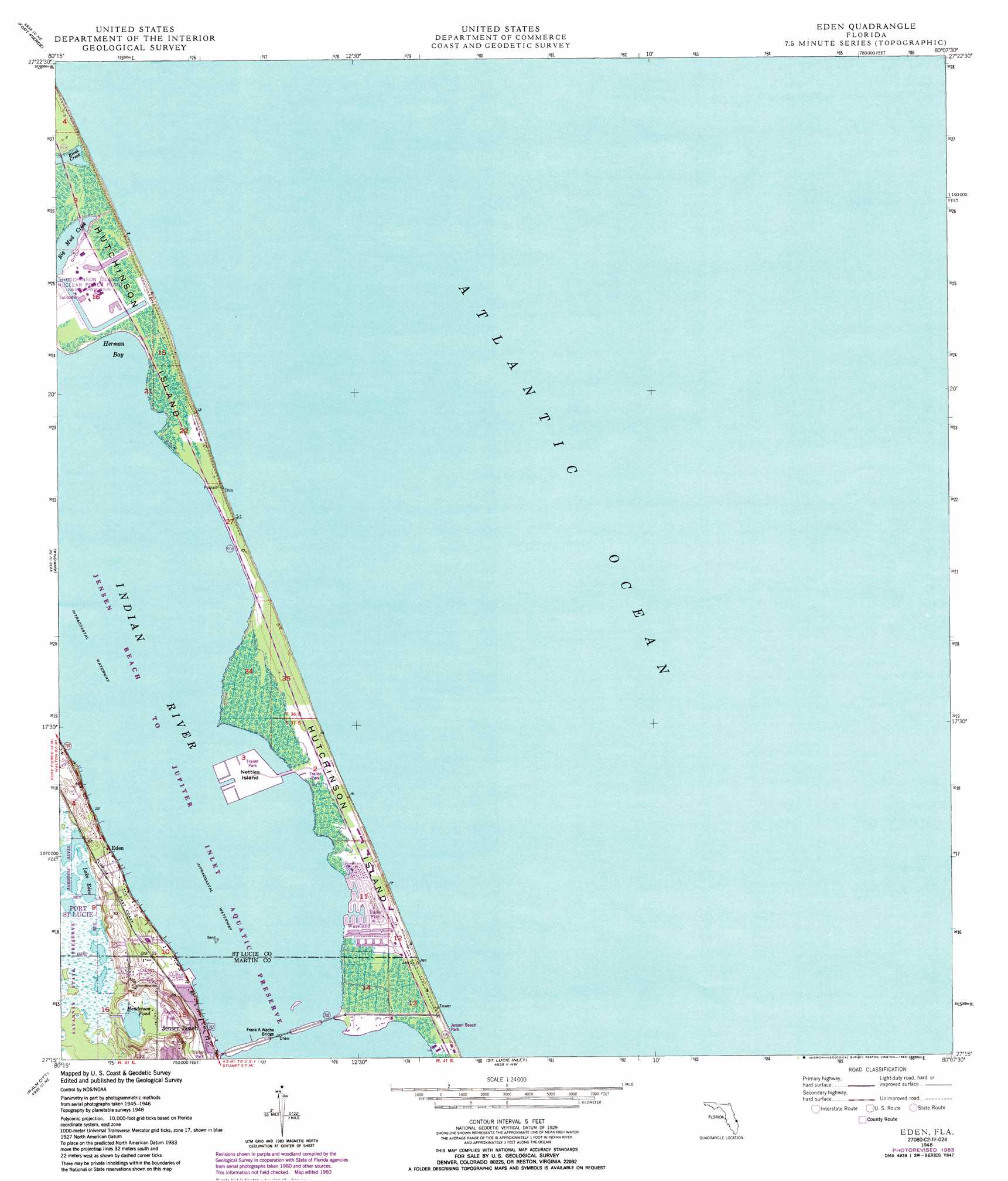
Eden Topo Map Florida
To zoom in, hover over the map of Eden
USGS Topo Quad 27080c2 - 1:24,000 scale
| Topo Map Name: | Eden |
| USGS Topo Quad ID: | 27080c2 |
| Print Size: | ca. 21 1/4" wide x 27" high |
| Southeast Coordinates: | 27.25° N latitude / 80.125° W longitude |
| Map Center Coordinates: | 27.3125° N latitude / 80.1875° W longitude |
| U.S. State: | FL |
| Filename: | O27080C2.jpg |
| Download Map JPG Image: | Eden topo map 1:24,000 scale |
| Map Type: | Topographic |
| Topo Series: | 7.5´ |
| Map Scale: | 1:24,000 |
| Source of Map Images: | United States Geological Survey (USGS) |
| Alternate Map Versions: |
Eden FL 1948, updated 1965 Download PDF Buy paper map Eden FL 1948, updated 1971 Download PDF Buy paper map Eden FL 1948, updated 1983 Download PDF Buy paper map Eden FL 1950 Download PDF Buy paper map Eden FL 2012 Download PDF Buy paper map Eden FL 2015 Download PDF Buy paper map |
1:24,000 Topo Quads surrounding Eden
Oslo |
Indrio |
|||
Fort Pierce Nw |
Fort Pierce |
|||
Fort Pierce Sw |
Ankona |
Eden |
||
Indian Town Nw |
Palm City |
Saint Lucie Inlet |
||
Indian Town |
Indiantown Se |
Gomez |
Hobe Sound |
> Back to 27080a1 at 1:100,000 scale
> Back to 27080a1 at 1:250,000 scale
> Back to U.S. Topo Maps home
Eden topo map: Gazetteer
Eden: Airports
Florida Power and Light Nuclear Power Plant Heliport elevation 0m 0′Eden: Bars
Pierce Shoal elevation 0m 0′Saint Lucie Shoal elevation 0m 0′
Eden: Bays
Herman Bay elevation 0m 0′Eden: Bridges
The Frank A Wacha Bridge elevation 0m 0′Eden: Islands
Hutchinson Island elevation 2m 6′Nettles Island elevation 0m 0′
Eden: Lakes
Henderson Pond elevation 4m 13′Lake Eden elevation 4m 13′
Eden: Parks
Jensen Beach Park elevation 1m 3′Eden: Populated Places
Eden elevation 5m 16′Jensen Beach elevation 2m 6′
Waveland elevation 0m 0′
Eden digital topo map on disk
Buy this Eden topo map showing relief, roads, GPS coordinates and other geographical features, as a high-resolution digital map file on DVD: