Okeechobee 1 Se Topo Map Florida
To zoom in, hover over the map of Okeechobee 1 Se
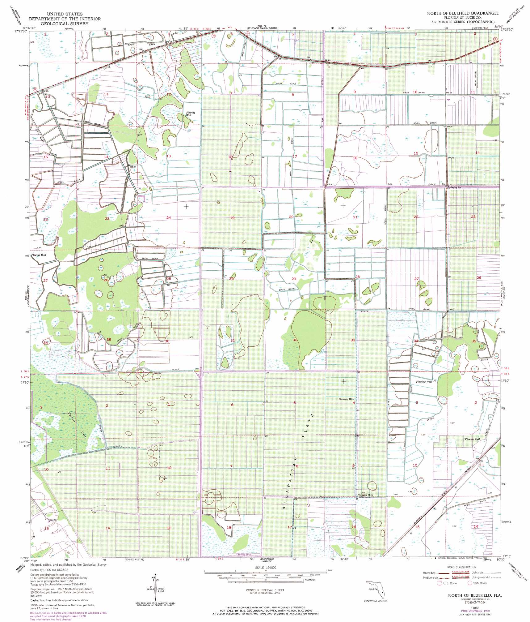
USGS Topo Quad 27080c5 - 1:24,000 scale
| Topo Map Name: | Okeechobee 1 Se |
| USGS Topo Quad ID: | 27080c5 |
| Print Size: | ca. 21 1/4" wide x 27" high |
| Southeast Coordinates: | 27.25° N latitude / 80.5° W longitude |
| Map Center Coordinates: | 27.3125° N latitude / 80.5625° W longitude |
| U.S. State: | FL |
| Filename: | O27080C5.jpg |
| Download Map JPG Image: | Okeechobee 1 Se topo map 1:24,000 scale |
| Map Type: | Topographic |
| Topo Series: | 7.5´ |
| Map Scale: | 1:24,000 |
| Source of Map Images: | United States Geological Survey (USGS) |
| Alternate Map Versions: |
Okeechobee 1 SE FL 1953, updated 1954 Download PDF Buy paper map Okeechobee 1 SE FL 1953, updated 1971 Download PDF Buy paper map North Of Bluefield FL 1953, updated 1993 Download PDF Buy paper map North of Bluefield FL 2012 Download PDF Buy paper map North of Bluefield FL 2015 Download PDF Buy paper map |
1:24,000 Topo Quads surrounding Okeechobee 1 Se
Fort Drum |
Fellsmere 4 Sw |
Fellsmere 4 Se |
Oslo |
Indrio |
Taylor Creek Ne |
Okeechobee 1 Nw |
Okeechobee 1 Ne |
Fort Pierce Nw |
Fort Pierce |
Taylor Creek Se |
Okeechobee 1 Sw |
Okeechobee 1 Se |
Fort Pierce Sw |
Ankona |
Okeechobee |
Okeechobee 4 Nw |
Okeechobee 4 Ne |
Indian Town Nw |
Palm City |
Okeechobee Se |
Okeechobee 4 Sw |
Okeechobee 4 Se |
Indian Town |
Indiantown Se |
> Back to 27080a1 at 1:100,000 scale
> Back to 27080a1 at 1:250,000 scale
> Back to U.S. Topo Maps home
Okeechobee 1 Se topo map: Gazetteer
Okeechobee 1 Se: Airports
Aero Acres Airport elevation 6m 19′Evans Properties Incorporated Airport elevation 7m 22′
Hales 700 Airport elevation 7m 22′
Harold F Brown Heliport elevation 7m 22′
Okeechobee 1 Se digital topo map on disk
Buy this Okeechobee 1 Se topo map showing relief, roads, GPS coordinates and other geographical features, as a high-resolution digital map file on DVD: