Riomar Topo Map Florida
To zoom in, hover over the map of Riomar
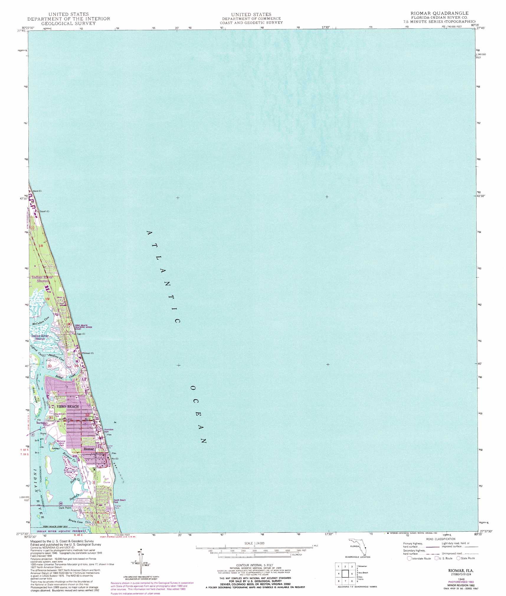
USGS Topo Quad 27080f3 - 1:24,000 scale
| Topo Map Name: | Riomar |
| USGS Topo Quad ID: | 27080f3 |
| Print Size: | ca. 21 1/4" wide x 27" high |
| Southeast Coordinates: | 27.625° N latitude / 80.25° W longitude |
| Map Center Coordinates: | 27.6875° N latitude / 80.3125° W longitude |
| U.S. State: | FL |
| Filename: | O27080F3.jpg |
| Download Map JPG Image: | Riomar topo map 1:24,000 scale |
| Map Type: | Topographic |
| Topo Series: | 7.5´ |
| Map Scale: | 1:24,000 |
| Source of Map Images: | United States Geological Survey (USGS) |
| Alternate Map Versions: |
Riomar FL 1948, updated 1966 Download PDF Buy paper map Riomar FL 1948, updated 1971 Download PDF Buy paper map Riomar FL 1948, updated 1983 Download PDF Buy paper map Riomar FL 1948, updated 1993 Download PDF Buy paper map Riomar FL 1950 Download PDF Buy paper map Riomar FL 2012 Download PDF Buy paper map Riomar FL 2015 Download PDF Buy paper map |
1:24,000 Topo Quads surrounding Riomar
Grant |
Sebastian Nw |
|||
Fellsmere |
Sebastian |
|||
Fellsmere 4 Ne |
Vero Beach |
Riomar |
||
Fellsmere 4 Se |
Oslo |
Indrio |
||
Okeechobee 1 Ne |
Fort Pierce Nw |
Fort Pierce |
> Back to 27080e1 at 1:100,000 scale
> Back to 27080a1 at 1:250,000 scale
> Back to U.S. Topo Maps home
Riomar topo map: Gazetteer
Riomar: Bays
Erwin Cove elevation 0m 0′Jandrew Cove elevation 0m 0′
McCullers Cove elevation 0m 0′
Riomar: Bridges
Merril P Barber Bridge elevation 0m 0′Riomar: Capes
Dark Point elevation 0m 0′Riomar: Channels
Gifford Cut elevation 0m 0′Riomar: Islands
Farley Island elevation 0m 0′Fritz Island elevation 0m 0′
Riomar: Parks
Humiston Park elevation 2m 6′South Beach Park elevation 3m 9′
Riomar: Populated Places
Riomar elevation 2m 6′Riomar: Streams
Bethel Creek elevation 0m 0′North Creek elevation 0m 0′
Riomar Creek elevation 0m 0′
South Creek elevation 0m 0′
Riomar digital topo map on disk
Buy this Riomar topo map showing relief, roads, GPS coordinates and other geographical features, as a high-resolution digital map file on DVD: