Brighton Sw Topo Map Florida
To zoom in, hover over the map of Brighton Sw
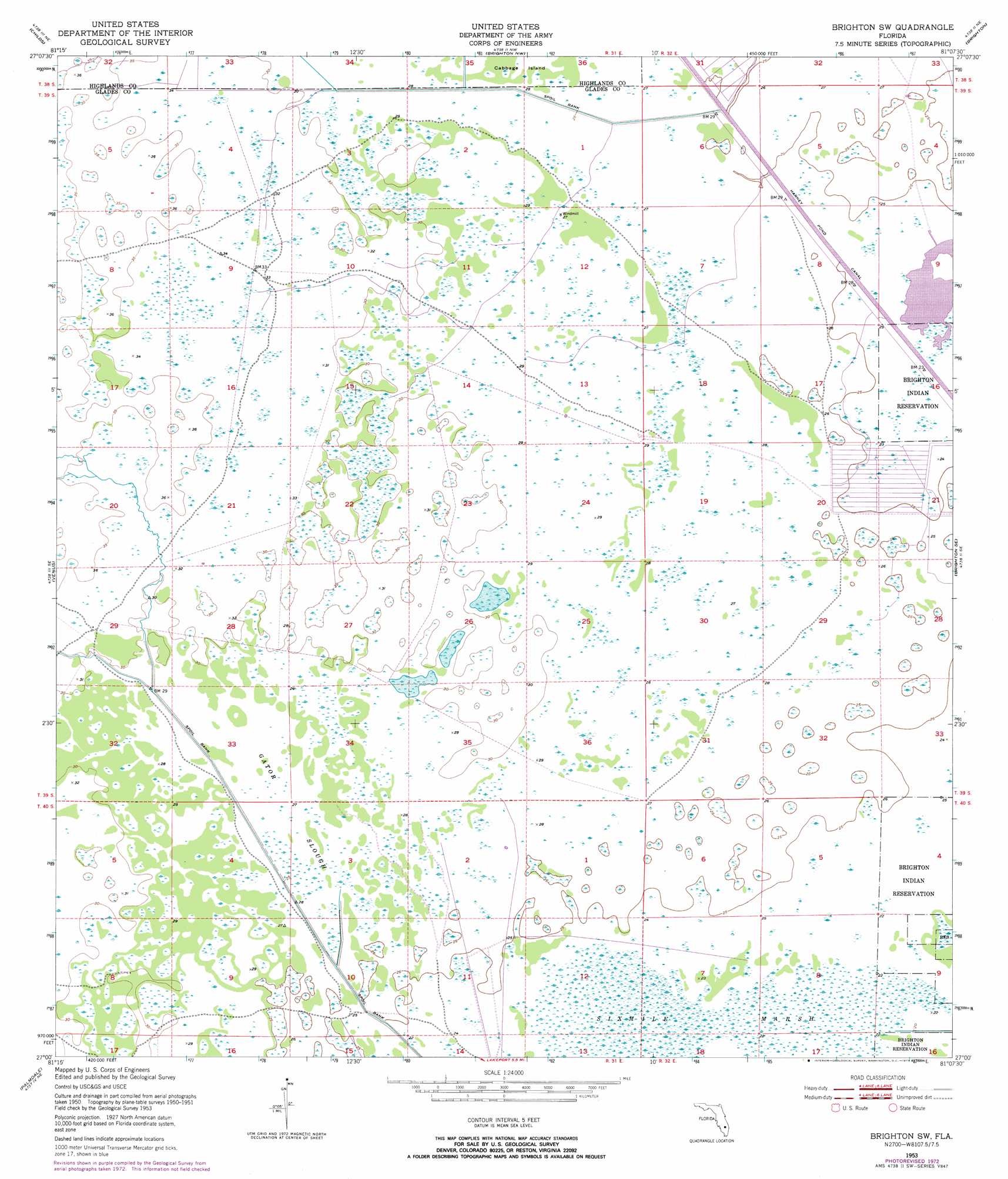
USGS Topo Quad 27081a2 - 1:24,000 scale
| Topo Map Name: | Brighton Sw |
| USGS Topo Quad ID: | 27081a2 |
| Print Size: | ca. 21 1/4" wide x 27" high |
| Southeast Coordinates: | 27° N latitude / 81.125° W longitude |
| Map Center Coordinates: | 27.0625° N latitude / 81.1875° W longitude |
| U.S. State: | FL |
| Filename: | O27081A2.jpg |
| Download Map JPG Image: | Brighton Sw topo map 1:24,000 scale |
| Map Type: | Topographic |
| Topo Series: | 7.5´ |
| Map Scale: | 1:24,000 |
| Source of Map Images: | United States Geological Survey (USGS) |
| Alternate Map Versions: |
Brighton SW FL 1953, updated 1954 Download PDF Buy paper map Brighton SW FL 1953, updated 1966 Download PDF Buy paper map Brighton SW FL 1953, updated 1973 Download PDF Buy paper map Brighton SW FL 2012 Download PDF Buy paper map Brighton SW FL 2015 Download PDF Buy paper map |
1:24,000 Topo Quads surrounding Brighton Sw
Lake June In Winter |
Lake Placid |
Basinger Sw |
Fort Basinger |
Taylor Creek Sw |
Venus Nw |
Childs |
Brighton Nw |
Brighton |
Okeechobee Nw |
Venus Sw |
Venus |
Brighton Sw |
Brighton Se |
Okeechobee Sw |
La Belle Nw |
Palmdale |
Lakeport |
Fisheating Bay |
Cochrans Pass |
La Belle |
Goodno |
Lake Hicpochee |
Moore Haven |
Clewiston North |
> Back to 27081a1 at 1:100,000 scale
> Back to 27080a1 at 1:250,000 scale
> Back to U.S. Topo Maps home
Brighton Sw topo map: Gazetteer
Brighton Sw: Canals
Harney Pond Canal elevation 7m 22′Brighton Sw: Guts
Gator Slough elevation 8m 26′Brighton Sw: Islands
Cabbage Island elevation 8m 26′Brighton Sw: Parks
Fisheating Creek Wildlife Refuge elevation 8m 26′Brighton Sw digital topo map on disk
Buy this Brighton Sw topo map showing relief, roads, GPS coordinates and other geographical features, as a high-resolution digital map file on DVD: