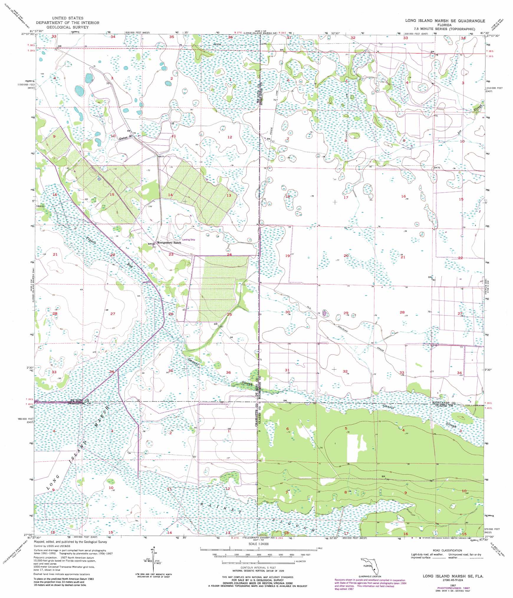
Long Island Marsh Se Topo Map Florida
To zoom in, hover over the map of Long Island Marsh Se
USGS Topo Quad 27081a5 - 1:24,000 scale
| Topo Map Name: | Long Island Marsh Se |
| USGS Topo Quad ID: | 27081a5 |
| Print Size: | ca. 21 1/4" wide x 27" high |
| Southeast Coordinates: | 27° N latitude / 81.5° W longitude |
| Map Center Coordinates: | 27.0625° N latitude / 81.5625° W longitude |
| U.S. State: | FL |
| Filename: | O27081A5.jpg |
| Download Map JPG Image: | Long Island Marsh Se topo map 1:24,000 scale |
| Map Type: | Topographic |
| Topo Series: | 7.5´ |
| Map Scale: | 1:24,000 |
| Source of Map Images: | United States Geological Survey (USGS) |
| Alternate Map Versions: |
Long Island Marsh SE FL 1957, updated 1958 Download PDF Buy paper map Long Island Marsh SE FL 1957, updated 1973 Download PDF Buy paper map Long Island Marsh SE FL 1957, updated 1987 Download PDF Buy paper map Long Island Marsh SE FL 2012 Download PDF Buy paper map Long Island Marsh SE FL 2015 Download PDF Buy paper map |
1:24,000 Topo Quads surrounding Long Island Marsh Se
Gardner |
Crewsville Sw |
Crewsville Se |
Lake June In Winter |
Lake Placid |
Arcadia |
Long Island Marsh Nw |
Long Island Marsh Ne |
Venus Nw |
Childs |
Arcadia Se |
Long Island Marsh Sw |
Long Island Marsh Se |
Venus Sw |
Venus |
Bermont |
Telegraph Swamp Nw |
Telegraph Swamp Ne |
La Belle Nw |
Palmdale |
Tuckers Corner |
Telegraph Swamp |
Telegraph Swamp Se |
La Belle |
Goodno |
> Back to 27081a1 at 1:100,000 scale
> Back to 27080a1 at 1:250,000 scale
> Back to U.S. Topo Maps home
Long Island Marsh Se topo map: Gazetteer
Long Island Marsh Se: Airports
Montgomery Ranch Airport elevation 23m 75′Long Island Marsh Se: Guts
Gannet Slough elevation 21m 68′Gator Branch elevation 21m 68′
Long Island Marsh Se: Streams
Tippen Bay elevation 16m 52′Long Island Marsh Se digital topo map on disk
Buy this Long Island Marsh Se topo map showing relief, roads, GPS coordinates and other geographical features, as a high-resolution digital map file on DVD: