Arcadia Se Topo Map Florida
To zoom in, hover over the map of Arcadia Se
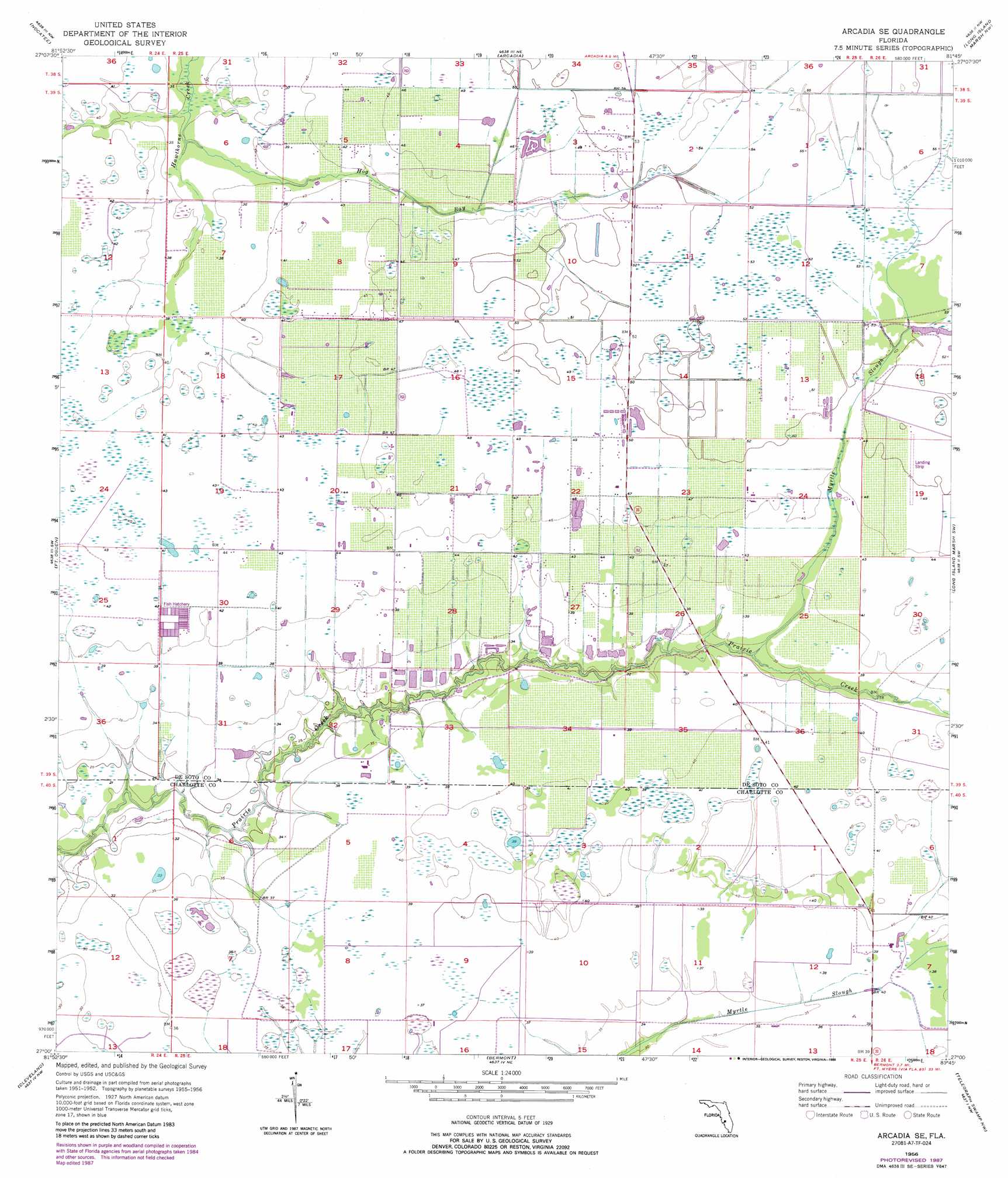
USGS Topo Quad 27081a7 - 1:24,000 scale
| Topo Map Name: | Arcadia Se |
| USGS Topo Quad ID: | 27081a7 |
| Print Size: | ca. 21 1/4" wide x 27" high |
| Southeast Coordinates: | 27° N latitude / 81.75° W longitude |
| Map Center Coordinates: | 27.0625° N latitude / 81.8125° W longitude |
| U.S. State: | FL |
| Filename: | O27081A7.jpg |
| Download Map JPG Image: | Arcadia Se topo map 1:24,000 scale |
| Map Type: | Topographic |
| Topo Series: | 7.5´ |
| Map Scale: | 1:24,000 |
| Source of Map Images: | United States Geological Survey (USGS) |
| Alternate Map Versions: |
Arcadia SE FL 1956, updated 1957 Download PDF Buy paper map Arcadia SE FL 1956, updated 1971 Download PDF Buy paper map Arcadia SE FL 1956, updated 1988 Download PDF Buy paper map Arcadia SE FL 2012 Download PDF Buy paper map Arcadia SE FL 2015 Download PDF Buy paper map |
1:24,000 Topo Quads surrounding Arcadia Se
Edgeville |
Limestone |
Gardner |
Crewsville Sw |
Crewsville Se |
Murdock Ne |
Nocatee |
Arcadia |
Long Island Marsh Nw |
Long Island Marsh Ne |
Murdock Se |
Fort Ogden |
Arcadia Se |
Long Island Marsh Sw |
Long Island Marsh Se |
Punta Gorda |
Cleveland |
Bermont |
Telegraph Swamp Nw |
Telegraph Swamp Ne |
Punta Gorda Se |
Gilchrist |
Tuckers Corner |
Telegraph Swamp |
Telegraph Swamp Se |
> Back to 27081a1 at 1:100,000 scale
> Back to 27080a1 at 1:250,000 scale
> Back to U.S. Topo Maps home
Arcadia Se topo map: Gazetteer
Arcadia Se: Airports
Carlstrom Field elevation 10m 32′Hennessy Airport elevation 12m 39′
Arcadia Se: Lakes
Hog Bay Lake elevation 15m 49′Pine Island Lake elevation 16m 52′
Thimble Lake elevation 10m 32′
Arcadia Se: Streams
Hog Bay elevation 9m 29′Myrtle Slough elevation 9m 29′
Arcadia Se digital topo map on disk
Buy this Arcadia Se topo map showing relief, roads, GPS coordinates and other geographical features, as a high-resolution digital map file on DVD: