Griffins Corner Topo Map Florida
To zoom in, hover over the map of Griffins Corner
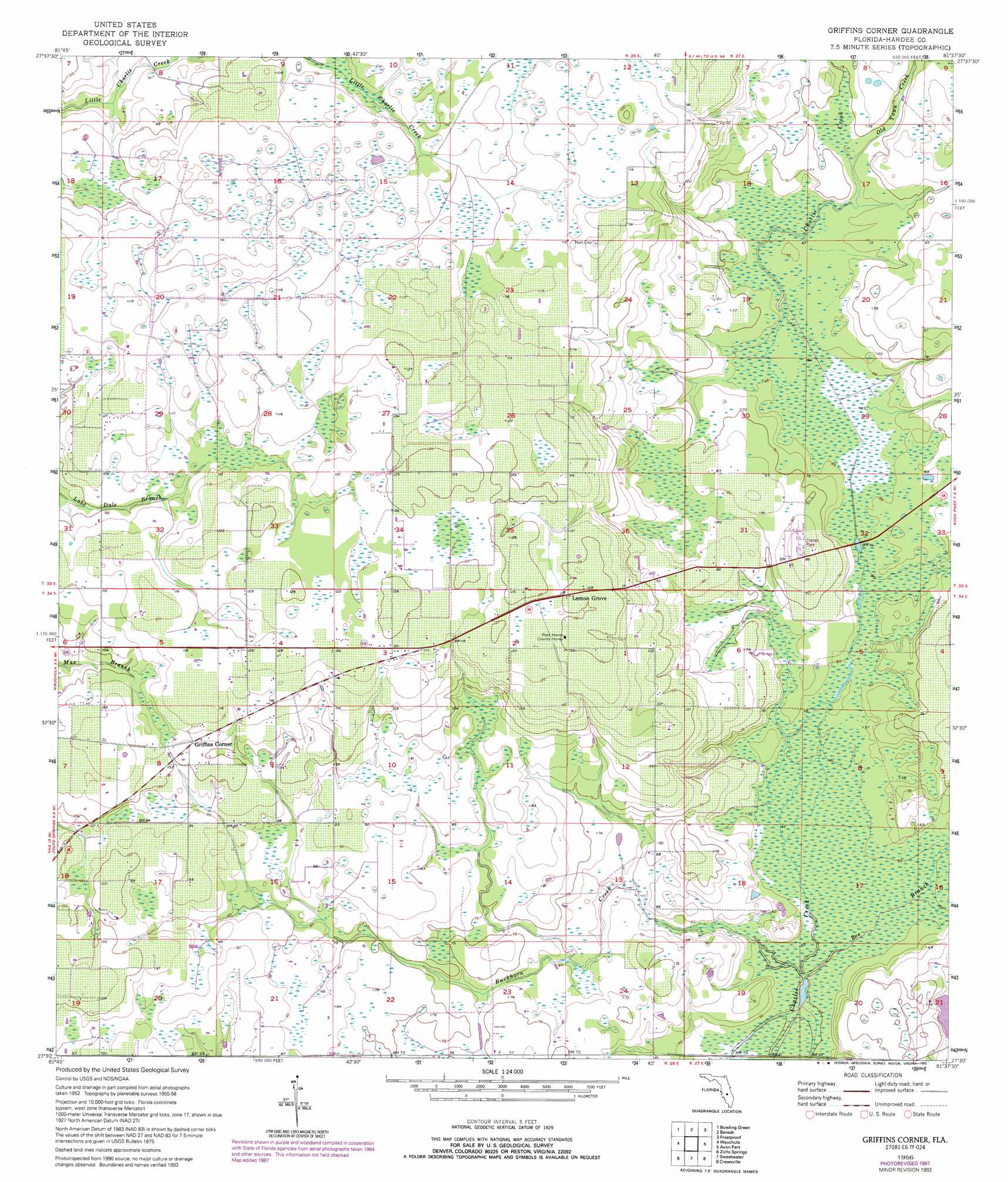
USGS Topo Quad 27081e6 - 1:24,000 scale
| Topo Map Name: | Griffins Corner |
| USGS Topo Quad ID: | 27081e6 |
| Print Size: | ca. 21 1/4" wide x 27" high |
| Southeast Coordinates: | 27.5° N latitude / 81.625° W longitude |
| Map Center Coordinates: | 27.5625° N latitude / 81.6875° W longitude |
| U.S. State: | FL |
| Filename: | O27081E6.jpg |
| Download Map JPG Image: | Griffins Corner topo map 1:24,000 scale |
| Map Type: | Topographic |
| Topo Series: | 7.5´ |
| Map Scale: | 1:24,000 |
| Source of Map Images: | United States Geological Survey (USGS) |
| Alternate Map Versions: |
Griffins Corner FL 1956, updated 1957 Download PDF Buy paper map Griffins Corner FL 1956, updated 1957 Download PDF Buy paper map Griffins Corner FL 1956, updated 1988 Download PDF Buy paper map Griffins Corner FL 1956, updated 1993 Download PDF Buy paper map Griffins Corner FL 2012 Download PDF Buy paper map Griffins Corner FL 2015 Download PDF Buy paper map |
1:24,000 Topo Quads surrounding Griffins Corner
Bradley Junction |
Homeland |
Alturas |
Babson Park |
Lake Weohyakapka |
Baird |
Bowling Green |
Bereah |
Frostproof |
Lake Arbuckle |
Fort Green |
Wauchula |
Griffins Corner |
Avon Park |
Lake Arbuckle Sw |
Ona |
Zolfo Springs |
Sweetwater |
Crewsville |
Sebring |
Limestone |
Gardner |
Crewsville Sw |
Crewsville Se |
Lake June In Winter |
> Back to 27081e1 at 1:100,000 scale
> Back to 27080a1 at 1:250,000 scale
> Back to U.S. Topo Maps home
Griffins Corner topo map: Gazetteer
Griffins Corner: Populated Places
Griffins Corner elevation 32m 104′Lemon Grove elevation 38m 124′
Griffins Corner: Streams
Bee Branch elevation 15m 49′Buckhorn Creek elevation 15m 49′
Little Charley Bowlegs Creek elevation 16m 52′
Old Town Creek elevation 21m 68′
Griffins Corner digital topo map on disk
Buy this Griffins Corner topo map showing relief, roads, GPS coordinates and other geographical features, as a high-resolution digital map file on DVD: