Fort Kissimmee Ne Topo Map Florida
To zoom in, hover over the map of Fort Kissimmee Ne
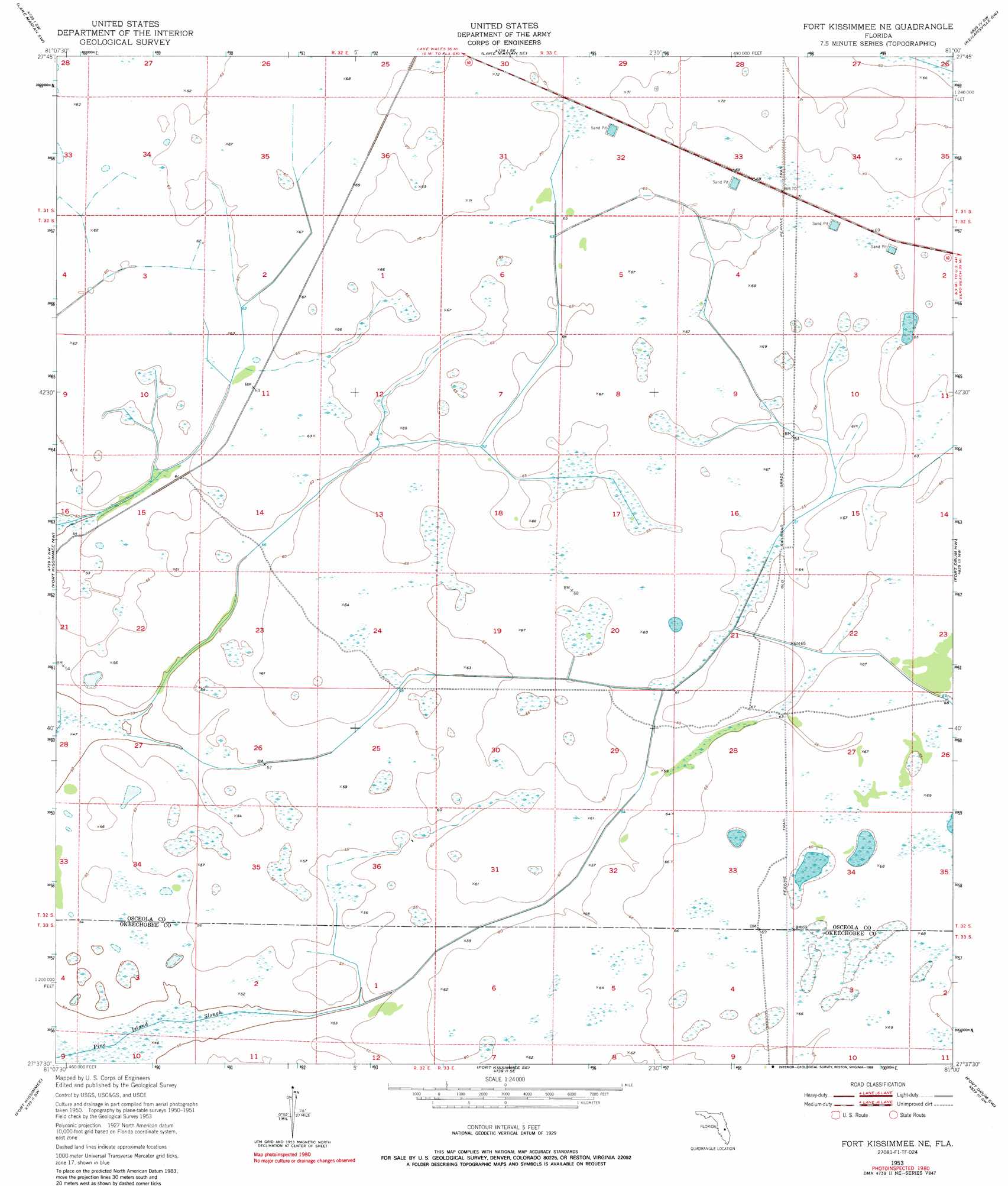
USGS Topo Quad 27081f1 - 1:24,000 scale
| Topo Map Name: | Fort Kissimmee Ne |
| USGS Topo Quad ID: | 27081f1 |
| Print Size: | ca. 21 1/4" wide x 27" high |
| Southeast Coordinates: | 27.625° N latitude / 81° W longitude |
| Map Center Coordinates: | 27.6875° N latitude / 81.0625° W longitude |
| U.S. State: | FL |
| Filename: | O27081F1.jpg |
| Download Map JPG Image: | Fort Kissimmee Ne topo map 1:24,000 scale |
| Map Type: | Topographic |
| Topo Series: | 7.5´ |
| Map Scale: | 1:24,000 |
| Source of Map Images: | United States Geological Survey (USGS) |
| Alternate Map Versions: |
Fort Kissimmee NE FL 1953, updated 1954 Download PDF Buy paper map Fort Kissimmee NE FL 1953, updated 1965 Download PDF Buy paper map Fort Kissimmee NE FL 1953, updated 1988 Download PDF Buy paper map Fort Kissimmee NE FL 2012 Download PDF Buy paper map Fort Kissimmee NE FL 2015 Download PDF Buy paper map |
1:24,000 Topo Quads surrounding Fort Kissimmee Ne
Lake Weohyakapka Ne |
Lake Marian Nw |
Lake Marian Ne |
Kenansville |
Kenansville Ne |
Lake Weohyakpka Se |
Lake Marian Sw |
Lake Marian Se |
Kenansville Sw |
Kenansville Se |
Lake Arbuckle Ne |
Fort Kissimmee Nw |
Fort Kissimmee Ne |
Fort Drum Nw |
Fort Drum Ne |
Lake Arbuckle Se |
Fort Kissimmee |
Fort Kissimmee Se |
Fort Drum Sw |
Fort Drum |
Lorida |
Basinger Nw |
Basinger |
Taylor Creek Nw |
Taylor Creek Ne |
> Back to 27081e1 at 1:100,000 scale
> Back to 27080a1 at 1:250,000 scale
> Back to U.S. Topo Maps home
Fort Kissimmee Ne topo map: Gazetteer
Fort Kissimmee Ne: Guts
Pine Island Slough elevation 15m 49′Fort Kissimmee Ne: Trails
Peavine Trail elevation 19m 62′Fort Kissimmee Ne digital topo map on disk
Buy this Fort Kissimmee Ne topo map showing relief, roads, GPS coordinates and other geographical features, as a high-resolution digital map file on DVD: