Bereah Topo Map Florida
To zoom in, hover over the map of Bereah
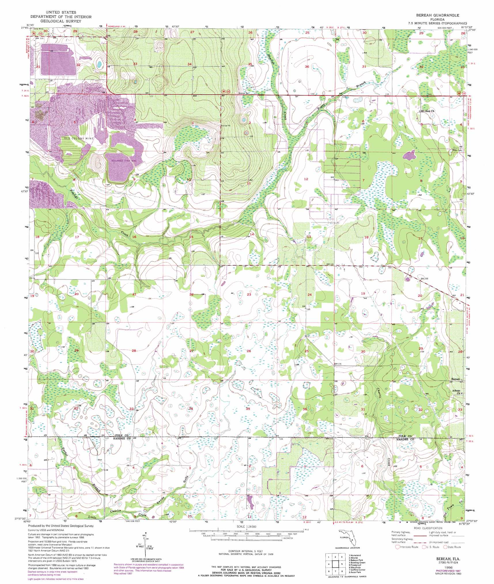
USGS Topo Quad 27081f6 - 1:24,000 scale
| Topo Map Name: | Bereah |
| USGS Topo Quad ID: | 27081f6 |
| Print Size: | ca. 21 1/4" wide x 27" high |
| Southeast Coordinates: | 27.625° N latitude / 81.625° W longitude |
| Map Center Coordinates: | 27.6875° N latitude / 81.6875° W longitude |
| U.S. State: | FL |
| Filename: | O27081F6.jpg |
| Download Map JPG Image: | Bereah topo map 1:24,000 scale |
| Map Type: | Topographic |
| Topo Series: | 7.5´ |
| Map Scale: | 1:24,000 |
| Source of Map Images: | United States Geological Survey (USGS) |
| Alternate Map Versions: |
Bereah FL 1956, updated 1957 Download PDF Buy paper map Bereah FL 1956, updated 1974 Download PDF Buy paper map Bereah FL 1956, updated 1988 Download PDF Buy paper map Bereah FL 1956, updated 1993 Download PDF Buy paper map Bereah FL 2012 Download PDF Buy paper map Bereah FL 2015 Download PDF Buy paper map |
1:24,000 Topo Quads surrounding Bereah
Mulberry |
Bartow |
Eloise |
Lake Wales |
Hesperides |
Bradley Junction |
Homeland |
Alturas |
Babson Park |
Lake Weohyakapka |
Baird |
Bowling Green |
Bereah |
Frostproof |
Lake Arbuckle |
Fort Green |
Wauchula |
Griffins Corner |
Avon Park |
Lake Arbuckle Sw |
Ona |
Zolfo Springs |
Sweetwater |
Crewsville |
Sebring |
> Back to 27081e1 at 1:100,000 scale
> Back to 27080a1 at 1:250,000 scale
> Back to U.S. Topo Maps home
Bereah topo map: Gazetteer
Bereah: Mines
Old Colony Mine elevation 37m 121′Bereah: Populated Places
Bereah elevation 44m 144′Bereah: Streams
Boggy Branch elevation 35m 114′Parker Branch elevation 28m 91′
Sandy Gully elevation 30m 98′
Bereah digital topo map on disk
Buy this Bereah topo map showing relief, roads, GPS coordinates and other geographical features, as a high-resolution digital map file on DVD: