Lake Weohyakapka Topo Map Florida
To zoom in, hover over the map of Lake Weohyakapka
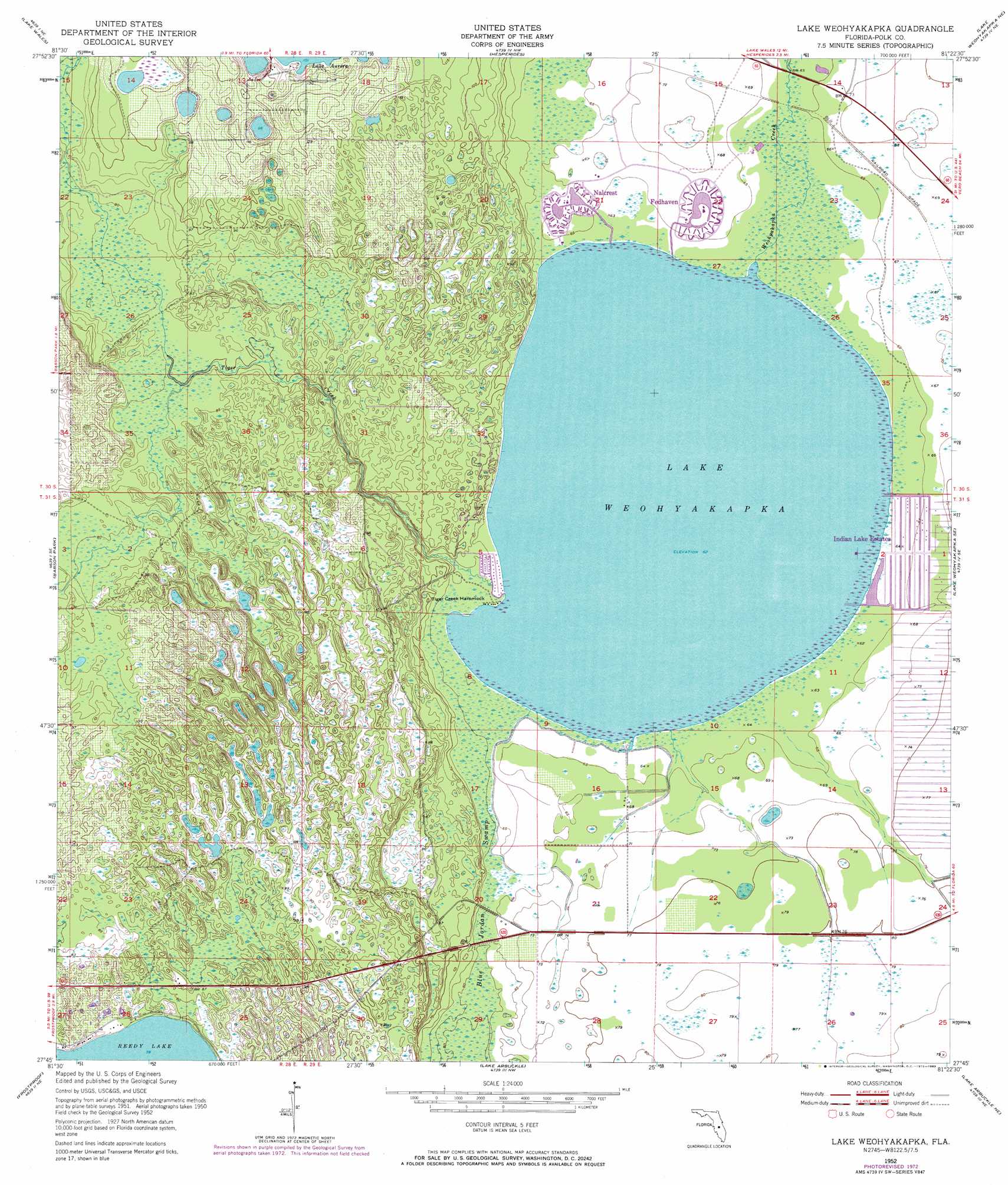
USGS Topo Quad 27081g4 - 1:24,000 scale
| Topo Map Name: | Lake Weohyakapka |
| USGS Topo Quad ID: | 27081g4 |
| Print Size: | ca. 21 1/4" wide x 27" high |
| Southeast Coordinates: | 27.75° N latitude / 81.375° W longitude |
| Map Center Coordinates: | 27.8125° N latitude / 81.4375° W longitude |
| U.S. State: | FL |
| Filename: | O27081G4.jpg |
| Download Map JPG Image: | Lake Weohyakapka topo map 1:24,000 scale |
| Map Type: | Topographic |
| Topo Series: | 7.5´ |
| Map Scale: | 1:24,000 |
| Source of Map Images: | United States Geological Survey (USGS) |
| Alternate Map Versions: |
Lake Weohyakapka FL 1952, updated 1953 Download PDF Buy paper map Lake Weohyakapka FL 1952, updated 1968 Download PDF Buy paper map Lake Weohyakapka FL 1952, updated 1973 Download PDF Buy paper map Lake Weohyakapka FL 1952, updated 1983 Download PDF Buy paper map Lake Weohyakapka FL 2012 Download PDF Buy paper map Lake Weohyakapka FL 2015 Download PDF Buy paper map |
1:24,000 Topo Quads surrounding Lake Weohyakapka
Winter Haven |
Dundee |
Lake Hatchineha |
Cypress Lake |
Holopaw Sw |
Eloise |
Lake Wales |
Hesperides |
Lake Weohyakapka Ne |
Lake Marian Nw |
Alturas |
Babson Park |
Lake Weohyakapka |
Lake Weohyakpka Se |
Lake Marian Sw |
Bereah |
Frostproof |
Lake Arbuckle |
Lake Arbuckle Ne |
Fort Kissimmee Nw |
Griffins Corner |
Avon Park |
Lake Arbuckle Sw |
Lake Arbuckle Se |
Fort Kissimmee |
> Back to 27081e1 at 1:100,000 scale
> Back to 27080a1 at 1:250,000 scale
> Back to U.S. Topo Maps home
Lake Weohyakapka topo map: Gazetteer
Lake Weohyakapka: Islands
Tiger Creek Hammock elevation 19m 62′Lake Weohyakapka: Lakes
Lake Weohyakapka elevation 19m 62′Lake Weohyakapka: Populated Places
Fedhaven elevation 20m 65′Indian Lake Estates elevation 20m 65′
Nalcrest elevation 19m 62′
Walden Shores Mobile Home Park elevation 20m 65′
Lake Weohyakapka: Streams
Tiger Creek elevation 19m 62′Lake Weohyakapka digital topo map on disk
Buy this Lake Weohyakapka topo map showing relief, roads, GPS coordinates and other geographical features, as a high-resolution digital map file on DVD: