Lower Myakka Lake Topo Map Florida
To zoom in, hover over the map of Lower Myakka Lake
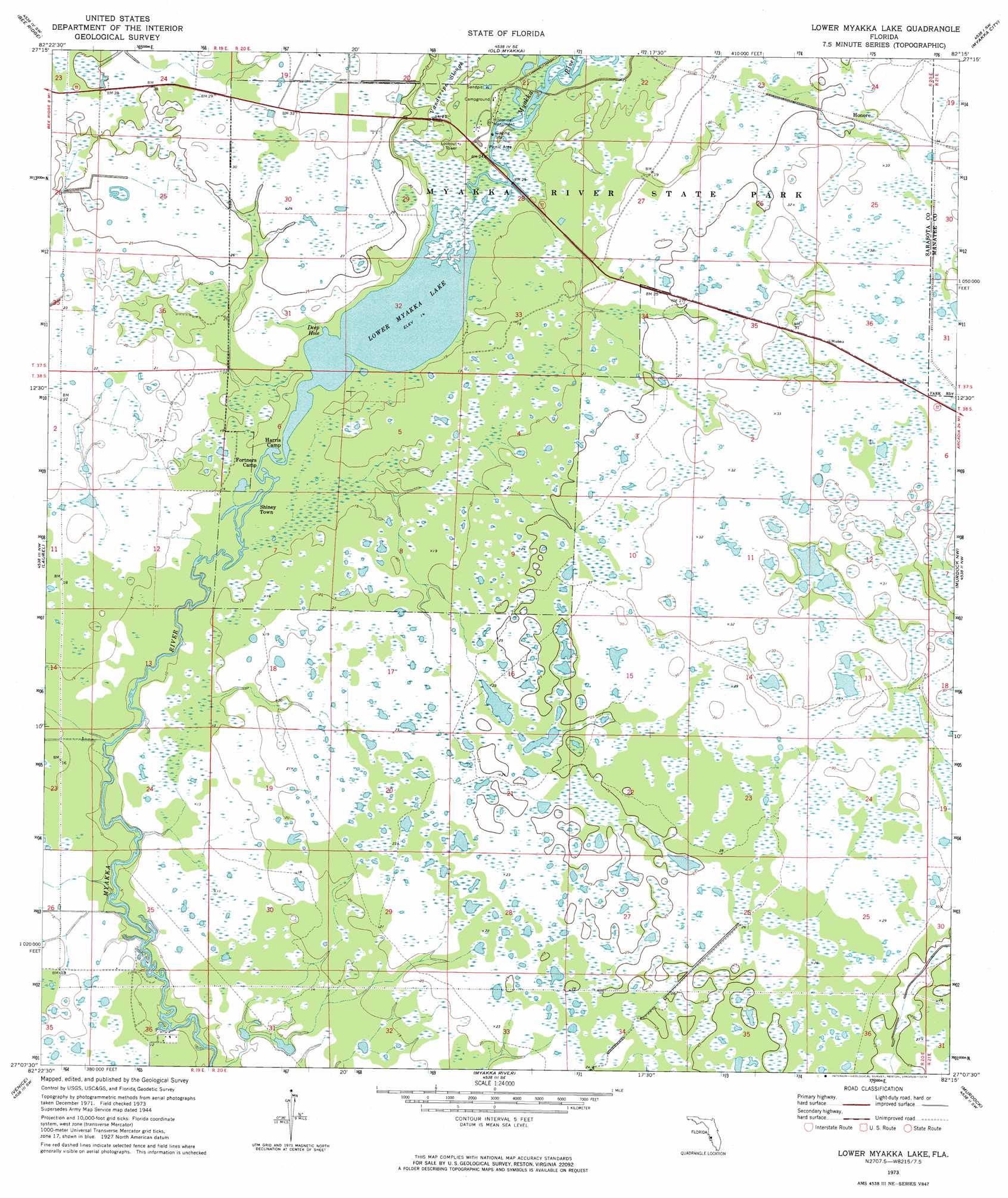
USGS Topo Quad 27082b3 - 1:24,000 scale
| Topo Map Name: | Lower Myakka Lake |
| USGS Topo Quad ID: | 27082b3 |
| Print Size: | ca. 21 1/4" wide x 27" high |
| Southeast Coordinates: | 27.125° N latitude / 82.25° W longitude |
| Map Center Coordinates: | 27.1875° N latitude / 82.3125° W longitude |
| U.S. State: | FL |
| Filename: | O27082B3.jpg |
| Download Map JPG Image: | Lower Myakka Lake topo map 1:24,000 scale |
| Map Type: | Topographic |
| Topo Series: | 7.5´ |
| Map Scale: | 1:24,000 |
| Source of Map Images: | United States Geological Survey (USGS) |
| Alternate Map Versions: |
Lower Myakka Lake FL 1944, updated 1961 Download PDF Buy paper map Lower Myakka Lake FL 1973, updated 1974 Download PDF Buy paper map Lower Myakka Lake FL 2012 Download PDF Buy paper map Lower Myakka Lake FL 2015 Download PDF Buy paper map |
1:24,000 Topo Quads surrounding Lower Myakka Lake
Bradenton |
Lorraine |
Verna |
Myakka City Nw |
Myakka Head |
Sarasota |
Bee Ridge |
Old Myakka |
Myakka City |
Edgeville |
Bird Keys |
Laurel |
Lower Myakka Lake |
Murdock Nw |
Murdock Ne |
Venice |
Myakka River |
Murdock |
Murdock Se |
|
Englewood Nw |
Englewood |
El Jobean |
Punta Gorda |
> Back to 27082a1 at 1:100,000 scale
> Back to 27082a1 at 1:250,000 scale
> Back to U.S. Topo Maps home
Lower Myakka Lake topo map: Gazetteer
Lower Myakka Lake: Bays
Deep Hole elevation 4m 13′Lower Myakka Lake: Lakes
Lower Myakka Lake elevation 4m 13′Lower Myakka Lake: Parks
Myakka River State Park elevation 4m 13′Lower Myakka Lake: Populated Places
Honore elevation 9m 29′Shiney Town elevation 4m 13′
Lower Myakka Lake digital topo map on disk
Buy this Lower Myakka Lake topo map showing relief, roads, GPS coordinates and other geographical features, as a high-resolution digital map file on DVD: