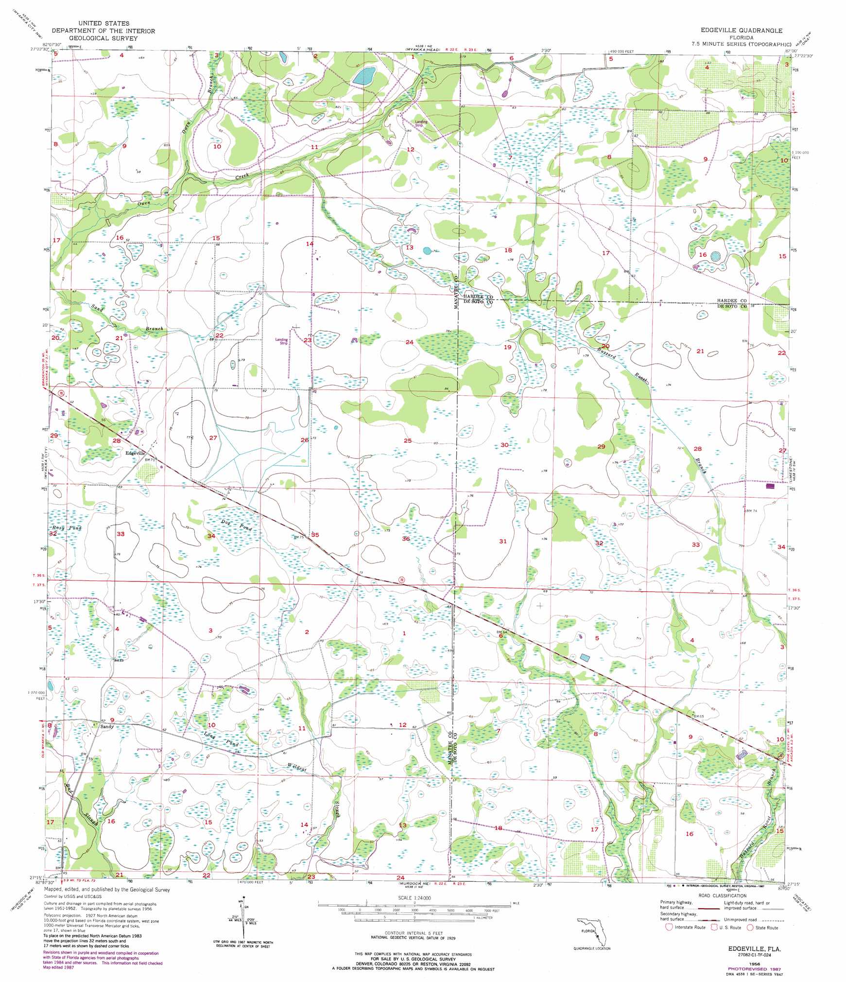
Edgeville Topo Map Florida
To zoom in, hover over the map of Edgeville
USGS Topo Quad 27082c1 - 1:24,000 scale
| Topo Map Name: | Edgeville |
| USGS Topo Quad ID: | 27082c1 |
| Print Size: | ca. 21 1/4" wide x 27" high |
| Southeast Coordinates: | 27.25° N latitude / 82° W longitude |
| Map Center Coordinates: | 27.3125° N latitude / 82.0625° W longitude |
| U.S. State: | FL |
| Filename: | O27082C1.jpg |
| Download Map JPG Image: | Edgeville topo map 1:24,000 scale |
| Map Type: | Topographic |
| Topo Series: | 7.5´ |
| Map Scale: | 1:24,000 |
| Source of Map Images: | United States Geological Survey (USGS) |
| Alternate Map Versions: |
Edgeville FL 1956, updated 1957 Download PDF Buy paper map Edgeville FL 1956, updated 1971 Download PDF Buy paper map Edgeville FL 1956, updated 1987 Download PDF Buy paper map Edgeville FL 2012 Download PDF Buy paper map Edgeville FL 2015 Download PDF Buy paper map |
1:24,000 Topo Quads surrounding Edgeville
Rye |
Keentown |
Duette |
Fort Green |
Wauchula |
Verna |
Myakka City Nw |
Myakka Head |
Ona |
Zolfo Springs |
Old Myakka |
Myakka City |
Edgeville |
Limestone |
Gardner |
Lower Myakka Lake |
Murdock Nw |
Murdock Ne |
Nocatee |
Arcadia |
Myakka River |
Murdock |
Murdock Se |
Fort Ogden |
Arcadia Se |
> Back to 27082a1 at 1:100,000 scale
> Back to 27082a1 at 1:250,000 scale
> Back to U.S. Topo Maps home
Edgeville topo map: Gazetteer
Edgeville: Lakes
Coffee Pond elevation 21m 68′Edgeville: Populated Places
Edgeville elevation 21m 68′Sandy elevation 18m 59′
Edgeville: Streams
Owen Branch elevation 15m 49′Edgeville: Swamps
Dog Pond elevation 21m 68′Long Pond elevation 18m 59′
Roxy Pond elevation 21m 68′
Edgeville digital topo map on disk
Buy this Edgeville topo map showing relief, roads, GPS coordinates and other geographical features, as a high-resolution digital map file on DVD: