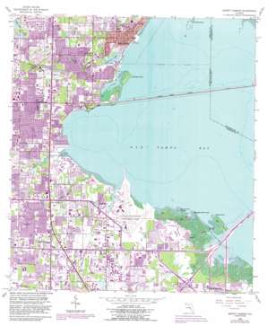
Safety Harbor Topo Map Florida
To zoom in, hover over the map of Safety Harbor
USGS Topo Quad 27082h6 - 1:24,000 scale
| Topo Map Name: | Safety Harbor |
| USGS Topo Quad ID: | 27082h6 |
| Print Size: | ca. 21 1/4" wide x 27" high |
| Southeast Coordinates: | 27.875° N latitude / 82.625° W longitude |
| Map Center Coordinates: | 27.9375° N latitude / 82.6875° W longitude |
| U.S. State: | FL |
| Filename: | O27082H6.jpg |
| Download Map JPG Image: | Safety Harbor topo map 1:24,000 scale |
| Map Type: | Topographic |
| Topo Series: | 7.5´ |
| Map Scale: | 1:24,000 |
| Source of Map Images: | United States Geological Survey (USGS) |
| Alternate Map Versions: |
Safety Harbor FL 1952, updated 1952 Download PDF Buy paper map Safety Harbor FL 1956, updated 1957 Download PDF Buy paper map Safety Harbor FL 1956, updated 1971 Download PDF Buy paper map Safety Harbor FL 1956, updated 1982 Download PDF Buy paper map Safety Harbor FL 1956, updated 1988 Download PDF Buy paper map Safety Harbor FL 1956, updated 1988 Download PDF Buy paper map Safety Harbor FL 1998, updated 2001 Download PDF Buy paper map Safety Harbor FL 2012 Download PDF Buy paper map Safety Harbor FL 2015 Download PDF Buy paper map |
1:24,000 Topo Quads surrounding Safety Harbor
> Back to 27082e1 at 1:100,000 scale
> Back to 27082a1 at 1:250,000 scale
> Back to U.S. Topo Maps home
Safety Harbor topo map: Gazetteer
Safety Harbor: Airports
Arbor Office Park Heliport elevation 5m 16′Johnson Heliport elevation 18m 59′
Pinellas County Mosquito Control Heliport elevation 3m 9′
Saint Petersburg-Clearwater International Airport elevation 2m 6′
Safety Harbor: Bays
Cooper Bayou elevation 0m 0′Largo Inlet elevation 0m 0′
Safety Harbor: Capes
Booth Point elevation 0m 0′Cabbage Patch Point elevation 0m 0′
Cedar Point elevation 0m 0′
Cooper Point elevation 0m 0′
Grassy Point elevation 0m 0′
Safety Harbor: Channels
Big Island Gap elevation 0m 0′Safety Harbor: Crossings
Interchange 30 elevation 2m 6′Interchange 31A elevation 0m 0′
Interchange 31B elevation 0m 0′
Interchange 32 elevation 0m 0′
Safety Harbor: Islands
Big Island elevation 0m 0′Bunker Hill Island elevation 0m 0′
Safety Harbor: Lakes
Alligator Lake elevation 1m 3′Beckett Lake elevation 16m 52′
Harbor Lake elevation 18m 59′
Lake Patricia elevation 14m 45′
Safety Harbor: Parks
Alligator Park elevation 6m 19′Art Park elevation 5m 16′
Baranoff Park elevation 5m 16′
Carpenter Field elevation 7m 22′
Cliff Stephens Park elevation 5m 16′
Coachman Ridge Park elevation 11m 36′
Community Center elevation 4m 13′
Cooper Bayou Park elevation 2m 6′
Coopers Point Nature Park elevation 1m 3′
Courtney Campbell Parkway elevation 1m 3′
Daisy Douglas Park elevation 5m 16′
Del Oro Park elevation 10m 32′
E. C. Moore Complex (1 - 7) elevation 10m 32′
E. C. Moore Fields (8 - 9) elevation 13m 42′
Henry L McMullen Tennis Complex elevation 12m 39′
Ian Tilmann Skatepark elevation 4m 13′
Joe Dimaggio Fields elevation 8m 26′
John Wilson Park elevation 6m 19′
Kapok Park elevation 3m 9′
Long Center elevation 13m 42′
Marina Park elevation 2m 6′
Moccasin Lake Nature Park elevation 6m 19′
Morningside Recreation Complex elevation 6m 19′
Northeast Coachman Park elevation 5m 16′
Pinebrook Park elevation 3m 9′
Rigsby Recreation Center elevation 4m 13′
Safety Harbor City Park elevation 2m 6′
Safety Harbor Dog Park elevation 4m 13′
Salls Lake 1 and 2 elevation 14m 45′
Sunset Road Playfield elevation 17m 55′
Town Place Park elevation 9m 29′
U S 19 Soccer Practice Fields elevation 15m 49′
Safety Harbor: Populated Places
Bayview elevation 4m 13′Coachman elevation 12m 39′
Dellwood elevation 7m 22′
Feather Sound elevation 0m 0′
Four Corners elevation 5m 16′
High Point elevation 3m 9′
Highpoint elevation 4m 13′
Safety Harbor elevation 6m 19′
South Highpoint elevation 4m 13′
Safety Harbor: Post Offices
High Point Branch Post Office elevation 4m 13′Safety Harbor Post Office elevation 6m 19′
Safety Harbor: Streams
Allen Creek elevation 0m 0′Alligator Creek elevation 1m 3′
Grassy Creek elevation 0m 0′
Long Branch elevation 0m 0′
Mullet Creek elevation 0m 0′
Safety Harbor: Trails
Bayshore Linear Greenway Recreation Trail elevation 1m 3′Safety Harbor digital topo map on disk
Buy this Safety Harbor topo map showing relief, roads, GPS coordinates and other geographical features, as a high-resolution digital map file on DVD:


