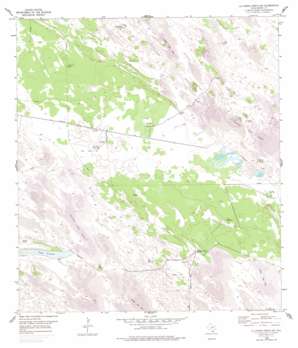
La Parra Ranch Sw Topo Map Texas
To zoom in, hover over the map of La Parra Ranch Sw
USGS Topo Quad 27097a6 - 1:24,000 scale
| Topo Map Name: | La Parra Ranch Sw |
| USGS Topo Quad ID: | 27097a6 |
| Print Size: | ca. 21 1/4" wide x 27" high |
| Southeast Coordinates: | 27° N latitude / 97.625° W longitude |
| Map Center Coordinates: | 27.0625° N latitude / 97.6875° W longitude |
| U.S. State: | TX |
| Filename: | o27097a6.jpg |
| Download Map JPG Image: | La Parra Ranch Sw topo map 1:24,000 scale |
| Map Type: | Topographic |
| Topo Series: | 7.5´ |
| Map Scale: | 1:24,000 |
| Source of Map Images: | United States Geological Survey (USGS) |
| Alternate Map Versions: |
La Parra Ranch SW TX 1954, updated 1955 Download PDF Buy paper map La Parra Ranch SW TX 1954, updated 1978 Download PDF Buy paper map La Parra Ranch SW TX 2010 Download PDF Buy paper map La Parra Ranch SW TX 2013 Download PDF Buy paper map La Parra Ranch SW TX 2016 Download PDF Buy paper map |
1:24,000 Topo Quads surrounding La Parra Ranch Sw
> Back to 27097a1 at 1:100,000 scale
> Back to 27096a1 at 1:250,000 scale
> Back to U.S. Topo Maps home
La Parra Ranch Sw topo map: Gazetteer
La Parra Ranch Sw: Lakes
Cayo Grande elevation 5m 16′La Parra Ranch Sw: Oilfields
Humble Oil Company Hub Number 1 elevation 11m 36′La Parra Ranch Sw: Summits
Marana Trap elevation 8m 26′Padre Juanito Trap elevation 8m 26′
La Parra Ranch Sw: Wells
Kennedy Lease Oil Well Number 1 elevation 6m 19′Los Indios Artesian Well elevation 4m 13′
Marana Artesian Well elevation 6m 19′
Mota Redonda Artesian Well elevation 16m 52′
Padre Juanito Artesian Well elevation 8m 26′
Telefone Artesian Well elevation 8m 26′
Tio Colas Artesian Well elevation 6m 19′
La Parra Ranch Sw digital topo map on disk
Buy this La Parra Ranch Sw topo map showing relief, roads, GPS coordinates and other geographical features, as a high-resolution digital map file on DVD:


