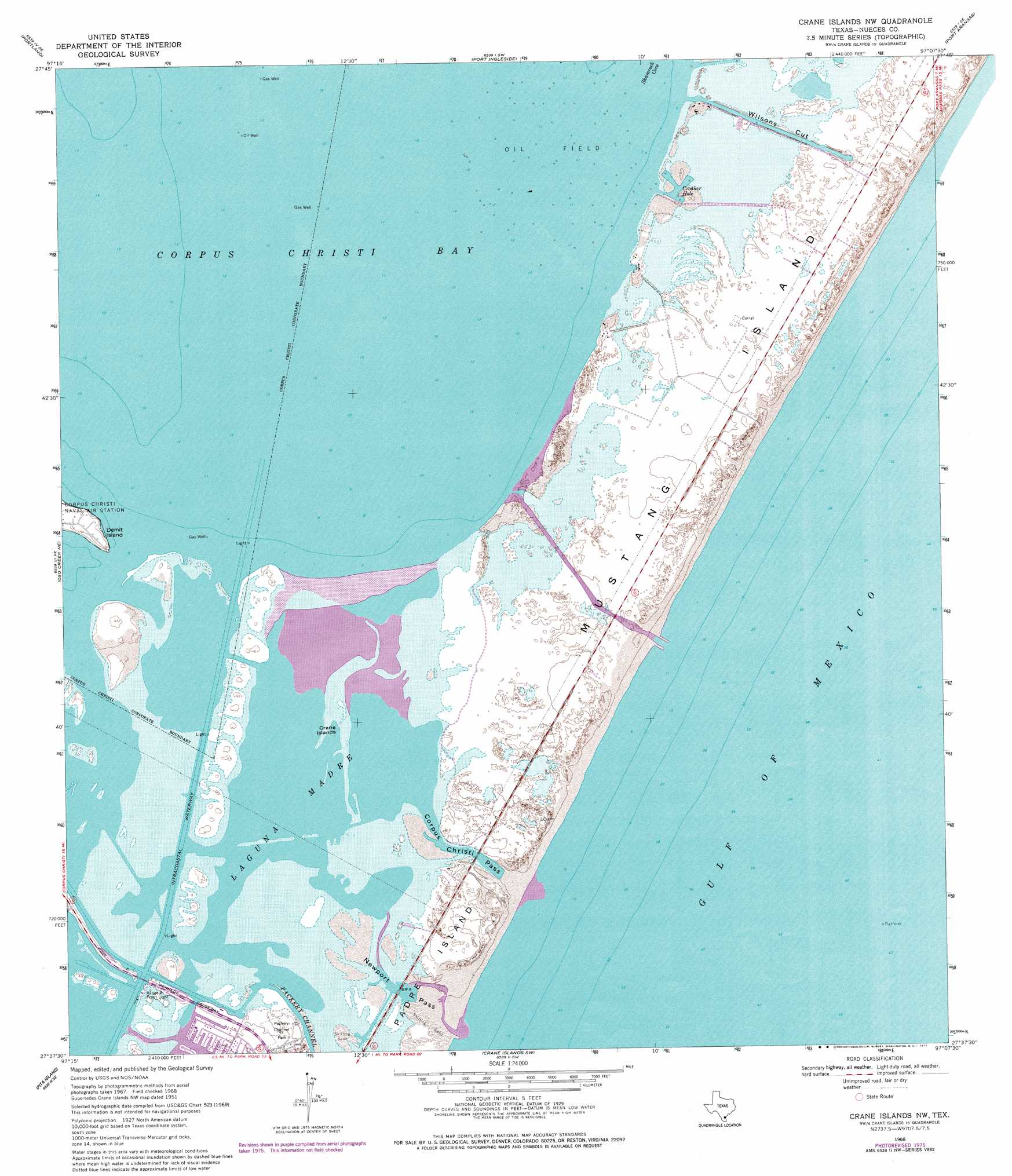
Crane Islands Nw Topo Map Texas
To zoom in, hover over the map of Crane Islands Nw
USGS Topo Quad 27097f2 - 1:24,000 scale
| Topo Map Name: | Crane Islands Nw |
| USGS Topo Quad ID: | 27097f2 |
| Print Size: | ca. 21 1/4" wide x 27" high |
| Southeast Coordinates: | 27.625° N latitude / 97.125° W longitude |
| Map Center Coordinates: | 27.6875° N latitude / 97.1875° W longitude |
| U.S. State: | TX |
| Filename: | o27097f2.jpg |
| Download Map JPG Image: | Crane Islands Nw topo map 1:24,000 scale |
| Map Type: | Topographic |
| Topo Series: | 7.5´ |
| Map Scale: | 1:24,000 |
| Source of Map Images: | United States Geological Survey (USGS) |
| Alternate Map Versions: |
Crane Islands NW TX 1951, updated 1953 Download PDF Buy paper map Crane Islands NW TX 1951, updated 1955 Download PDF Buy paper map Crane Islands NW TX 1968, updated 1971 Download PDF Buy paper map Crane Islands NW TX 1968, updated 1977 Download PDF Buy paper map Crane Islands NW TX 1968, updated 1977 Download PDF Buy paper map Crane Islands NW TX 2010 Download PDF Buy paper map Crane Islands NW TX 2013 Download PDF Buy paper map Crane Islands NW TX 2016 Download PDF Buy paper map |
1:24,000 Topo Quads surrounding Crane Islands Nw
Taft |
Gregory |
Aransas Pass |
Estes |
Allyns Bight |
Corpus Christi |
Portland |
Port Ingleside |
Port Aransas |
|
Oso Creek Nw |
Oso Creek Ne |
Crane Islands Nw |
||
Chapman Ranch |
Pita Island |
Crane Islands Sw |
||
South Bird Island Nw |
South Bird Island |
> Back to 27097e1 at 1:100,000 scale
> Back to 27096a1 at 1:250,000 scale
> Back to U.S. Topo Maps home
Crane Islands Nw topo map: Gazetteer
Crane Islands Nw: Airports
Mustang Island Heliport elevation 1m 3′Crane Islands Nw: Basins
Boat Hole elevation 0m 0′Dead Man Hole elevation 0m 0′
Kates Hole elevation 0m 0′
Crane Islands Nw: Bays
Croaker Hole elevation 1m 3′Crane Islands Nw: Capes
Demit Island elevation 4m 13′Crane Islands Nw: Channels
Corpus Christi Pass elevation 0m 0′Fish Pass elevation 1m 3′
Newport Pass elevation 0m 0′
Wilsons Cut elevation 0m 0′
Crane Islands Nw: Islands
Crane Islands elevation 1m 3′Mustang Island elevation 2m 6′
Crane Islands Nw: Parks
Mustang Island State Park elevation 1m 3′Packery Channel Park elevation 1m 3′
Crane Islands Nw: Slopes
Grants Cove elevation 0m 0′Crane Islands Nw digital topo map on disk
Buy this Crane Islands Nw topo map showing relief, roads, GPS coordinates and other geographical features, as a high-resolution digital map file on DVD: