Thompsonville Topo Map Texas
To zoom in, hover over the map of Thompsonville
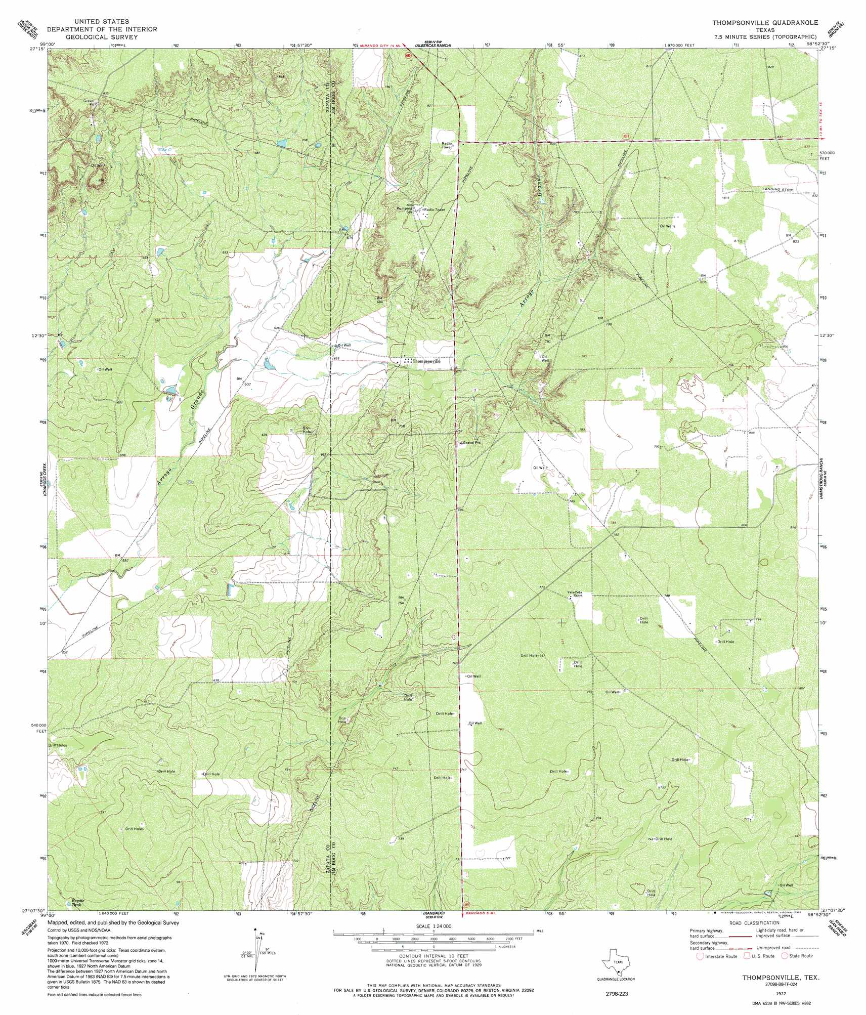
USGS Topo Quad 27098b8 - 1:24,000 scale
| Topo Map Name: | Thompsonville |
| USGS Topo Quad ID: | 27098b8 |
| Print Size: | ca. 21 1/4" wide x 27" high |
| Southeast Coordinates: | 27.125° N latitude / 98.875° W longitude |
| Map Center Coordinates: | 27.1875° N latitude / 98.9375° W longitude |
| U.S. State: | TX |
| Filename: | o27098b8.jpg |
| Download Map JPG Image: | Thompsonville topo map 1:24,000 scale |
| Map Type: | Topographic |
| Topo Series: | 7.5´ |
| Map Scale: | 1:24,000 |
| Source of Map Images: | United States Geological Survey (USGS) |
| Alternate Map Versions: |
Thompsonville TX 1972, updated 1975 Download PDF Buy paper map Thompsonville TX 1972, updated 1992 Download PDF Buy paper map Thompsonville TX 2010 Download PDF Buy paper map Thompsonville TX 2013 Download PDF Buy paper map Thompsonville TX 2016 Download PDF Buy paper map |
1:24,000 Topo Quads surrounding Thompsonville
Retama Creek |
Mirando City |
Oilton |
Bruni |
Hebbronville Nw |
Agua Azul Creek West |
Agua Azul Creek East |
Albercas Ranch |
Bruni Se |
Hebbronville |
Las Ovejas Creek |
Chargos Creek |
Thompsonville |
Armstrong Ranch |
Mccampbell Ranch |
Mogotes Hill |
Escobas |
Randado |
San Pablo Ranch |
Alta Vista Ranch Sw |
Arroyo Veleno |
Arroyo Huisache |
Guerra |
San Antonio Viejo |
Agua Nueva Nw |
> Back to 27098a1 at 1:100,000 scale
> Back to 27098a1 at 1:250,000 scale
> Back to U.S. Topo Maps home
Thompsonville digital topo map on disk
Buy this Thompsonville topo map showing relief, roads, GPS coordinates and other geographical features, as a high-resolution digital map file on DVD: