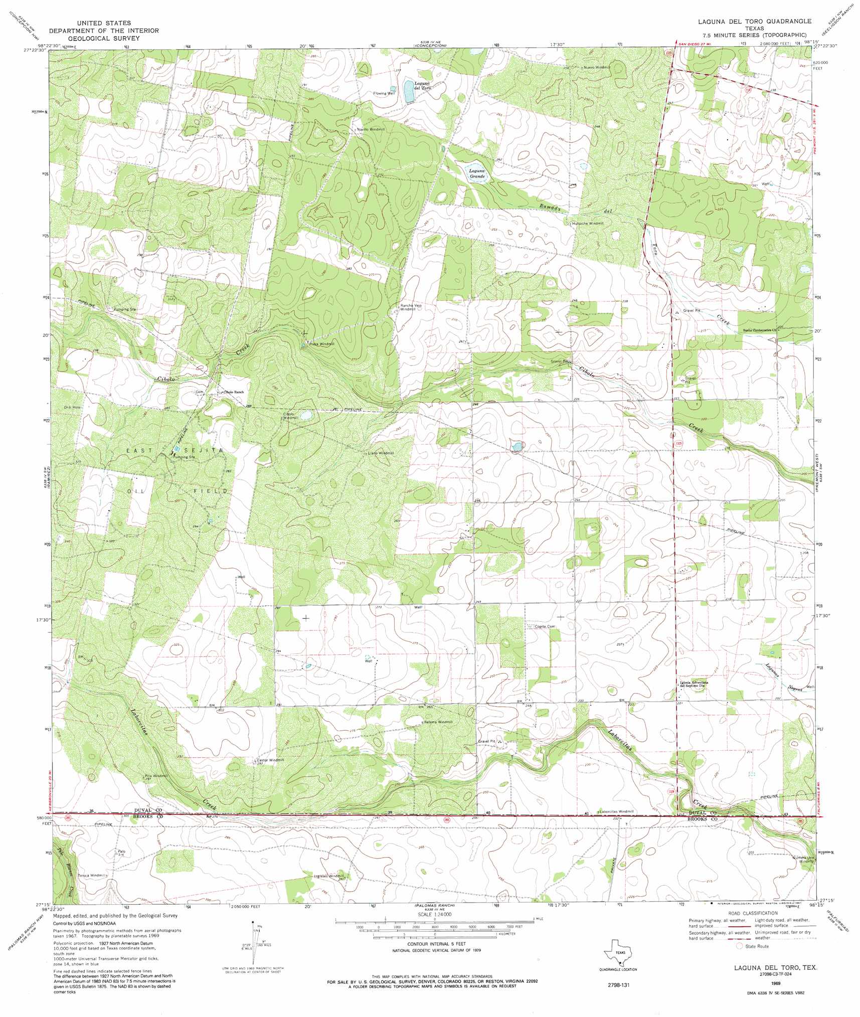
Laguna Del Toro Topo Map Texas
To zoom in, hover over the map of Laguna Del Toro
USGS Topo Quad 27098c3 - 1:24,000 scale
| Topo Map Name: | Laguna Del Toro |
| USGS Topo Quad ID: | 27098c3 |
| Print Size: | ca. 21 1/4" wide x 27" high |
| Southeast Coordinates: | 27.25° N latitude / 98.25° W longitude |
| Map Center Coordinates: | 27.3125° N latitude / 98.3125° W longitude |
| U.S. State: | TX |
| Filename: | o27098c3.jpg |
| Download Map JPG Image: | Laguna Del Toro topo map 1:24,000 scale |
| Map Type: | Topographic |
| Topo Series: | 7.5´ |
| Map Scale: | 1:24,000 |
| Source of Map Images: | United States Geological Survey (USGS) |
| Alternate Map Versions: |
Laguna Del Toro TX 1969, updated 1971 Download PDF Buy paper map Laguna Del Toro TX 1969, updated 1991 Download PDF Buy paper map Laguna Del Toro TX 2010 Download PDF Buy paper map Laguna Del Toro TX 2013 Download PDF Buy paper map Laguna Del Toro TX 2016 Download PDF Buy paper map |
1:24,000 Topo Quads surrounding Laguna Del Toro
Parrilla Creek Se |
Benavides |
San Jose |
Palito Blanco |
Ben Bolt Se |
Realitos |
Concepcion Nw |
Concepcion |
Seeligson Ranch |
Ella |
Hebbronville Se |
Ramirez |
Laguna Del Toro |
Premont West |
Premont East |
Baluarte Ranch |
Palomas Ranch Nw |
Palomas Ranch |
Falfurrias |
Flowella |
Alta Vista Ranch |
Palomas Ranch Sw |
Palomas Ranch Se |
Cage Ranch |
Falfurrias Se |
> Back to 27098a1 at 1:100,000 scale
> Back to 27098a1 at 1:250,000 scale
> Back to U.S. Topo Maps home
Laguna Del Toro topo map: Gazetteer
Laguna Del Toro: Lakes
Laguna Grande elevation 76m 249′Laguna Del Toro: Oilfields
East Sejita Oil Field elevation 91m 298′Laguna Del Toro: Reservoirs
Laguna del Toro elevation 82m 269′Laguna Del Toro digital topo map on disk
Buy this Laguna Del Toro topo map showing relief, roads, GPS coordinates and other geographical features, as a high-resolution digital map file on DVD: