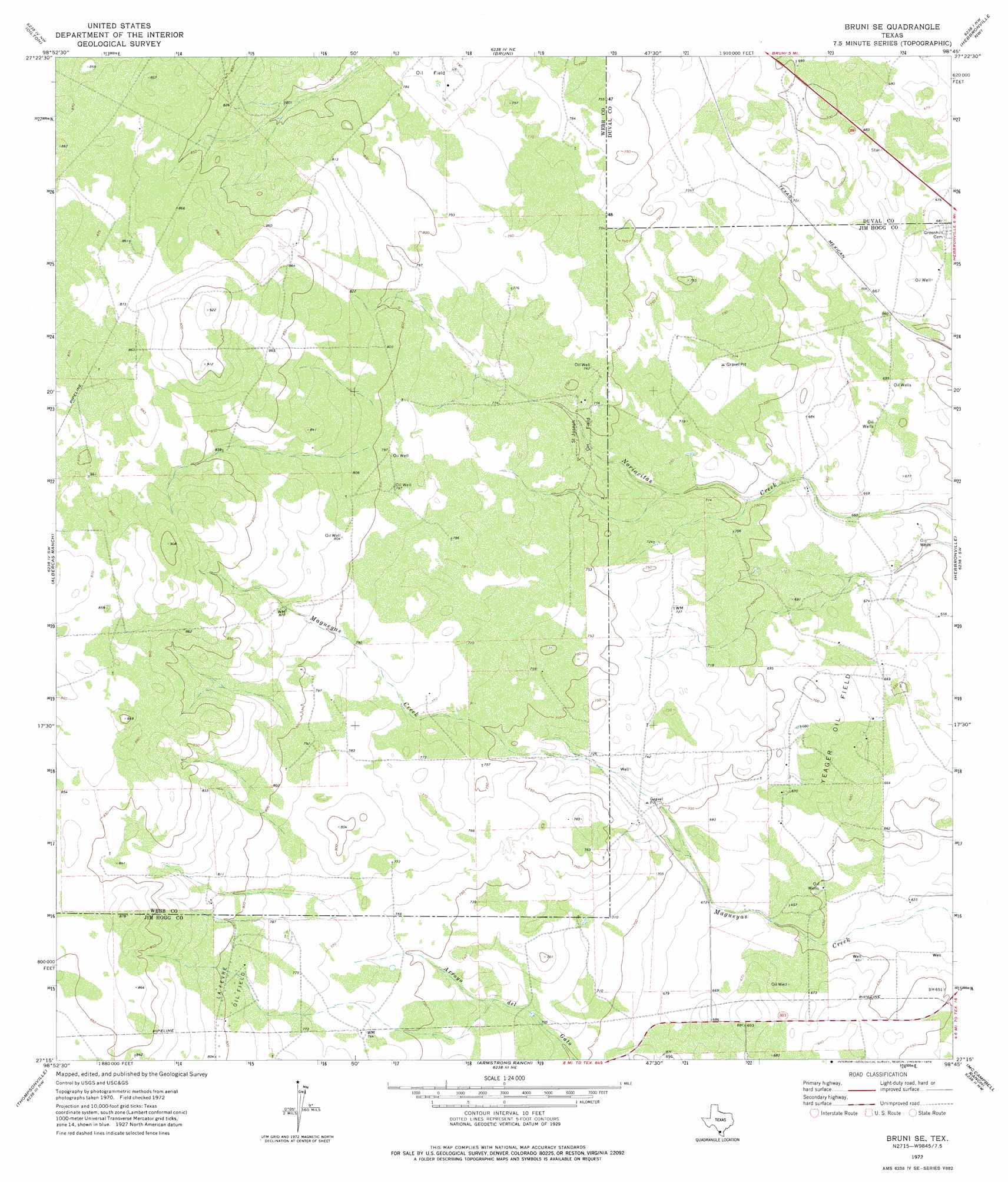
Bruni Se Topo Map Texas
To zoom in, hover over the map of Bruni Se
USGS Topo Quad 27098c7 - 1:24,000 scale
| Topo Map Name: | Bruni Se |
| USGS Topo Quad ID: | 27098c7 |
| Print Size: | ca. 21 1/4" wide x 27" high |
| Southeast Coordinates: | 27.25° N latitude / 98.75° W longitude |
| Map Center Coordinates: | 27.3125° N latitude / 98.8125° W longitude |
| U.S. State: | TX |
| Filename: | o27098c7.jpg |
| Download Map JPG Image: | Bruni Se topo map 1:24,000 scale |
| Map Type: | Topographic |
| Topo Series: | 7.5´ |
| Map Scale: | 1:24,000 |
| Source of Map Images: | United States Geological Survey (USGS) |
| Alternate Map Versions: |
Bruni SE TX 1972, updated 1975 Download PDF Buy paper map Bruni SE TX 2010 Download PDF Buy paper map Bruni SE TX 2013 Download PDF Buy paper map Bruni SE TX 2016 Download PDF Buy paper map |
1:24,000 Topo Quads surrounding Bruni Se
Shipp Ranch |
Mills Bennett Sw |
San Pablo |
Parrilla Creek Sw |
Parrilla Creek Se |
Mirando City |
Oilton |
Bruni |
Hebbronville Nw |
Realitos |
Agua Azul Creek East |
Albercas Ranch |
Bruni Se |
Hebbronville |
Hebbronville Se |
Chargos Creek |
Thompsonville |
Armstrong Ranch |
Mccampbell Ranch |
Baluarte Ranch |
Escobas |
Randado |
San Pablo Ranch |
Alta Vista Ranch Sw |
Alta Vista Ranch |
> Back to 27098a1 at 1:100,000 scale
> Back to 27098a1 at 1:250,000 scale
> Back to U.S. Topo Maps home
Bruni Se topo map: Gazetteer
Bruni Se: Oilfields
La Fevre Oil Field elevation 242m 793′Saint Joseph Oil Field elevation 227m 744′
Yeager Oil Field elevation 210m 688′
Bruni Se digital topo map on disk
Buy this Bruni Se topo map showing relief, roads, GPS coordinates and other geographical features, as a high-resolution digital map file on DVD: