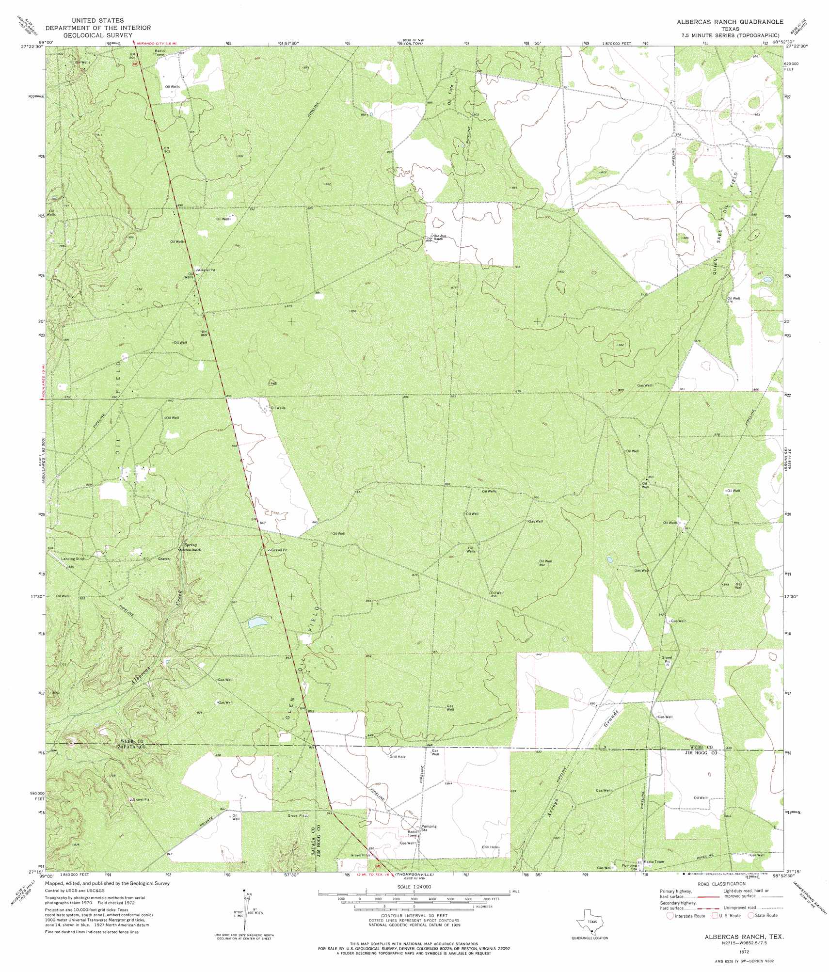
Albercas Ranch Topo Map Texas
To zoom in, hover over the map of Albercas Ranch
USGS Topo Quad 27098c8 - 1:24,000 scale
| Topo Map Name: | Albercas Ranch |
| USGS Topo Quad ID: | 27098c8 |
| Print Size: | ca. 21 1/4" wide x 27" high |
| Southeast Coordinates: | 27.25° N latitude / 98.875° W longitude |
| Map Center Coordinates: | 27.3125° N latitude / 98.9375° W longitude |
| U.S. State: | TX |
| Filename: | o27098c8.jpg |
| Download Map JPG Image: | Albercas Ranch topo map 1:24,000 scale |
| Map Type: | Topographic |
| Topo Series: | 7.5´ |
| Map Scale: | 1:24,000 |
| Source of Map Images: | United States Geological Survey (USGS) |
| Alternate Map Versions: |
Albercas Ranch TX 1972, updated 1975 Download PDF Buy paper map Albercas Ranch TX 2010 Download PDF Buy paper map Albercas Ranch TX 2013 Download PDF Buy paper map Albercas Ranch TX 2016 Download PDF Buy paper map |
1:24,000 Topo Quads surrounding Albercas Ranch
Burrito Tank |
Shipp Ranch |
Mills Bennett Sw |
San Pablo |
Parrilla Creek Sw |
Retama Creek |
Mirando City |
Oilton |
Bruni |
Hebbronville Nw |
Agua Azul Creek West |
Agua Azul Creek East |
Albercas Ranch |
Bruni Se |
Hebbronville |
Las Ovejas Creek |
Chargos Creek |
Thompsonville |
Armstrong Ranch |
Mccampbell Ranch |
Mogotes Hill |
Escobas |
Randado |
San Pablo Ranch |
Alta Vista Ranch Sw |
> Back to 27098a1 at 1:100,000 scale
> Back to 27098a1 at 1:250,000 scale
> Back to U.S. Topo Maps home
Albercas Ranch topo map: Gazetteer
Albercas Ranch: Oilfields
Glen Oil Field elevation 259m 849′Quien Sabe Oil Field elevation 274m 898′
Albercas Ranch: Springs
Albercas de San Felipe Spring elevation 262m 859′Albercas Ranch digital topo map on disk
Buy this Albercas Ranch topo map showing relief, roads, GPS coordinates and other geographical features, as a high-resolution digital map file on DVD: